
17.5
PDI
9.4 mi
DISTANCE
3,052 ft
GAINED
6.1 %
AVG. GRADE
FULL CLIMB STATS
INTRO
Col du Portel from Rimont climbs 15.1 km (9.4 mi) from the village of Rimont, between Saint-Girons and Foix, to the Col du Portel - at 1432 m (4698 ft) the high point of the ridge road across the Massif de l'Arize. It gains 930 m (3052 ft) at a 6.1% average and ranks #242 in France and #1284 in the world in our database.
The first 3.3 km (2.1 mi) are close to flat along the valley floor, so the 6.1% average flatters it. Once the D18B crosses the stream and starts to climb, it barely relents: 8.0 km (5.0 mi) at 8.5% through chestnut woods and meadows, past the unmarked Col de Vigne and the Col de Rille (938 m), to the Col de la Crouzette. Riders who know it describe it as a steady grind with no real respite and compare it with the Col d'Agnes. The steepest kilometer is 9.6%, with a few short ramps well into double digits.
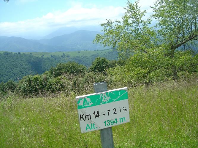
From the junction with the D33 from Rivèrenert, you're on the road the 2008 Tour de France used to cross the Col du Portel on Stage 11 from Lannemezan to Foix, when Amaël Moinard led over the top. Beyond the Crouzette the ridge road eases, dips briefly, and finishes with 1.9 km (1.2 mi) at 7.2% to the col.
PLAN YOUR ROUTE
 We've partnered with Sherpa-Map.com to bring you the best route planning tool. With a PRO Membership you can use this climb as a reference when creating your route.
Col du Portel from Rimont is 15.1 km (9.4 mi) long and gains 930 m (3052 ft) at a 6.1% average, from 515 m (1690 ft) in Rimont to about 1429 m (4689 ft) at the col.
The opening 3.3 km (2.1 mi) are almost flat at 1.0%. From there the real climb begins: 8.0 km (5.0 mi) at 8.5% to the Col de la Crouzette at about km 11.3 (7.0 mi). It's remarkably consistent - the steepest kilometer is 9.6%, the steepest 2 km average 9.2% and the steepest 5 km 8.7% - with a few very short ramps steeper than that.
After the Crouzette, the ridge road runs 1.9 km (1.2 mi) at an easy 3.4%, including a short descent, before the final 1.9 km (1.2 mi) at 7.2% to the Col du Portel.
Roadway: The D18B is paved all the way to the Crouzette, but it's a narrow lane with a coarse, gritty surface in places, though riders report that some of the worst stretches have been resurfaced. Much of the climb is shaded by forest, and in autumn expect chestnut husks and leaves on the road. The descent mixes tight hairpins with long, fast straights, so check your brakes before heading down. Snow can keep the Crouzette closed into spring, so check Ariège's Inforoute09 road information before riding outside summer.
Traffic: Traffic is light. The D18B serves only farms and hamlets on its way up, and above the D33 junction the road carries little more than local traffic and summer visitors heading for the cols.
Parking: Rimont has a parking area in the village center, a short roll from the start of the D18B. If someone is collecting you, the Col du Portel has a large parking area beside the summit meadow.
Gear: Once it starts, this is 8.0 km (5.0 mi) of steady 8-9% climbing, so pick a gear you can turn for close to an hour - a compact with a 28- to 32-tooth cog suits most riders. The shade helps on hot days, but the ridge and summit are exposed, so bring a light wind layer for the long, fast descent.
Provisions: Start with full bottles from Rimont. There are springs along the way - one just off the road after a bend at around km 7 and another near the Ferme du Rille - but they aren't reliably drinkable, and there are no shops or cafes on the climb or at the cols.
Before heading out on any cycling adventure check out our Things to Bring on a Cycling Trip and use our interactive check list to ensure you don't forget anything.
Rimont is known in the Ariège as a village martyr. On 21 August 1944, during the German retreat, troops shot eleven people and burned the village: 236 buildings were damaged or destroyed, 152 of them burned out completely, leaving around 231 people homeless. The rebuilt village has a war memorial to its dead, and higher up the climb, near the Col de la Crouzette, a stele commemorates the fighting of 21 July 1944.
Also within the commune, the Abbaye de Combelongue was founded in 1138 by the Count of Pallars. Its Romanesque church shows an unusual Mudéjar influence, unique in the region, and was listed as a Monument Historique in 2007. The abbey's gardens, which hold France's Jardin Remarquable label, mix medieval, Renaissance, orchard and contemporary French-style plots; visits are by booking, so check ahead.
Rimont sits on the D117 between Saint-Girons and Foix, so it's an easy base for the cols of the Couserans. At the top, our Col du Portel (Biert) page covers the summit meadow and the ridge road east toward the Col de Péguère.
ROUTE MAP

MEMBER RATING
CURRENT WEATHER
PJAMM TRIPS ADVENTURE STARTER BUNDLES
Check out PJAMM Adventure's prepackaged (self-guided) cycling trips. They will help you plan, document and conquer your next adventure.
NEARBY CLIMBS (0) RADIAL PROXIMITY
FROM No Climbs Found
MEMBER REVIEWS & COMMENTS
Let us know what you thought of this climb. Signup for our FREE membership to write a review or post a comment.
Already have an account?
LOG IN HERE
