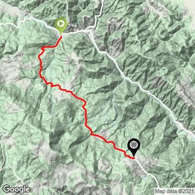
3.8
PDI
4.1 mi
DISTANCE
910 ft
GAINED
3.6 %
AVG. GRADE
FULL CLIMB STATS
INTRO
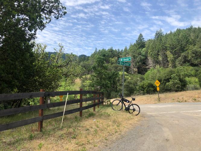
Mt. Veeder from Dry Creek Road is a great addition to a ride to get to or from Napa or can be done as a loop with Dry Creek road. This direction it starts steep and mellows out as you ride further into the forest. This is pretty shady road so summer is a great time to ride, winter can be a little wet.
PLAN YOUR ROUTE
See more details and tools regarding this climb's grade via our interactive Profile Tool.
Information Not Available
If you have any information regarding this climb, we'd like to hear from you. Click the CONTRIBUTE button to share your thoughts with us.
Information Not Available
If you have any information regarding this climb, we'd like to hear from you. Click the CONTRIBUTE button to share your thoughts with us.
Before heading out on any cycling adventure check out our Things to Bring on a Cycling Trip and use our interactive check list to ensure you don't forget anything.
Information Not Available
If you have any information regarding this climb, we'd like to hear from you. Click the CONTRIBUTE button to share your thoughts with us.
ROUTE MAP
MEMBER RATING
CURRENT WEATHER
PJAMM TRIPS ADVENTURE STARTER BUNDLES
Check out PJAMM Adventure's prepackaged (self-guided) cycling trips. They will help you plan, document and conquer your next adventure.
NEARBY CLIMBS (0) RADIAL PROXIMITY
FROM No Climbs Found
MEMBER REVIEWS & COMMENTS
Let us know what you thought of this climb. Signup for our FREE membership to write a review or post a comment.
Already have an account?
LOG IN HERE
lirizar1
Nice climb! New pavement for most of the way up except a few spots where there is uneven/ broken pavement but in terms of roads in Napa this is the best pavement I have encountered! Not much in terms of scenery to look at but you are in the woods with lots of tree covering and minimal traffic so it makes for a nice relaxing climb. The decent down the south side however had much tougher pavement but it looks like they are in the process of replacing! Recommended if in the area!