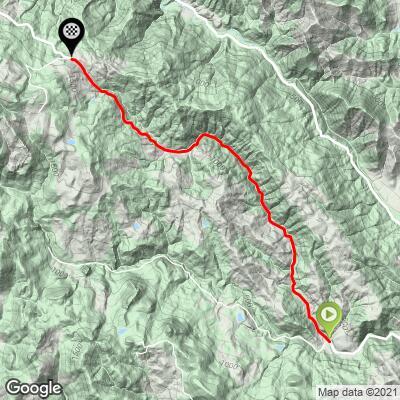
4.7
PDI
4.3 mi
DISTANCE
1,016 ft
GAINED
4.5 %
AVG. GRADE
FULL CLIMB STATS
INTRO
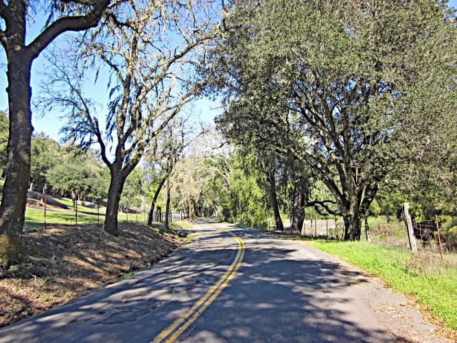
This side of Mt Veeder is less steep but still gains a some elevation. It is a great connection back to Dry Creek and into Santa Rosa. It is shady so summer is a great time to ride, winter plan on a wet and slightly twisty downhill.
PLAN YOUR ROUTE
See more details and tools regarding this climb's grade via our interactive Profile Tool.
Information Not Available
If you have any information regarding this climb, we'd like to hear from you. Click the CONTRIBUTE button to share your thoughts with us.
Information Not Available
If you have any information regarding this climb, we'd like to hear from you. Click the CONTRIBUTE button to share your thoughts with us.
Before heading out on any cycling adventure check out our Things to Bring on a Cycling Trip and use our interactive check list to ensure you don't forget anything.
Information Not Available
If you have any information regarding this climb, we'd like to hear from you. Click the CONTRIBUTE button to share your thoughts with us.
ROUTE MAP
MEMBER RATING
CURRENT WEATHER
PJAMM TRIPS ADVENTURE STARTER BUNDLES
Check out PJAMM Adventure's prepackaged (self-guided) cycling trips. They will help you plan, document and conquer your next adventure.
NEARBY CLIMBS (0) RADIAL PROXIMITY
FROM No Climbs Found
MEMBER REVIEWS & COMMENTS
Let us know what you thought of this climb. Signup for our FREE membership to write a review or post a comment.
Already have an account?
LOG IN HERE
Chasmo99


A great Napa climb. The road surface was repaved in 2022 with chip n seal. One year has helped smooth it out and excess gravel is gone so the descent if you turn around at the summit is a pleasure. The much beloved Popeye and Oliveoyl landmark is sadly decomposing. 😢