
16.8
PDI
6.2 mi
DISTANCE
2,517 ft
GAINED
7.7 %
AVG. GRADE
FULL CLIMB STATS
Page Contributor(s): Giacomo Rizzo, Madrid, Spain
INTRO
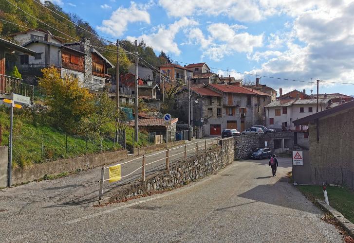
About 3 km into this climb you ride into an open-air art gallery. In 1956 the Varese provincial tourism association picked Arcumeggia, a small village on the hillside above the Valcuvia, as the place to send painters on holiday, and they covered its house walls with frescoes - around forty of them now, by artists including Aligi Sassu and Achille Funi. It's worth stopping, partly because the climb gets much harder later.
From Casalzuigno the route covers 9.9 km (6.2 mi) to the Passo del Cuvignone at 1057 m (3469 ft), gaining 767 m (2517 ft) at 7.7%. The first 3 km to Arcumeggia climb steadily at 8-9%. Then there's a breather: three easy kilometers at 2-4% along the hillside to the Valico di Sant'Antonio, the saddle where the SP7 meets the SP8. The last 3.5 km are the business end - a narrow, wooded road with tight hairpins at 10.6%, 11.7% and 11.5% per kilometer, the steepest kilometer reaching 12.5%. From the Valico you're on the same road as the north side up from Castelveccana.
The pass is a wooded saddle below Monte Nudo (1235 m / 4052 ft). The south side from Cittiglio has been closed above Vararo since a heavy snowfall in March 2026, but this side was never affected, and with the north side it's the way to reach the pass while that road stays shut.
PLAN YOUR ROUTE
 We've partnered with Sherpa-Map.com to bring you the best route planning tool. With a PRO Membership you can use this climb as a reference when creating your route.
The first 3 km climb from Casalzuigno to Arcumeggia at 7.8%, 8.8% and 8.9%. From Arcumeggia the road flattens out for 3 km toward the Valico di Sant'Antonio - 2.1%, 4.4% and 3.0% - which is the only real recovery on the climb.
The last 4 km are the steepest: 8.7%, then 10.6%, 11.7% and 11.5% to the pass. The steepest kilometer averages 12.5% and the steepest 2 km average 11.7%.
Overall: 9.9 km (6.2 mi), 767 m (2517 ft) of climbing, 7.7% average, steepest 5 km at 9.0%.
Roadway: Paved throughout, with sound asphalt on September 2025 Street View imagery. The SP7 up to Arcumeggia is narrow - barely two and a half meters wide in places - and the SP8 above the Valico di Sant'Antonio is a mountain road barely wider than one car, in the woods, with guardrails on the outside of the hairpins. Leaves and loose stones collect under the trees, so take the descent carefully. If you're planning to descend the south side to Cittiglio: the Provincia di Varese closed the SP8 from Vararo to the pass to all traffic, bikes included, after the 15 March 2026 snowfall, the ordinance was extended to at least 1 September 2026, and we haven't seen a reopening announced - check the Province's road notices first.
Traffic: Light. Arcumeggia gets visitors on weekends, so expect a few cars on the lower road; above the Valico di Sant'Antonio there's very little.
Parking: Park in Casalzuigno near the bottom of Via Arcumeggia (start on the map). Arcumeggia has a small public car park on the SP7 by the Pro Loco building, handy if you'd rather come back later and see the frescoes on foot.
Gear: The last 3.5 km average close to 11%, so a 34x32 or bigger bottom gear is a good idea even if the first half feels easy. The pass is in the woods and cooler than the valley; bring a layer for the way down.
Provisions: Get water and food in the Valcuvia before you start. Arcumeggia has a couple of restaurants at km 3, and after that there's nothing you can rely on up to the pass.
Before heading out on any cycling adventure check out our Things to Bring on a Cycling Trip and use our interactive check list to ensure you don't forget anything.
Casalzuigno's own sight is Villa Della Porta Bozzolo, a FAI-run villa and gardens close to the start - easy to combine with the ride. The Valcuvia cycle path runs along the valley floor, and a good day out starts at Luino station, follows the Margorabbia and Valcuvia paths to Casalzuigno and climbs the Cuvignone through Arcumeggia. While the south side is closed, come down the north side to the lake and ride the shore back to Luino.
The pass has two other paved sides: Passo Cuvignone North up from Castelveccana on the lake, which shares the top 3.5 km with this one, and Passo Cuvignone South from Cittiglio, Alfredo Binda's hometown climb.
ROUTE MAP

MEMBER RATING
CURRENT WEATHER
PJAMM TRIPS ADVENTURE STARTER BUNDLES
Check out PJAMM Adventure's prepackaged (self-guided) cycling trips. They will help you plan, document and conquer your next adventure.
NEARBY CLIMBS (0) RADIAL PROXIMITY
FROM No Climbs Found
MEMBER REVIEWS & COMMENTS
Let us know what you thought of this climb. Signup for our FREE membership to write a review or post a comment.
Already have an account?
LOG IN HERE
