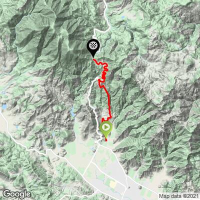
10.4
PDI
5.5 mi
DISTANCE
1,817 ft
GAINED
6.3 %
AVG. GRADE
FULL CLIMB STATS
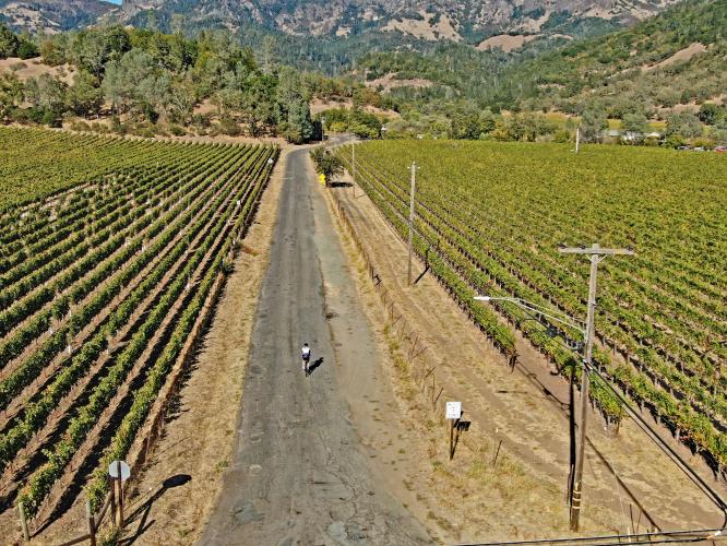
INTRO
This climb shares is the first 5 1/2 miles of the most difficult climb in the North Bay Area (Mt. St. Helena). Old Lawley Toll Road intersects with Hwy 29 just before the highway pitches up for its 5 mile climb to Robert Louis Stevenson State Park (OLTR runs roughly parallel to Hwy 29 for 3 miles until intersecting it again a little over halfway to the pass).
PLAN YOUR ROUTE
See more details and tools regarding this climb's grade via our interactive Profile Tool.
Information Not Available
If you have any information regarding this climb, we'd like to hear from you. Click the CONTRIBUTE button to share your thoughts with us.
Information Not Available
If you have any information regarding this climb, we'd like to hear from you. Click the CONTRIBUTE button to share your thoughts with us.
Before heading out on any cycling adventure check out our Things to Bring on a Cycling Trip and use our interactive check list to ensure you don't forget anything.
Information Not Available
If you have any information regarding this climb, we'd like to hear from you. Click the CONTRIBUTE button to share your thoughts with us.
ROUTE MAP
MEMBER RATING
CURRENT WEATHER
PJAMM TRIPS ADVENTURE STARTER BUNDLES
Check out PJAMM Adventure's prepackaged (self-guided) cycling trips. They will help you plan, document and conquer your next adventure.
NEARBY CLIMBS (0) RADIAL PROXIMITY
FROM No Climbs Found
MEMBER REVIEWS & COMMENTS
Let us know what you thought of this climb. Signup for our FREE membership to write a review or post a comment.
Already have an account?
LOG IN HERE