
27.9
PDI
8.5 mi
DISTANCE
3,781 ft
GAINED
8.4 %
AVG. GRADE
FULL CLIMB STATS
INTRO
Windgrube climbs out of Styria's Thörl-Aflenz valley to the high alpine pastures of the Aflenzer Bürgeralm, gaining 1153 m (3,781 ft) over 13.7 km (8.5 mi) at an average grade of 8.4%. The route finishes at 1,796 m (5,893 ft), just beneath the grassy summit of Windgrube (1809 m) in the Hochschwab range, currently ranked #423 in our global difficulty database.
The defining feature of this climb is its access road: the Panoramastraße, an approximately 8 km gravel toll road built with a maximum grade of 10% that climbs from Gasthaus Pierergut (1000 m) to the Almboden parking area (1500 m). Cars and motorcycles pay a toll here, but cyclists ride it free of charge - a genuine rarity for an Alpine ascent.
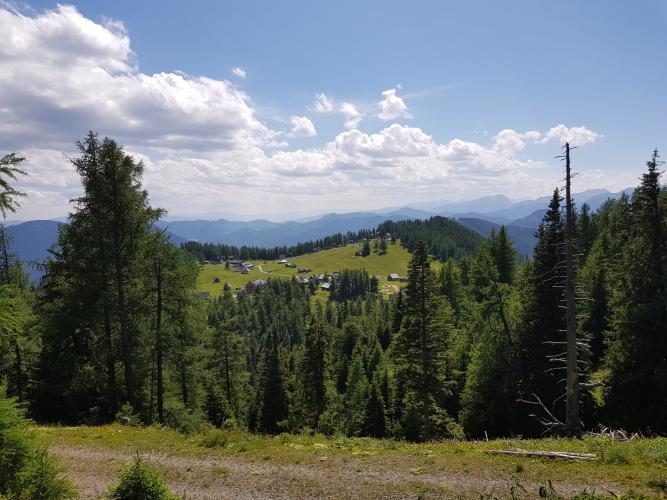
From Almboden, the final push to the Schönleitenhaus (1810 m) follows a well-maintained but unpaved Fahrweg, opening onto broad, sunlit meadows with sweeping views over the Aflenzer Becken toward the Hochschwab massif.
The Bürgeralm's chairlift stopped running in March 2025, so this high plateau is now reachable only by the Panoramastraße itself, on foot, or by bike. Plan around the toll road's usual early-May-to-November season, and note that the final stretch above Almboden is loose, alpine terrain best suited to a gravel or mountain bike rather than a skinny-tired road machine.
PLAN YOUR ROUTE
 We've partnered with Sherpa-Map.com to bring you the best route planning tool. With a PRO Membership you can use this climb as a reference when creating your route.
 Windgrube gains 1,153 m (3,781 ft) over 13.7 km (8.5 mi) for a steady average of 8.4% - one of the more sustained toll-road ascents in the Austrian Alps. The grade holds remarkably even for a mountain climb: the hardest kilometer averages 12.5%, and the toughest mile comes in at 11.9%, both within the lower Panoramastraße section as the road climbs out of the Aflenzer Becken.
The final kilometers ease off across the open meadows below the Schönleitenhaus, giving tired legs a break before the finish at 1,796 m (5,893 ft), just short of the Windgrube summit itself at 1,809 m.
Roadway: The lower stretch through the Thörl-Aflenz valley is a paved local road. From Gasthaus Pierergut, the climb follows the Aflenzer Bürgeralm's Panoramastraße, an approximately 8 km gravel toll road (Schotterstraße) built to a maximum grade of 10%, up to the Almboden car park at 1,500 m. Above Almboden, the final approach to the Schönleitenhaus follows a well-maintained but unpaved Fahrweg - expect loose alpine gravel rather than smooth pavement for the upper half of this climb. The toll road is normally open from early May into November, or until the first heavy snowfall; confirm the current season's dates with the Aflenz municipality before heading up.
Traffic: Traffic on the Panoramastraße is light - the toll deters casual sightseeing drivers, and with the Bürgeralm chairlift out of service since March 2025, there's even less vehicle activity heading up to the alm. Expect the occasional local, farm vehicle, or alm visitor's car, but otherwise the road belongs mostly to cyclists and hikers.
Parking: Most riders start from the valley in Thörl or Aflenz, where free street parking is easy to find in both small towns. Cyclists use the Panoramastraße toll-free, so there's no need to stop at the tollbooth near Gasthaus Pierergut; the marked lot at Almboden is the natural spot to refuel at the Almrauschhütte before continuing on foot or bike to the Schönleitenhaus.
A road bike with wider tires (28mm or more) will handle the paved lower valley roads fine, but the Panoramastraße's gravel surface and the unpaved Fahrweg above Almboden reward a gravel or mountain bike with real tread - this isn't a climb for narrow slicks.
Layer up for the top: even in summer, the exposed meadows near the Schönleitenhaus at 1,796 m (5,893 ft) run noticeably cooler and windier than the valley floor, and the Hochschwab massif can pull in fast-moving weather. The Almrauschhütte at Almboden and the Schönleitenhaus itself both serve regional Styrian food, so it's realistic to travel light and refuel along the way rather than carrying a full day's provisions.
Before heading out on any cycling adventure check out our Things to Bring on a Cycling Trip and use our interactive check list to ensure you don't forget anything.
Base yourself in Thörl or Aflenz Kurort, both small Styrian towns with guesthouses and easy access to the start of the climb. Gasthaus Pierergut, about a kilometer up the Panoramastraße, serves traditional Styrian dishes and is a popular first stop; the Almrauschhütte at Almboden has a playground alongside its kitchen, making the lower half of this climb realistic as a family outing even for those who won't ride all the way to the top.
If you're around on the second Sunday of August, the Bürgeralm hosts its traditional Gipfelmesse (summit mass) followed by an Almfest - worth timing a visit around if you want to see the alm at its liveliest. Check current conditions at the top before you go with our Weather tool, since the exposed plateau near the Schönleitenhaus can turn wet and windy well before the valley notices any change.
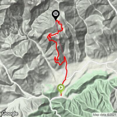
ROUTE MAP
MEMBER RATING
CURRENT WEATHER
PJAMM TRIPS ADVENTURE STARTER BUNDLES
Check out PJAMM Adventure's prepackaged (self-guided) cycling trips. They will help you plan, document and conquer your next adventure.
NEARBY CLIMBS (0) RADIAL PROXIMITY
FROM No Climbs Found
MEMBER REVIEWS & COMMENTS
Let us know what you thought of this climb. Signup for our FREE membership to write a review or post a comment.
Already have an account?
LOG IN HERE
