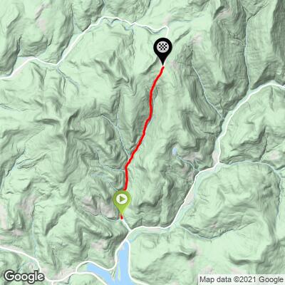
10.4
PDI
4.1 mi
DISTANCE
1,604 ft
GAINED
7.5 %
AVG. GRADE
FULL CLIMB STATS
Page Contributor(s): Ties Arts, Bussum, Netherlands
INTRO
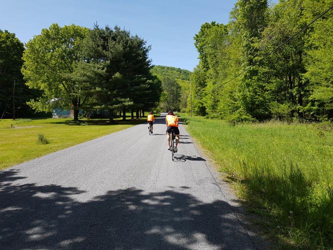
Another great Catskills climb. This climb can (should?) be linked to the #2 Most Difficult New York State Climb - Glade Hill. One can link many of these Catskills climbs together to create one heck of a climbing adventure (e.g. Doug Jansen’s “Catskills Climb Fest” of 14,000’).
PLAN YOUR ROUTE
7.6% average grade. 34% is at 0-5%, 37% at 5-10% and 23% is at 10-15% grade. The steepest quarter mile is 14.3% and steepest mile is 12.6%.
See more details and tools regarding this climb's grade via the “Profile Tool” button above.
Roadway: This is a narrow 2 lane rural road with no center stripe that is in good condition.
Traffic: Minimal.
Parking: On the right side of the road near the start of the climb - Map; Street View.
There are no provisions on this climb or in the immediate vicinity. The closest food and drink is in Grahamsville three miles to the southwest - Route Map; Google Map - Stores-Deli in Grahamsville.
Before heading out on any cycling adventure check out our Things to Bring on a Cycling Trip and use our interactive check list to ensure you don't forget anything.
Visit the Grahamsville Little World's Fair three miles from climb start during your visit to the area if you are riding in the area in mid-August during the three days of the fair - Route Map; Google Map + Reviews.
ROUTE MAP
MEMBER RATING
CURRENT WEATHER
PJAMM TRIPS ADVENTURE STARTER BUNDLES
Check out PJAMM Adventure's prepackaged (self-guided) cycling trips. They will help you plan, document and conquer your next adventure.
NEARBY CLIMBS (0) RADIAL PROXIMITY
FROM No Climbs Found
MEMBER REVIEWS & COMMENTS
Let us know what you thought of this climb. Signup for our FREE membership to write a review or post a comment.
Already have an account?
LOG IN HERE
ShlomoZ.11
Good climb. Sketchy chicane at the top but not if you ease up. Super fun area