INTRO
PLAN YOUR ROUTE
 We've partnered with Sherpa-Map.com to bring you the best route planning tool. With a PRO Membership you can use this climb as a reference when creating your route.
 ROUTE MAP


 We've partnered with Sherpa-Map.com to bring you the best route planning tool. With a PRO Membership you can use this climb as a reference when creating your route.
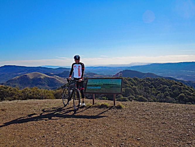
Sunrise atop Bald Mountain January 1, 2015.
Climb summary by PJAMM’s John Johnson.
Cycling Bald Mountain - very challenging - 33 mm tires recommended.
Ride 4.1 miles to 2,733’ gaining 2,122’ at 9.5% average grade.
Steepest ¼ mile is near the top - 17%
This climb ranks as the #2 most difficult on the Tri-County Top Climbs list with an eye popping (for these parts) FIETS Index of 6.15 (this is only 1 of 2 climbs in the tri- county area that top 6 on the FIETS scale). Located in the Mayacamas Mountain range, Bald Mountain is, for a number of reasons, a very challenging ascent, but with 360 degree views from the top unparalleled in Sonoma/Napa/Lake counties.
95% of the route is located in Sugarloaf State Park (4,020 acres) which is in the Mayacamas Mountains. Bald Mountain is the high point of the park and we climb to the top on this bike ride. The Bald Mountain is situated between the lush Sonoma and Napa valleys and both are visible from the climb’s finish. Bald Mountain and Mt. St. Helena (Napa/Sonoma) are the only points in Wine Country where you have 360 degree views of Sonoma and Napa vineyards.
From its peak at 2,673' (by our Garmin - the official elevation is 2,729') we have spectacular and unobstructed views of the Sonoma Valley to the west, San Pablo Bay/Mt Tamalpais to the south, Mt. Diablo to the southeast, Napa County to the east, and Mt. St. Helena to the north.
Traffic/Roadway surface: O.k. - here's the rub. The first mile is on a well maintained and good state park road.
At the 1.17 mile mark, we turn left onto gravel for .5 miles at 5.8% (manageable, even on a road bike).
Turn left at the ranger kiosk at mile 1.1
The next 1.9 miles are on very rough, broken and rutted pavement with much gravel and debris (very, very hazardous on the descent) at 10.6%.
Gate at mile 1.5
And, that's not the worst part - at mile 3.57 we encounter gravel for the remainder of the climb at 11.3% average grade (the first .1 at 21%).
The Wall
THE SUMMIT
IT’S TO DIE FOR!!
Gettin there!!
Napa Valley to the east
Mt. Tamalpais to the south
Mt. St. Helena north - center background of photo.
On our attempts via road bike (3 times up on cross bike - no problem), we did make it to the top once without dismounting, but this ride is much better suited to the cross or road bike. The descent, in our opinion, is the most difficult in Sonoma County. The positive side, other than the occasional hiker, or nutty cyclist, no traffic as the road is closed to all but official vehicles.
When I was only 55 I climbed this baby with 28mm tires + 34 chainring + 27 cassette.
May, 2019 at 62 = 33mm knobby’s + 34 chaingring + 42 Cassette . . . NO PROBLEM! 👍😊
That’s a wrap!