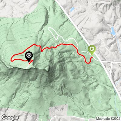
8
PDI
2.3 mi
DISTANCE
1,072 ft
GAINED
9.1 %
AVG. GRADE
FULL CLIMB STATS
Page Contributor(s): Robert Rheault, Kernersville, North Carolina
INTRO
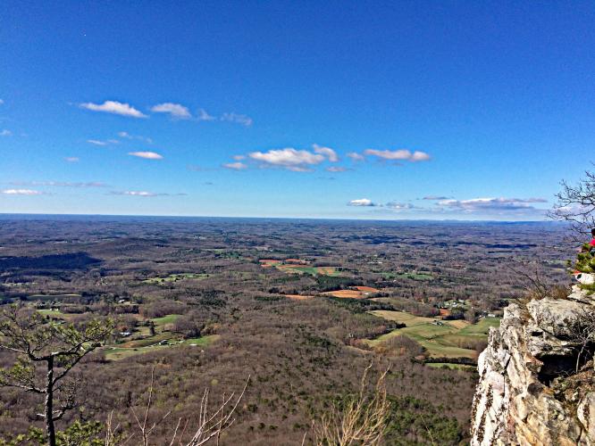
This is a very nice climb with a view at the top. There is no charge to enter Pilot Mountain State Park.
PLAN YOUR ROUTE
See more details and tools regarding this climb's grade via our interactive Profile Tool.
Information Not Available
If you have any information regarding this climb, we'd like to hear from you. Click the CONTRIBUTE button to share your thoughts with us.
Information Not Available
If you have any information regarding this climb, we'd like to hear from you. Click the CONTRIBUTE button to share your thoughts with us.
Before heading out on any cycling adventure check out our Things to Bring on a Cycling Trip and use our interactive check list to ensure you don't forget anything.
Information Not Available
If you have any information regarding this climb, we'd like to hear from you. Click the CONTRIBUTE button to share your thoughts with us.
ROUTE MAP
MEMBER RATING
CURRENT WEATHER
PJAMM TRIPS ADVENTURE STARTER BUNDLES
Check out PJAMM Adventure's prepackaged (self-guided) cycling trips. They will help you plan, document and conquer your next adventure.
NEARBY CLIMBS (0) RADIAL PROXIMITY
FROM No Climbs Found
MEMBER REVIEWS & COMMENTS
Let us know what you thought of this climb. Signup for our FREE membership to write a review or post a comment.
Already have an account?
LOG IN HERE
RuhRoh

One of the three climbs part of the "Triple Hump" route. The other two are Sauratown and Hanging Rock. This climb has the best view of the three once you get to the top with water and restrooms available. The first half is the steepest, but don't burn all your matches there, the second half still has a sting in its tail. Traffic can be heavy at times, especially during summer weekends.