![]()
2025 TOUR DE FRANCE STAGE 19
Stage 19: Albertville → La Plagne · 129.9 km · ≈ 4 550 m+
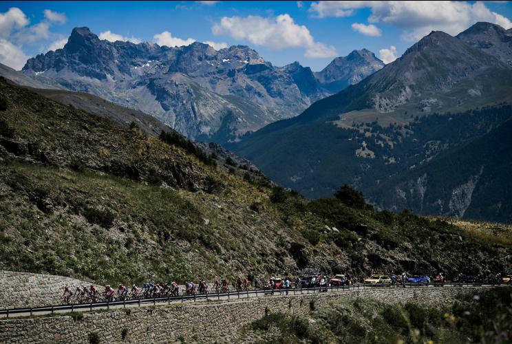
This short but savage Alpine finale packs a punch. Riders take on five key cols: Col des Saisies, Col du Pré, and Cormet de Roselend, before the final 19.1 km HC ascent to La Plagne at about 7.2% .
Albertville, host of the 1992 Winter Olympics, is surrounded by towering Alpine peaks and sets the stage perfectly for a high-stakes mountain showdown. It’s a town that feels built for big racing days, and today is one of them. La Plagne returns after 23 years, with its steep ski resort roads ready to decide who still has legs in the closing days of the Tour.
Despite its brevity, the stage offers intense climbing from start to finish. Recovery windows are few and far between, meaning GC teams must remain drilled.
![]()
The beautiful Lac de Roselend, coming at mile 43.
Expect fireworks on the Roselend, but the defining move will come on La Plagne. Pogačar and Vingegaard will push hard, with Evenepoel riding close behind. Break specialists or stage hunters like David Gaudu or Pinot may try their luck if the GC battle loosens, but the final climb belongs to the elite. It’s a punchy finale to the Alps, where seconds will count and fatigue determines the losers.
See our 2025 Tour de France page for the best way to view, analyze and filter Tour de France stage routes and climbs.
![]()
![]()
COMMENTS FROM RACE DIRECTOR CHRISTIAN PRUDHOMME - STAGE 19:
“The ultra-mountainous tone of this stage, which features five climbs, is amplified by its relative shortness. The first of those climbs, the Côte d’Héry-sur-Ugine, arrives around ten kilometres after the stage start. Thanks to the spicy nature of what’s gone before, the final 19.1-kilometre ascent to La Plagne will seem all the more interminable.” (Tour de France Stage 19).
KOM Corner
STANDINGS AFTER STAGE 21 (July 27) |
GC | Rider | Time | gap | Team |
1 | Tadej Pogacar | 76:00:32 | - | UAE |
2 | Jonas Vingegaard | 76:04:56 | 4:24 | Visma Lease-a-Bike |
3 | Florian Lipowitz | 76:12:44 | 11:00 | Red Bull - Bora - Hansgrohe |
KOM Standing | Rider | KOM Points | Country | Team |
1 | Tadej Pogacar | 119 | Slovenia | UAE |
2 | Jonas Vingegaard | 104 | Denmark | Visma Lease-a-Bike |
3 | Lenny Martinez | 97 | France | Bahrain Victorious |
4 | Thymen Arensman | 85 | Netherlands | Ineos Grenadiers |
5 | Ben O'Connor | 51 | Australia | Jayco Alula |
6 | Valentin Paret Peintre | 51 | France | Soudal Quick-step |
7 | Felix Gall | 46 | Austria | Decathlon AG2R Mondiale |
8 | Primoz Roglic | 43 | Slovenia | Red Bull - Bora - Hansgrohe |
9 | Oscar Olney | 42 | UK | Team Picnic PostNL |
10 | Michael Woods | 38 | Canada | Israel - Premier Tech |
| Times in TdF | Category | Winner | Points Awarded |
|
|
|
|
|
|
|
|
|
|
|
|
|
|
|
Official post-race summary for Stage 19 (from letour.fr)

 We've partnered with Sherpa-Map.com to bring you the best route planning tool. With a PRO Membership you can use this climb as a reference when creating your route.

