
21.1
PDI
11.7 mi
DISTANCE
3,654 ft
GAINED
5.7 %
AVG. GRADE
FULL CLIMB STATS
Page Contributor(s): Ard Oostra, Montreux, Switzerland
INTRO
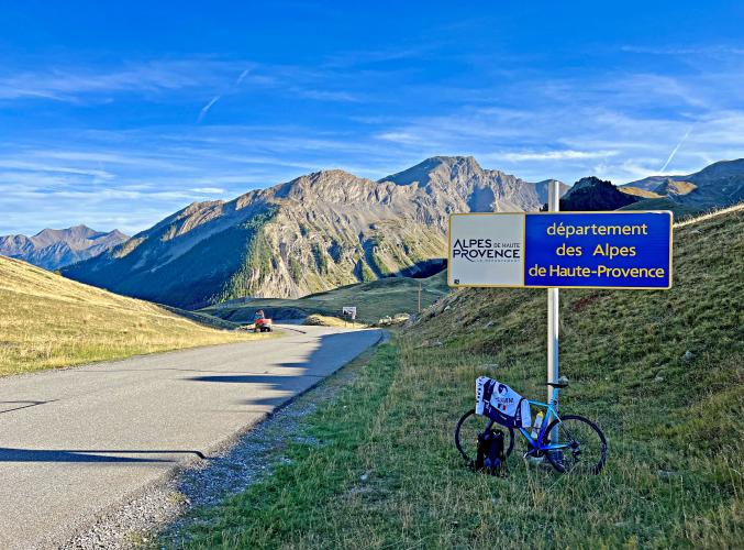
The Col de Vars climbs 18.9 km (11.7 mi) from Guillestre to a 2,108 m (6,916 ft) pass on the D902 in the French Alps, gaining 1,114 m (3,654 ft) at a 5.7% average. The col links the Guillestrois and the Queyras with the Ubaye valley, and it is a regular on the Route des Grandes Alpes.
It is a climb of two characters. The steepest ramps come early, as the road leaves Guillestre, then the grade eases and flattens in places through the villages of the Vars ski resort (Saint-Marcellin, Sainte-Marie and Les Claux) before an easier final few kilometers to the col, with views toward the Parpaillon massif and a small lake near the top.
The Tour de France has crossed the Col de Vars more than 30 times since 1922, when Philippe Thys was first over the top, most recently on stage 18 of the 2019 Tour from Embrun to Valloire. The pass is open all year except during heavy snowfall.
PLAN YOUR ROUTE
 We've partnered with Sherpa-Map.com to bring you the best route planning tool. With a PRO Membership you can use this climb as a reference when creating your route.
 The climb averages 5.7% over 18.9 km (11.7 mi), gaining 1,114 m (3,654 ft) from Guillestre at 1,036 m (3,399 ft) to the col at 2,108 m (6,916 ft).
The steepest 91 m (100 yd) is 12.7%, the steepest 500 m 11.2%, the steepest kilometer 10.5% and the steepest 2 km 9.2%. The steepest 5 km (3.1 mi) averages 8.3%, while the steepest 10 km (6.2 mi) averages only 5.9%, so after the opening pitches the grade drops back, with flatter stretches through the resort villages before an easy finish.
Roadway: The D902 is paved the entire way to the col. The pass is open all year except during heavy snowfall, and the Hautes-Alpes department has closed the road near the col in winter because of avalanche risk and strong wind, so check the department's road-status information before an early- or late-season ride.
Traffic: Moderate. The D902 is the through road for the Vars resort villages and a crossing on the Route des Grandes Alpes, so you will share it with cars, motorcycles and other cyclists in the summer season.
Parking: Guillestre is a small town at the meeting point of the Vars, Queyras and Durance valleys and is the natural place to start. Park in or at the edge of the village (the tourist office is on Place Salva and can point you to current parking) and ride out on the D902. Monday is market day in the center, so allow extra time to find a spot. If you arrive by train, the nearest station is Mont-Dauphin - Guillestre.
Gear: A 5.7% average with a steepest kilometer of 10.5% is manageable on standard gearing, but a compact crankset is welcome over 18.9 km (11.7 mi) at altitude. The col is at 2,108 m (6,916 ft), so pack a windbreaker for the descent.
Provisions: Fill your bottles in Guillestre before you start: the first water fountain on the route is at Vars Saint-Marcellin, about 14 km (8.7 mi) into the climb, with more at Vars Sainte-Marie and Vars les Claux. The resort villages also have restaurants and sports shops, and there is a refuge and a car park at the col.
Before heading out on any cycling adventure check out our Things to Bring on a Cycling Trip and use our interactive check list to ensure you don't forget anything.
Guillestre is the gateway to the Queyras Regional Natural Park, and it has real character: a 16th-century church, Notre-Dame d'Aquilon, with a porch on four columns of pink Guillestre marble, and a large weekly market on Mondays. For the Izoard side and the Casse Déserte, see our Col d'Izoard (Arvieux) page, and for Saint-Véran and the Queyras, our Col Agnel page.
Beyond the col, the D902 drops into the Ubaye valley toward Saint-Paul-sur-Ubaye, Jausiers and Barcelonnette. The Route des Grandes Alpes links Guillestre to Barcelonnette over the Col de Vars in a 50 km (31 mi) stage with 1,249 m (4,098 ft) of climbing, passing the Fort de Tournoux on the cliff above the valley. Our Col de Vars (Jausiers) page covers the south side.
See other climbs nearby, including Risoul and the Montée de Ceillac, or build a custom route from here, with our Routes in the Area tool.
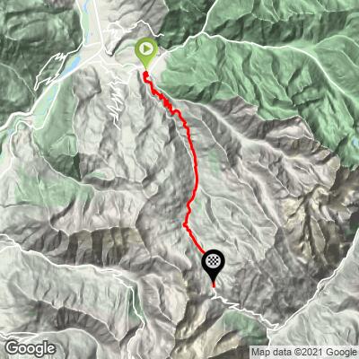
ROUTE MAP
MEMBER RATING
CURRENT WEATHER
PJAMM TRIPS ADVENTURE STARTER BUNDLES
Check out PJAMM Adventure's prepackaged (self-guided) cycling trips. They will help you plan, document and conquer your next adventure.
NEARBY CLIMBS (0) RADIAL PROXIMITY
FROM No Climbs Found
MEMBER REVIEWS & COMMENTS
Let us know what you thought of this climb. Signup for our FREE membership to write a review or post a comment.
Already have an account?
LOG IN HERE
