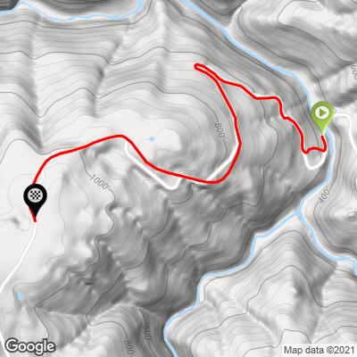
5.2
PDI
1.6 mi
DISTANCE
716 ft
GAINED
8.8 %
AVG. GRADE
FULL CLIMB STATS
INTRO
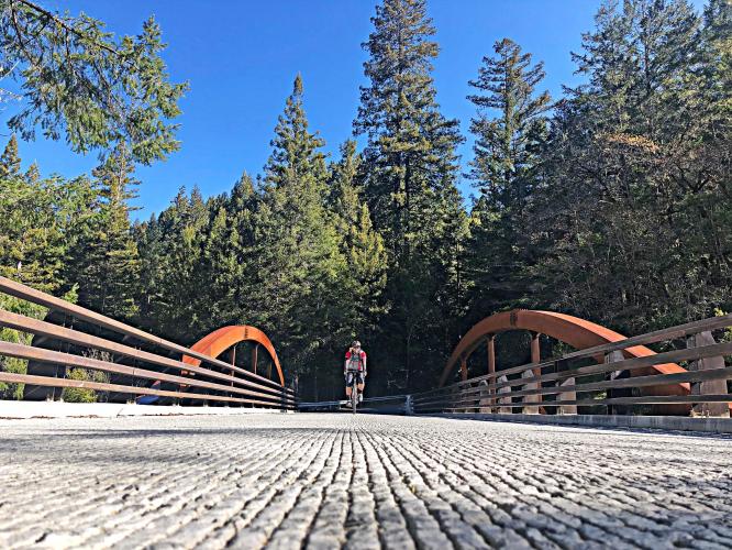
This is a short climb that begins at the base of the descent of Hauser Bridge Road from its intersection with King Ridge Road. King Ridge is the climbing backbone of what many feel is the jewel of Sonoma County cycling, Kings Ridge Road and is included in Levi's Gran Fondo (circa 2003), an extremely popular and well run wine country century held in September each year and attended by 7,500 riders, give or take. This climb starts in the dense redwoods and takes up to the open roads of King Ridge, typically this is the descent and when descent this road use caution because it is very steep and deceptively more technical (and often wet).
PLAN YOUR ROUTE
See more details and tools regarding this climb's grade via our interactive Profile Tool.
Information Not Available
If you have any information regarding this climb, we'd like to hear from you. Click the CONTRIBUTE button to share your thoughts with us.
Information Not Available
If you have any information regarding this climb, we'd like to hear from you. Click the CONTRIBUTE button to share your thoughts with us.
Before heading out on any cycling adventure check out our Things to Bring on a Cycling Trip and use our interactive check list to ensure you don't forget anything.
Information Not Available
If you have any information regarding this climb, we'd like to hear from you. Click the CONTRIBUTE button to share your thoughts with us.
ROUTE MAP
MEMBER RATING
CURRENT WEATHER
PJAMM TRIPS ADVENTURE STARTER BUNDLES
Check out PJAMM Adventure's prepackaged (self-guided) cycling trips. They will help you plan, document and conquer your next adventure.
NEARBY CLIMBS (0) RADIAL PROXIMITY
FROM No Climbs Found
MEMBER REVIEWS & COMMENTS
Let us know what you thought of this climb. Signup for our FREE membership to write a review or post a comment.
Already have an account?
LOG IN HERE