12.8
PDI
4.1 mi
DISTANCE
1,803 ft
GAINED
8.5 %
AVG. GRADE
FULL CLIMB STATS
INTRO
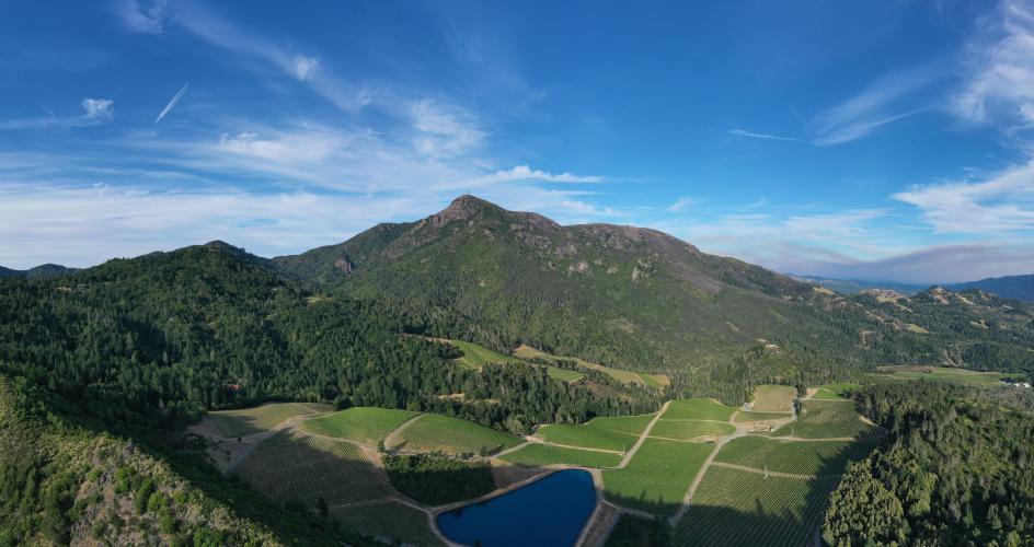
This is the climb ranks #3 on PJAMM's Sonoma County top climbs list. The climb is very scenic, with views to the east of Mount St. Helena, hillside vineyards throughout the climb, and spectacular views to the south of the Knight's Valley.
PLAN YOUR ROUTE
Average grade is 8.5% with 1,800' gained in 4.1 miles and 0 descent. 59% of the climb is at 5-10% grade and 30% is at 10-15%. The steepest quarter-mile is 11.6%.
See more details and tools regarding this climb's grade via the “Profile Tool” button.
Roadway: Narrow two lane with no center stripe and rough in spots - caution on the descent due to shade and debris.
Traffic: Minimal - the occasional car or vineyard vehicle.
Parking: Right side of the road at the start of the climb - Map; Street View.
Provisions: There is no water or food on this route and it can get very hot during the summer - bring plenty of water. The closest provisions are in Calistoga eight miles southeast, Geyserville 17 miles northwest, or Healdsburg 16 miles southwest. The Jimtown Store 10 miles west of the climb on Highway 128 may be an option if it has reopened after its closing in 2020.
Before heading out on any cycling adventure check out our Things to Bring on a Cycling Trip and use our interactive check list to ensure you don't forget anything.
See PJAMM's Sonoma County climb area page for more details on Wine Country bike climbs. If you have travelled to Sonoma County to cycle or have any questions concerning cycling in the North Bay, you are welcome to contact me at john@pjammcycling.com with your questions about the area - I grew up and live in Sonoma County and have good knowledge of cycling in this region.
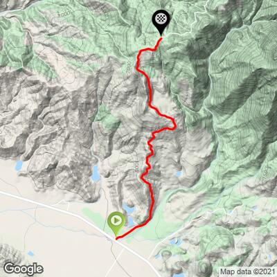
ROUTE MAP
MEMBER RATING
CURRENT WEATHER
PJAMM TRIPS ADVENTURE STARTER BUNDLES
Check out PJAMM Adventure's prepackaged (self-guided) cycling trips. They will help you plan, document and conquer your next adventure.
NEARBY CLIMBS (0) RADIAL PROXIMITY
FROM No Climbs Found
MEMBER REVIEWS & COMMENTS
Let us know what you thought of this climb. Signup for our FREE membership to write a review or post a comment.
Already have an account?
LOG IN HERE
D_Murdoch
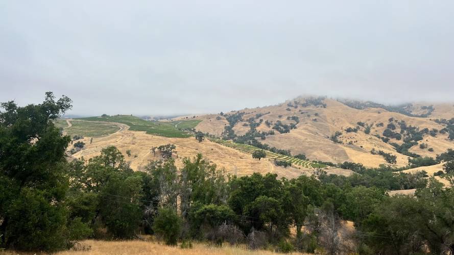
The road has recently been repaved which makes it quite enjoyable and easier to ride up the hill. The views were nice but we did it on a foggy summer morning so the fog and mist limited the views. We encountered almost zero traffic, which was nice.
Glendonius
A great resource for enjoyment or testing your chops.