INTRO
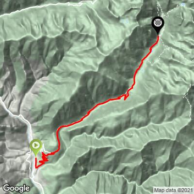
Belvédère (sud) climbs 16.5 km (10.2 mi) out of the Vésubie valley below Roquebillière, gaining 1131 m (3,712 ft) at a 6.9% average. The first 4.2 km (2.6 mi) carry you up the M71 to the perched village of Belvédère, whose name means "beautiful view" in the local dialect - and it earns it, looking straight down the Vésubie from its promontory at about 830 m (2,723 ft). From there the road turns north into the Vallon de la Gordolasque and keeps climbing for another 12 km (7.5 mi) to its dead end at Pont du Countet, 1686 m (5,531 ft), with the highest peaks of the Mercantour massif closing in around you.
This is a road that goes nowhere but the mountains, and that's the appeal. There's no through traffic, the upper valley is a patchwork of larch forest, boulder fields and summer pastures, and chamois and ibex are regularly spotted along the way. The hardest work comes in the middle of the Gordolasque section, where the grade holds around 9% for several kilometers, including a tight run of hairpins at the Cascade du Ray.
The road end at Pont du Countet is the trailhead for the Vallée des Merveilles, the prehistoric site known for its tens of thousands of Bronze Age rock engravings, and for the hike up to the Refuge de Nice - so on a summer day you'll share the top with hikers more than with other cyclists. The valley was among the first roads reopened after Storm Alex in 2020, and a few narrowed sections remain as reminders.
PLAN YOUR ROUTE
 We've partnered with Sherpa-Map.com to bring you the best route planning tool. With a PRO Membership you can use this climb as a reference when creating your route.
 Belvédère South is 16.5 km (10.2 mi) long with 1131 m (3,712 ft) of elevation gain, an average grade of 6.9%.
The climb comes in two distinct halves. The opening 4.2 km (2.6 mi) up to Belvédère village is a moderate warm-up at 5-7%. Once you turn into the Gordolasque valley the road steepens gradually, and from about km 8 to km 12 it settles into a sustained 8.5-9.5% - the heart of the climb, including the hairpins at the Cascade du Ray, where roughly 900 m (0.6 mi) average about 10.5%. The gradient is irregular up here, flicking between 6-7% and 10%, so expect to change gear often.
Km 15 is a near-flat breather along the valley floor (under 2%), before a final 2 km (1.2 mi) at around 7% to the road end at Pont du Countet.
Steepest sections: 0.5 km (0.3 mi) at 12.0%, 1 km (0.6 mi) at 10.0%, 2 km (1.2 mi) at 9.4%, and 5 km (3.1 mi) at 8.8%.
Roadway: Paved all the way on the M71 to Belvédère and then the narrower Gordolasque valley road to Pont du Countet. The valley road was reopened within weeks of Storm Alex in October 2020, but with several narrowed sections and a 3.5-tonne weight limit, and recovery work continues across the Vésubie valley, so expect the odd single-lane stretch. At almost 1700 m, the upper valley can hold snow into spring - check conditions before an early- or late-season ride.
Traffic: Light. This is a dead-end road serving Belvédère, a handful of hamlets and the Gordolasque trailheads, so the only real traffic is hikers driving up to Pont du Countet on summer weekends, mostly in the morning.
Parking: There's public parking in the center of Roquebillière, a short ride from the start at the M71 turn-off. At the top there's a trailhead parking area at Pont du Countet, which fills up with hikers bound for the Vallée des Merveilles on fine summer days.
Provisions: Roquebillière, at the bottom of the climb, is the place to stock up before you start. Higher up, the Relais des Merveilles, a family-run hotel-restaurant and gîte at about 1600 m (5,249 ft) in the upper Gordolasque, serves homemade mountain food from Easter to mid-October - a great lunch stop before the final push. Near the top, the Lucie Bertoli chalet sits beside a small lake with picnic tables.
Gear: Standard road gearing works, but you'll want something low for the 9-10% ramps in the middle of the valley. It's a long descent back down from almost 1700 m, and the Gordolasque is a deep, shaded valley, so pack a layer even in summer.
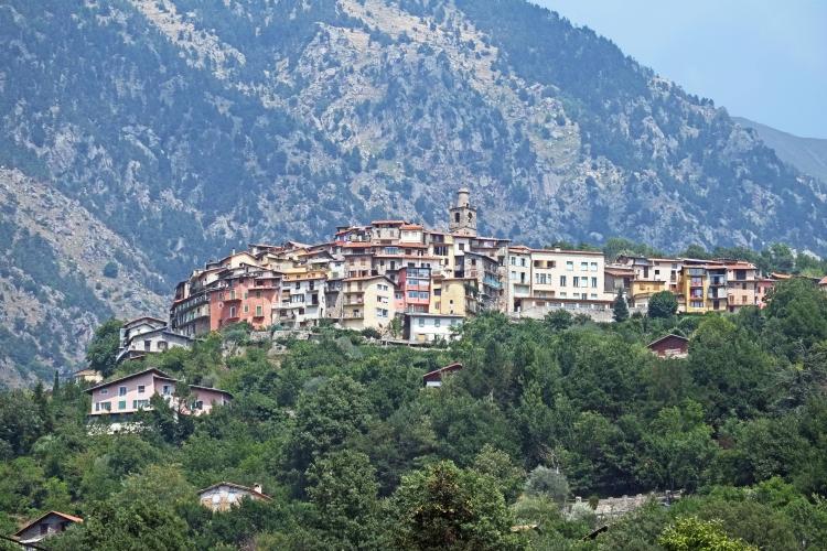
Belvédère deserves more than a quick bottle stop. Its tall village houses crowd onto a promontory above the Vésubie, the Baroque church of Saint-Pierre-et-Saint-Paul anchors the village square, and the village hosted the film crews of the Belle et Sébastien series. The views across the valley from the square are the reason the village got its name.
At the top, Pont du Countet is the gateway to the Vallée des Merveilles, a protected prehistoric site whose Bronze Age rock engravings are one of the great sights of the Mercantour National Park; the trails from here also lead to the Refuge de Nice and a string of high lakes. If you have the legs for a second climb, Col de Turini starts on the other side of the Vésubie at La Bollène (see our Col de Turini (La Bollène) page). With a finish near 1700 m, check current conditions before you go with our Weather tool.
ROUTE MAP