
17.3
PDI
7.9 mi
DISTANCE
2,805 ft
GAINED
6.6 %
AVG. GRADE
FULL CLIMB STATS
INTRO
Casterino is where the road gives up. Past the last auberge the D91 turns into tracks and trailheads for the Vallée des Merveilles and the Fontanalba valley, the Bronze Age rock-engraving country under Mont Bégo, and for most of the year the only traffic coming the other way is walkers' cars and the summer bus.
Getting there is honest work. From the Roya valley floor at Saint-Dalmas-de-Tende, the climb runs 12.7 km (7.9 mi) and gains 855 m (2805 ft) at a 6.6% average, but the first 8 km do almost all of it, holding 7-8.5% through the forest of the Vallon de la Minière, with the steepest kilometer at 10.0%. There's a short breather around km 9, one more stiff kilometer above 9%, and then the last 3 km roll gently at 1.5-2.5% across the meadows into the hamlet.
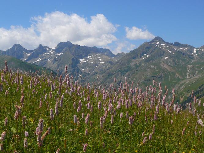
This valley carries some history you can feel on the ground. Until 1947 Tende and its high valleys were Italian, and the road was hammered by Storm Alex in October 2020, which cut access to Casterino for a long time; it has since been rebuilt and the hamlet is reachable again by car, bus and bike. At the top you're at the doorstep of the Mercantour National Park, in larch forest with the high peaks of the Merveilles above.
PLAN YOUR ROUTE
 We've partnered with Sherpa-Map.com to bring you the best route planning tool. With a PRO Membership you can use this climb as a reference when creating your route.
The climb is front-loaded. Kilometers 1 to 8 average about 8%, with little variation: 7.1% to start, then 8.3%, 8.6%, 8.4% and 8.2% as the road works up through the forest, easing only slightly to 7.4-7.9% before a 9.9% kilometer around km 8.
Kilometer 9 is the first real relief at about 4%, but it doesn't last: km 10 kicks back up to 9.4%. After that the road levels out completely, and the final 3 km into Casterino average just 1.6-2.5%.
Steepest sections on our profile: 0.5 km at 12.3%, 1 km at 10.0%, 2 km at 8.5% and 5 km at 8.4%. Overall: 12.7 km (7.9 mi) at 6.6%, from about 713 m to 1554 m (5099 ft).
Roadway: The D91 is a narrow, paved mountain road from Saint-Dalmas-de-Tende to Casterino. Storm Alex in October 2020 washed out sections of it and closed the upper part for a long time; it has since been rebuilt and reopened, so expect stretches of new tarmac and fresh retaining walls alongside older surface. Above the hamlet the road carries on a short way to trailhead car parks, then gives way to tracks. At 1554 m Casterino runs a Nordic ski area in winter, so snow and ice are normal from December to March.
Traffic: Light. The road serves only Casterino and the hiking trailheads, so most of what you meet is hikers' cars on summer weekends, the Zest line 23 bus (daily from 1 June to 30 September) and a few local vehicles. It's at its quietest on weekday mornings and in spring and autumn.
Parking: Park in Saint-Dalmas-de-Tende near the railway station - an oversized building put up when this was the Italian side of the border - and ride from the junction with the valley road. If you only want the top, there are car parks at Casterino itself and at Pautamon, about 2 km higher at 1723 m, used by walkers heading into the national park.
Gear: A compact chainset is the sensible choice: the first 8 km sit at 7-10% with nowhere to recover, and the flatter finish won't hand back what you spend low down. Bring a layer for the descent: you're coming down 855 m from a hamlet that runs a ski area in winter.
Provisions: Fill bottles in Saint-Dalmas or Tende before you start, since there's nothing reliable on the way up. In season, Casterino's hotels and auberges, among them Les Mélèzes, the Chamois d'Or, the Auberge Val Castérino and the Auberge Sainte-Marie-Madeleine, serve food and drinks; outside the summer and Nordic-ski seasons, check before you count on any of them being open.
Before heading out on any cycling adventure check out our Things to Bring on a Cycling Trip and use our interactive check list to ensure you don't forget anything.
Casterino is the base for the Vallée des Merveilles and the Fontanalba valley, where tens of thousands of Bronze Age engravings are cut into the rock around Mont Bégo. The engraving zones are inside the national park core, reached only on foot, so plan a rest day here rather than a quick look after the ride. Two refuges, the Refuge de Fontanalbe and the Refuge de la Valmasque, sit above the hamlet for anyone staying higher.
For the town of Tende, its museum of the Merveilles engravings and the old pass road to Italy, see our Col de Tende (France) page. If you're coming without a car, the Roya line reaches Saint-Dalmas-de-Tende and Tende from Nice via Breil-sur-Roya when services are running, and the summer bus covers the road up to Casterino.
ROUTE MAP

MEMBER RATING
CURRENT WEATHER
PJAMM TRIPS ADVENTURE STARTER BUNDLES
Check out PJAMM Adventure's prepackaged (self-guided) cycling trips. They will help you plan, document and conquer your next adventure.
NEARBY CLIMBS (0) RADIAL PROXIMITY
FROM No Climbs Found
MEMBER REVIEWS & COMMENTS
Let us know what you thought of this climb. Signup for our FREE membership to write a review or post a comment.
Already have an account?
LOG IN HERE
