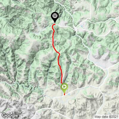
5
PDI
5.2 mi
DISTANCE
1,199 ft
GAINED
3.4 %
AVG. GRADE
FULL CLIMB STATS
INTRO
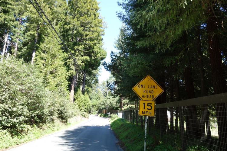
Joy Road is a short, steep, rolling climb through the redwoods. This road is iconic in local road races and known as a 'nasty finish'. Climbing from the Bodega Highway you start with some steep sections, pot hole filled pavement, and dense, beautiful redwood forest. As it turns into rolling hills with a false top, you can take a quick breather as you descent past Taylor Road and have one last push to the top. Joy Road connection to Colman Valley which is another iconic Sonoma county climb and can take you to the coast or to Occidental. Be on the look out pot holes, and a few blind corners.
PLAN YOUR ROUTE
See more details and tools regarding this climb's grade via our interactive Profile Tool.
Information Not Available
If you have any information regarding this climb, we'd like to hear from you. Click the CONTRIBUTE button to share your thoughts with us.
Information Not Available
If you have any information regarding this climb, we'd like to hear from you. Click the CONTRIBUTE button to share your thoughts with us.
Before heading out on any cycling adventure check out our Things to Bring on a Cycling Trip and use our interactive check list to ensure you don't forget anything.
Information Not Available
If you have any information regarding this climb, we'd like to hear from you. Click the CONTRIBUTE button to share your thoughts with us.
ROUTE MAP
MEMBER RATING
CURRENT WEATHER
PJAMM TRIPS ADVENTURE STARTER BUNDLES
Check out PJAMM Adventure's prepackaged (self-guided) cycling trips. They will help you plan, document and conquer your next adventure.
NEARBY CLIMBS (0) RADIAL PROXIMITY
FROM No Climbs Found
MEMBER REVIEWS & COMMENTS
Let us know what you thought of this climb. Signup for our FREE membership to write a review or post a comment.
Already have an account?
LOG IN HERE
bamiral
This ride surprised me, as it's only rated a 1.2 FEITS. For me, the climb was strenuous. There is also a lot more to it, as this page only shows the first part of Joy Rd, which is the most difficult, except for the section just after Bittner Road. Taking it all the way up to the top, which is on Coleman Valley Road near Timber Lane, is the full climb and very enjoyable!