
16.1
PDI
7.6 mi
DISTANCE
2,684 ft
GAINED
6.7 %
AVG. GRADE
FULL CLIMB STATS
INTRO
The Col de la Madone is where pros living around Monaco and Nice have long gone to see how fit they are. Tony Rominger and Lance Armstrong timed themselves on it, and Richie Porte's 29:40 before the 2014 Tour is still the time people quote. Their test starts in Menton. This version comes in from the side, up the little Route du Sanatorium from the Gorbio valley, and meets the main road below Sainte-Agnès.
It's 12.2 km (7.6 mi) from Le Pian at 102 m (335 ft) to the col at 920 m (3019 ft), gaining 818 m (2684 ft) at 6.7%. The Sanatorium road gets the short, sharp corners out of the way early, and then the D22 settles into a long, steady 7-8% up the open hillside, with the bay of Menton and the Italian coast getting wider every time you look back.
Past the Sainte-Agnès turnoff at km 7.1 the road narrows, roughens and eases to about 5% for 3 km, ducking through three short rock tunnels; goats are often on the road up here. The last 2 km kick back up to 7.5%. The col is a small clearing in the trees with a peace monument made from old shell fragments and a view inland toward Peille and the higher mountains.
PLAN YOUR ROUTE
 We've partnered with Sherpa-Map.com to bring you the best route planning tool. With a PRO Membership you can use this climb as a reference when creating your route.
Overall: 12.2 km (7.6 mi) from 102 m (335 ft) to 920 m (3019 ft), gaining 818 m (2684 ft) at an average of 6.7%.
The shape: 1.6 km at 6.5% on the Route du Sanatorium, with a few very steep corners; 5.5 km at 7.3% on the D22 to the Sainte-Agnès turnoff; 2.9 km at 5.1% through the tunnels; and the final 2.2 km at 7.5% to the col.
Kilometer by kilometer: 7.2%, 4.6%, 7.7%, 7.5%, 7.9%, 7.4%, 7.5%, 5.4%, 4.7%, 5.6%, 8.4%, 7.1%, and 4.8% for the final 0.2 km.
Steepest sections: 0.5 km at 9.1%, 1 km at 8.6%, 2 km at 8%, 5 km at 7.7%.
Roadway: Paved throughout. The Route du Sanatorium is a narrow lane with a couple of very tight, steep corners; the D22 up to the Sainte-Agnès turnoff is a proper two-lane road. Above the turnoff the Route du Col de la Madone narrows, passes through three short rock tunnels and has a patchier surface, and riders regularly mention gravel and fallen stones on the bends - take the descent carefully. After heavy rain, check the Alpes-Maritimes Inforoutes06 service for rockfall closures.
Traffic: Some local traffic on the D22, plus visitors heading for Sainte-Agnès on summer weekends. Above the turnoff it's very quiet - riders in 2025 reported almost no cars - and you'll usually see more cyclists than vehicles.
Parking: There's only roadside space at Le Pian, so most riders start from the coast and ride the short way up the Gorbio valley road. Menton and Roquebrune-Cap-Martin both have train stations and paid car parks near the seafront.
Gear: A compact with a 28 or 30 at the back is plenty - nothing here is steeper than the corners on the Sanatorium road. Put a rear light on for the tunnels, and start early in summer: the D22 is an exposed south-facing hillside above the Mediterranean.
Provisions: Fill up in Menton or Roquebrune before you start. Sainte-Agnès, a short climb up from the turnoff at km 7.1, has cafes and restaurants; there's nothing on the road above it or at the col.
Before heading out on any cycling adventure check out our Things to Bring on a Cycling Trip and use our interactive check list to ensure you don't forget anything.
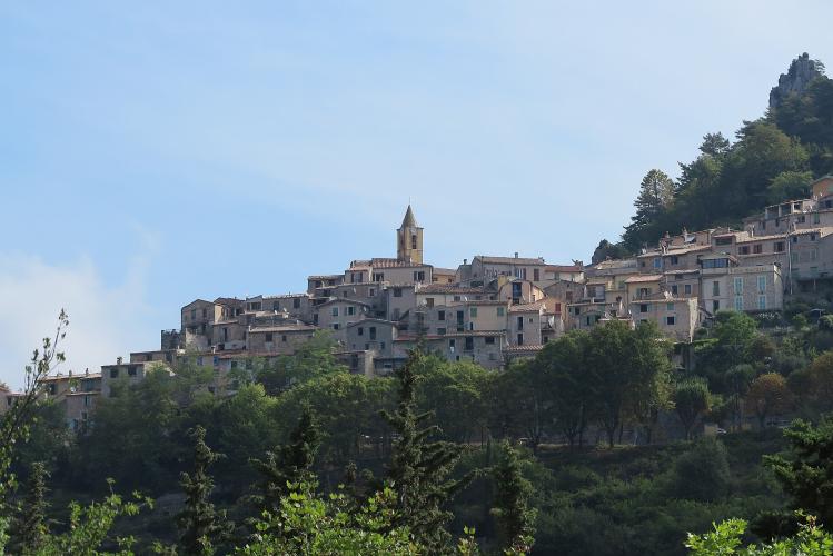
Sainte-Agnès is worth the detour: a stone village on a rocky spur around 800 m above the sea, with castle ruins above it and a Maginot Line fort, built in the 1930s, dug into the rock beside it. The fort is now a museum with guided tours - the schedule changes through the year, so check before you go.
From the col the road carries on down to Peille - our Col de la Madone (la Grave) page climbs that side - or round toward La Turbie and Mont Agel - our Mont Agel (Cape Martin) page covers that side and the Grande Corniche back down to the coast. For the classic test from the seafront, see our Col de la Madone page. Menton is an easy base, with trains along the coast to Monaco and Nice.
ROUTE MAP

MEMBER RATING
CURRENT WEATHER
PJAMM TRIPS ADVENTURE STARTER BUNDLES
Check out PJAMM Adventure's prepackaged (self-guided) cycling trips. They will help you plan, document and conquer your next adventure.
NEARBY CLIMBS (0) RADIAL PROXIMITY
FROM No Climbs Found
MEMBER REVIEWS & COMMENTS
Let us know what you thought of this climb. Signup for our FREE membership to write a review or post a comment.
Already have an account?
LOG IN HERE
