8.9
PDI
3 mi
DISTANCE
1,283 ft
GAINED
8.3 %
AVG. GRADE
FULL CLIMB STATS
INTRO
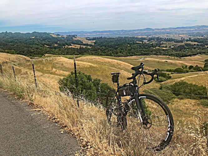
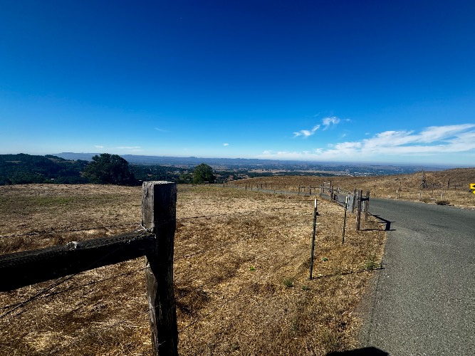
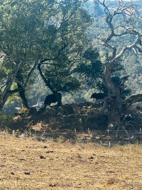
Lichau (pronounced Leech-Ow) Road is a little known cycling treat in Sonoma County. Located off Roberts Road near Sonoma State University, Lichau can be included in a nice loop or done as it's own climb. It starts mild and ramps up with steep turns and cattle guards quickly. The challenge is balanced by the great view of Rohnert Park you have to the west as you climb. Once you turn right the road feels harder than it looks as this sections is known as 'gravity hill.' A few milder pitches and you end at a gate just past the nature preserve to the right. Be careful going down as it can be bumpy and cars often speed up the road and take wide turns.
PLAN YOUR ROUTE
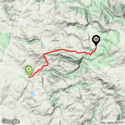
Average grade is 8.4% gaining 400' with 0 descent. 12% of the climb is at 0-5%, 59% at 5-10% and 29% is at 10-15%. The steepest quarter mile is 11.8%.
See more details and tools regarding this climb's grade via the “Profile Tool” button above.
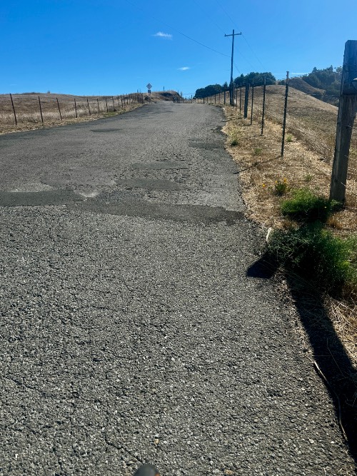
Roadway: Narrow two lane road in fair to poor condition with no center striping or shoulder.
Traffic: Mild.
Parking: Parking on the side of the road at the intersection of Roberts and Lichau Road.
Provisions: There are plenty of options for food and beverages in Rohnert Park - e.g., Starbucks 2.5 mile, etc. (Map)
Before heading out on any cycling adventure check out our Things to Bring on a Cycling Trip and use our interactive check list to ensure you don't forget anything.
Use the “Routes in Area” button on the menu bar above to see other bike climbs in this area.
If you have travelled to Sonoma County to cycle or have any questions concerning cycling in the North Bay, you are welcome to contact me at John@pjammcycling.com with your questions about the area - I grew up and live in Sonoma and have good knowledge of cycling in this region.
ROUTE MAP
MEMBER RATING
CURRENT WEATHER
PJAMM TRIPS ADVENTURE STARTER BUNDLES
Check out PJAMM Adventure's prepackaged (self-guided) cycling trips. They will help you plan, document and conquer your next adventure.
NEARBY CLIMBS (0) RADIAL PROXIMITY
FROM No Climbs Found
MEMBER REVIEWS & COMMENTS
Let us know what you thought of this climb. Signup for our FREE membership to write a review or post a comment.
Already have an account?
LOG IN HERE
Katcanyon
A good leg burner for climbing. Immediately you begin climbing, with some being steeper than others. The climbs are almost all back to back, but they are short (with the exception of one long climb). Definitely doable and not crazy steep, but you will definitely feel the burn since there are so many at once. Overall, not too long, but great for training days where you want to focus on drills or improving climbing endurance. Moderate cars passing by, so be careful with descending on corners. Also, parking isn’t the best, you just have to find an open spot. Nevertheless, the views in the first half are calming, and you get the chance to see the city below and animals passing by.
joelmblatt
There are quite a few cattle guards, but otherwise an excellent out and back on paved surface.
bamiral

This is a very nice ride that winds through the hills of central Sonoma County. The views are beautiful and ends with a very short gravel section at a gated private driveway. Well worth the effort!