Cunard Bike Climb - PJAMM Cycling

6.1
PDI
2 mi
DISTANCE
868 ft
GAINED
8.4 %
AVG. GRADE

FULL CLIMB STATS

Page Contributor(s): Stephen Rochworth, Longwood, Co. Meath, Ireland.

INTRO

This 2 mile bike climb is located in County Dublin, Ireland. The average gradient is 8.4% and there is a total elevation gain of 868 ft, finishing at 1,558 ft.

Use the profile tool, route map, and weather forecast to conquer this cycling climb.

See more details and tools regarding this climb's grade via our interactive Profile Tool.
Information Not Available

If you have any information regarding this climb, we'd like to hear from you. Click the CONTRIBUTE button to share your thoughts with us.

Information Not Available

If you have any information regarding this climb, we'd like to hear from you. Click the CONTRIBUTE button to share your thoughts with us.

Before heading out on any cycling adventure check out our Things to Bring on a Cycling Trip and use our interactive check list to ensure you don't forget anything.
Information Not Available

If you have any information regarding this climb, we'd like to hear from you. Click the CONTRIBUTE button to share your thoughts with us.

ROUTE MAP

MEMBER RATING

Not Yet Rated
-
Road
-
Traffic
-
Scenery

CURRENT WEATHER

PJAMM TRIPS ADVENTURE STARTER BUNDLES

Check out PJAMM Adventure's prepackaged (self-guided) cycling trips. They will help you plan, document and conquer your next adventure.
ALL TRIPS
Browse all of our prepackaged trips and find your next adventure!

NEARBY CLIMBS (0) RADIAL PROXIMITY

FROM
No Climbs Found

MEMBER REVIEWS & COMMENTS

Let us know what you thought of this climb. Signup for our FREE membership to write a review or post a comment.
Already have an account?
ROUTE MAP
PROFILE TOOL
Route Data
S.G. (%)
hide
Segment Data
hide
CLIMB SUMMARY

Cycling Cunard

Ride 3.2 kilometers gaining 267 meters at 8.5% average grade.

Climb summary by PJAMM Amabassador Stephen Rochworth, Longwood, Co. Meath, Ireland.

This is a beautiful climb. It starts close to the Bohernabreena reservoir in Dublin and ends at the junction with Military road, which continues on towards the Sally Gap and the climb up to mount Kippure.

The climb is relatively short but has plenty of bite. The strava segment, https://www.strava.com/segments/19084491 says it is 3.17km@ 8.5%,  however there is about a kilometer in the middle that averages between 3-5% with the start and finish much steeper.

Right from the beginning you need to be in the small ring as you are hit with an initial ramp of about 750m that averages 11.5% and goes above 15%, coupled with a road surface that is regularly damp and slippery. This narrow, tree lined section is vel shaded and often has green algae or moss for the first 100m so be prepared for some wheel spin!!!

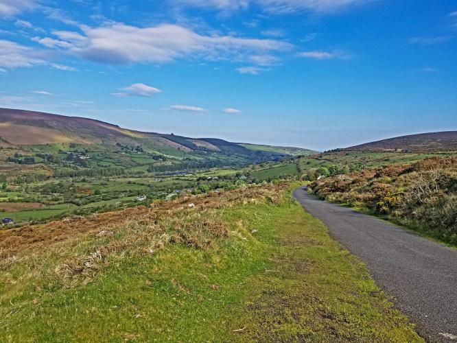
As the road flattens out a little you can look back behind and to your right to get a fantastic view of the valley with the reservoir surrounded by trees and small cottages. It's hard to believe you are so close to the city.

Continue right at the fork halfway up, at this point you can see the road pitching up ahead of you. Now comes the second hard section, 650m@10.5%.

There's a sharp left hand turn, again giving you a chance to really soak up the views, before a final push to the top of the climb.

The road has recently been resurfaced and is in very good condition. There is almost no traffic here and the only concern is the possibility of a sheep staying across the road if you chose to descend and also the mossy surface near the bottom.