6.3
PDI
1.9 mi
DISTANCE
858 ft
GAINED
8.8 %
AVG. GRADE
FULL CLIMB STATS
INTRO
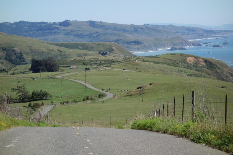
Meyers Grade is a very steep climb beginning on the rugged Sonoma Coast, just north of Jenner, CA. The first half of this climb offers stunning views of the Pacific Ocean to the west which gives way to a crushing three-quarter mile 13.1% average grade (miles 0.75 to 1.5). This road is known for being one of the most fun, fast and beautiful descents in Sonoma County. Located between Fort Ross, King Ridge, and Sea View Roads, it is typically used as a downhill connector to the next big climb. If descending make sure to check the road and plan for some off camber sections.
PLAN YOUR ROUTE
8.8% average grade with 0 descent. 30% of the climb is at 0-5%, 23% is at 5-10%, 34% is at 10-15%, and 13% of this climb is at 15-20% grade. The steepest quarter-mile is 15.3%.
See more details and tools regarding this climb's grade via the “Profile Tool” button.
Roadway; Two lane road in excellent condition with center stripe and no shoulder.
Traffic: Minimal.
Parking: This climb is rarely a stand alone, or even the start of a loop, but if you do need to park, there is a pull-out on the left at the climb start (Map; Street View).
Provisions: The closest food and beverages are in Jenner five miles south at either the Jenner Sea Store (Google Map + Reviews) or Cafe Aquatica (Google Map + Reviews) - Route Map.
Before heading out on any cycling adventure check out our Things to Bring on a Cycling Trip and use our interactive check list to ensure you don't forget anything.
Our favorite Sonoma County loop is Cazadero-King Ridge-Sea View-Meyers Grade (descent)-Jenner-Cazedero, which is 63 miles and 6,030' of climbing (Map).
If you have traveled to Sonoma County to cycle or have any questions concerning cycling in the North Bay, you are welcome to contact me at john@pjammcycling.com with your questions about the area. I grew up in and live in Sonoma County and have good knowledge of cycling in this region.
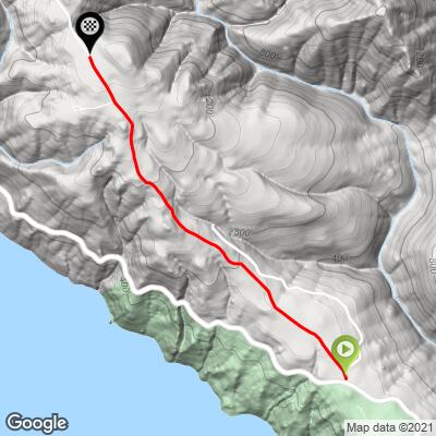
ROUTE MAP
MEMBER RATING
CURRENT WEATHER
PJAMM TRIPS ADVENTURE STARTER BUNDLES
Check out PJAMM Adventure's prepackaged (self-guided) cycling trips. They will help you plan, document and conquer your next adventure.
NEARBY CLIMBS (0) RADIAL PROXIMITY
FROM No Climbs Found
MEMBER REVIEWS & COMMENTS
Let us know what you thought of this climb. Signup for our FREE membership to write a review or post a comment.
Already have an account?
LOG IN HERE