
32.4
PDI
15.3 mi
DISTANCE
5,495 ft
GAINED
5.9 %
AVG. GRADE
FULL CLIMB STATS
INTRO
PLAN YOUR ROUTE
 We've partnered with Sherpa-Map.com to bring you the best route planning tool. With a PRO Membership you can use this climb as a reference when creating your route.
 Average grade is 5.9% over the climb's 15.3 miles, but that number is deceptive - the lower miles out of La Tour are gentle before the road tilts up hard in the final stretch: the steepest 2.5 miles average 9.1%, the steepest mile 10.7%, and the steepest half-mile 11.9%. Save something for the finish; the hardest pitches come only after the legs are already well into the effort.
Roadway: The road is paved for most of the route up from La Tour, but it narrows to a single lane with patchy, weathered pavement in the upper kilometers, and rider reports describe short rough or unpaved stretches near the top - a bike with slightly wider tires than a pure race setup is a sensible choice here.
Traffic: Traffic is very light for the entire climb - this is a remote connector road between two valleys, not a route to any major destination, so most of the ride is quiet enough to hear only the wind and the odd farm vehicle.
Parking: La Tour-sur-Tinee is a small perched village with limited but generally available roadside parking near the church and village center; there's no dedicated climb parking, so plan to leave your car on a quiet village street rather than expecting a formal lot.
This is a remote, lightly-serviced climb, so carry more water and food than you think you'll need - there's little to nothing in the way of shops or fountains once you leave La Tour. A bike with slightly wider tires is worth considering given the rougher pavement higher up (see Roadway above), and a spare tube or two is cheap insurance this far from help.
Before heading out on any cycling adventure check out our Things to Bring on a Cycling Trip and use our interactive check list to ensure you don't forget anything.
La Tour-sur-Tinee sits above the Tinee valley, one canyon over from the Vesubie valley, where the more famous - and considerably busier - Col de Turini begins its own climb near La Bollene-Vesubie. Riders splitting a multi-day trip between the two valleys can treat Andrion as the quiet, low-traffic counterpart to Turini's rally fame, though the two don't share a starting town and are best treated as separate outings rather than a single linked ride. Roquebilliere, at the northern end of the Andrion crossing, has a few small cafes if you're looking for a stop before or after the climb.
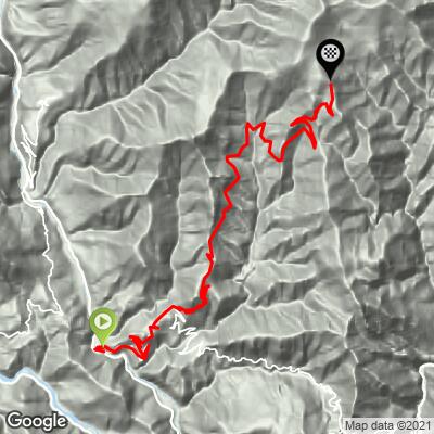
ROUTE MAP
MEMBER RATING
CURRENT WEATHER
PJAMM TRIPS ADVENTURE STARTER BUNDLES
Check out PJAMM Adventure's prepackaged (self-guided) cycling trips. They will help you plan, document and conquer your next adventure.
NEARBY CLIMBS (0) RADIAL PROXIMITY
FROM No Climbs Found
MEMBER REVIEWS & COMMENTS
Let us know what you thought of this climb. Signup for our FREE membership to write a review or post a comment.
Already have an account?
LOG IN HERE
