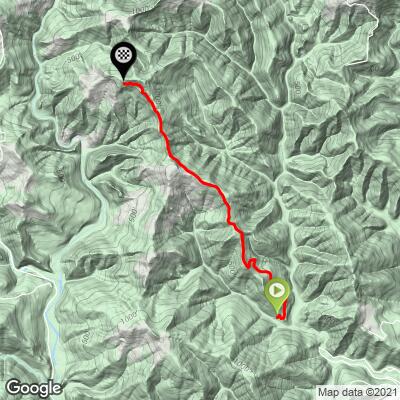
5.2
PDI
3.3 mi
DISTANCE
1,002 ft
GAINED
5.3 %
AVG. GRADE
FULL CLIMB STATS
INTRO
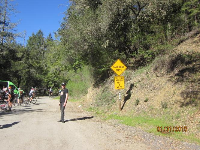
Old Caz is a rural West Sonoma County Road that is paved coming from Guerneville, but dirt, gravel and pine needles on its back side. This is a very peaceful and fun bike ride and can be done on a road bike.
PLAN YOUR ROUTE
The average grade of 5.2% spikes to 7.8% when descent is eliminated from the gradient formula. The grades on this climb are all over the board - 26% (0.9 mile) is descent, 22% (0.7 mile) is at 0-5%, 28% (0.9 mile) is at 5-10%, and 24% (0.8 mile) is at 10-15%. The steepest quarter-mile is 12.4% and steepest half-mile 11.4%.
See more details and tools regarding this climb's grade via the “Profile Tool” button.
Roadway: Narrow single lane road in decent shape but rough and with debris in others - as of 2019, the last few hundred yards were closed to motor vehicles.
Traffic: Minimal to none.
If you are heading down the backside to Cazadero, you will need to forge a creek on the way - unless there have been recent storms, this is manageable, but just a heads up.
Before heading out on any cycling adventure check out our Things to Bring on a Cycling Trip and use our interactive check list to ensure you don't forget anything.
There are a few options to stay near Guerneville. If you are cycling in Sonoma County another option is to rent a house or cabin in the area.
ROUTE MAP
MEMBER RATING
CURRENT WEATHER
PJAMM TRIPS ADVENTURE STARTER BUNDLES
Check out PJAMM Adventure's prepackaged (self-guided) cycling trips. They will help you plan, document and conquer your next adventure.
NEARBY CLIMBS (0) RADIAL PROXIMITY
FROM No Climbs Found
MEMBER REVIEWS & COMMENTS
Let us know what you thought of this climb. Signup for our FREE membership to write a review or post a comment.
Already have an account?
LOG IN HERE