13
PDI
4.9 mi
DISTANCE
2,007 ft
GAINED
7.4 %
AVG. GRADE
FULL CLIMB STATS
INTRO
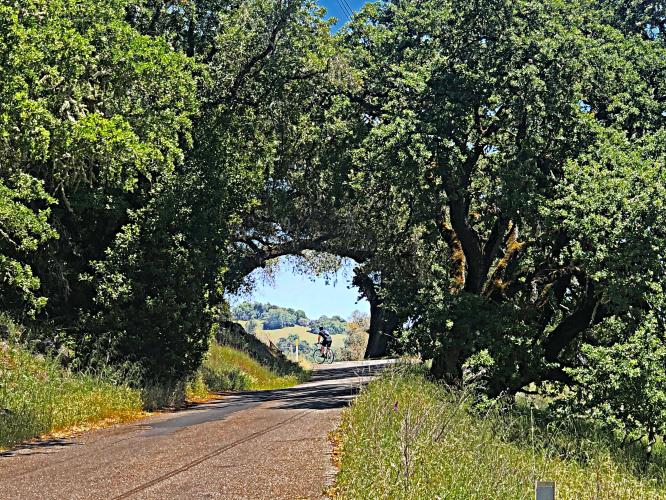
This is the sixth hardest bike climb in Sonoma County. The first half of the climb presents the greatest challenge with an average grade (9.2%) nearly double that of the second half (4.9%). During the summer, the temperatures in this area can approach and exceed 100 degrees, so beware of the weather. This is a private, peaceful, challenging climb surrounded by oaks and forest along most of this relatively secluded climb.
PLAN YOUR ROUTE
Average grade is 7.4% (8.6% climb only). 46% of the climb is at 5-10% grade and 33% is at 10-15%. The steepest quarter-mile is 12.7%.
See more details and tools regarding this climb's grade via the “Profile Tool” button.
Roadway: Narrow two lane roadway in fair to poor condition with potholes. There is no center stripe or shoulder.
Traffic: Minimal.
Parking: On the side of the road just before the start of the climb (Map; Street View).
Provisions: None on this remote climb. The closest food and beverages are in Cloverdale 2.3 miles from climb start (Map).
Before heading out on any cycling adventure check out our Things to Bring on a Cycling Trip and use our interactive check list to ensure you don't forget anything.
Geysers Road South and Pine Mountain out and back make for a good bike climbing day where you will see but a handful of motor vehicles (and not many cyclists, either . . . ). This climb is 60 miles gaining 9,200' (Map).
If you have traveled to Sonoma County to cycle or have any questions concerning cycling in the North Bay, you are welcome to contact me at john@pjammcycling.com with your questions about the area - I grew up and live in Sonoma and have good knowledge of cycling in this region.
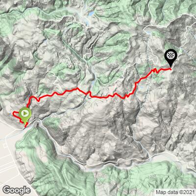
ROUTE MAP
MEMBER RATING
CURRENT WEATHER
PJAMM TRIPS ADVENTURE STARTER BUNDLES
Check out PJAMM Adventure's prepackaged (self-guided) cycling trips. They will help you plan, document and conquer your next adventure.
NEARBY CLIMBS (0) RADIAL PROXIMITY
FROM No Climbs Found
MEMBER REVIEWS & COMMENTS
Let us know what you thought of this climb. Signup for our FREE membership to write a review or post a comment.
Already have an account?
LOG IN HERE