This is a remote climb along an unsupported stretch in the far reaches of northwestern Sonoma County. “The Wall”, as it is known to locals, is the third steepest climb on the Sonoma/Napa/Lake climb list, just 1/10 % behind the legendary Oakville Grade in Napa (the shades of the elevation grid, below, tell the tale like few others you will see). This climb is the third and final in a series of challenging climbs travelling eastbound on Skaggs Springs/Stewarts Point Roads from Lake Sonoma.
![]()
Start of THE WALL
30 miles into the Skaggs-Stewarts Point ride.
![]()
A mere 1.3 miles . . . but . . .
12.5% average grade + steepest ¼ mile = 16%! 😓
![]()
![DSC01348.JPG]()
. . . or rot in the wilderness 👍👍
![]()
This is an infamous obstacle at mile 139 of the extremely challenging Santa Rosa Cycling Club's “Terrible Two” (a 16,000' climb double century held on the third Saturday of June each year). A very good "training" route is Warm Springs Dam to Stewart's Point and back (RideWithGPS Route ; Climb Page) , but be sure to take plenty of provisions as there are no supplies (other than water at Camp Liahona at mile 27.5 and Kashia Elementary School at the top of The Wall at mile 31.5) between the dam and Stewart's Point.
ON THE WAY TO THE WALL
![DSC01248.JPG]()
Generally we begin at Lake Sonoma -
30 miles ant 4400’ of climbing from start of Rancheria Wall.
![DSC01260.JPG]()
Finish of the first of 2 climbs on the way to Rancheria Wall
Mt. St. Helena in the background photo center top.
Aerial drone photo.
![]()
Start just past the bridge over Warm Springs Creek at mile 12 - 18 miles to Rancheria Wall from here.
Climb is 2.8 miles gaining 1,070’ at 6.8% average grade.
![]()
![DSC01320.JPG]()
Footbridge at Camp Liahona Redwoods (2 miles east ofThe Wall))
![]()
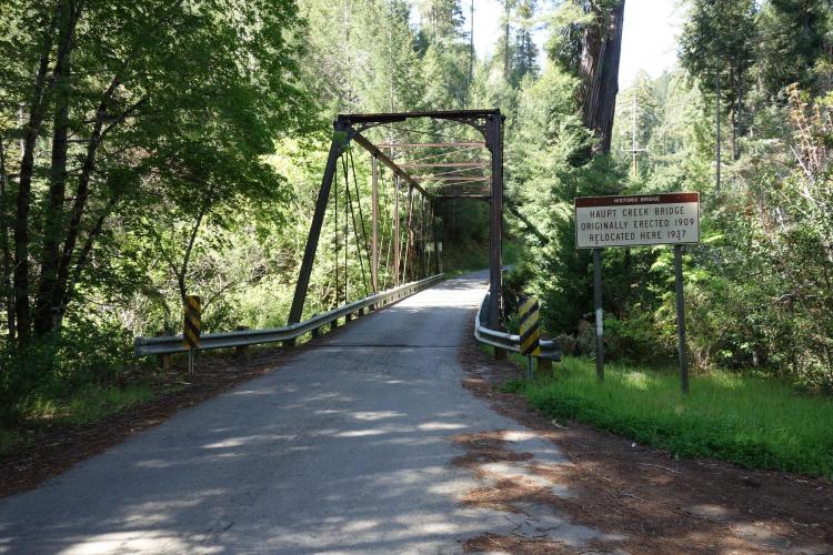
Annapolis Bridge - 200 yards before start of Rancheria Wall
Roadway surface/Traffic: The roadway is in moderately decent condition and there is very little traffic in this area. Care should be used for the descent as the road is extremely steep with several sharp curves on the way down.
![]()

 We've partnered with Sherpa-Map.com to bring you the best route planning tool. With a PRO Membership you can use this climb as a reference when creating your route.

