Ridge of Cappard Bike Climb - PJAMM Cycling

4
PDI
1.2 mi
DISTANCE
543 ft
GAINED
8.9 %
AVG. GRADE

FULL CLIMB STATS

Page Contributor(s): Stephen Rochford, Longwood, Co. Meath, Ireland.

INTRO

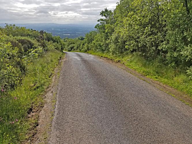
This 1.2 mile bike climb is located in County Laois, Ireland. The average gradient is 8.9% and there is a total elevation gain of 543 ft, finishing at 1,291 ft.

Use the profile tool, route map, and weather forecast to conquer this cycling climb.

See more details and tools regarding this climb's grade via our interactive Profile Tool.
Information Not Available

If you have any information regarding this climb, we'd like to hear from you. Click the CONTRIBUTE button to share your thoughts with us.

Information Not Available

If you have any information regarding this climb, we'd like to hear from you. Click the CONTRIBUTE button to share your thoughts with us.

Before heading out on any cycling adventure check out our Things to Bring on a Cycling Trip and use our interactive check list to ensure you don't forget anything.
Information Not Available

If you have any information regarding this climb, we'd like to hear from you. Click the CONTRIBUTE button to share your thoughts with us.

ROUTE MAP

MEMBER RATING

Not Yet Rated
-
Road
-
Traffic
-
Scenery

CURRENT WEATHER

PJAMM TRIPS ADVENTURE STARTER BUNDLES

Check out PJAMM Adventure's prepackaged (self-guided) cycling trips. They will help you plan, document and conquer your next adventure.
ALL TRIPS
Browse all of our prepackaged trips and find your next adventure!

NEARBY CLIMBS (0) RADIAL PROXIMITY

FROM
No Climbs Found

MEMBER REVIEWS & COMMENTS

Let us know what you thought of this climb. Signup for our FREE membership to write a review or post a comment.
Already have an account?
ROUTE MAP
PROFILE TOOL
Route Data
S.G. (%)
hide
Segment Data
hide

Climb Profile Not Found
CLIMB SUMMARY

Cycling Ridge of Cappard

Ride 1.9 kilometers gaining 162 meters at 8.8% average grade.

Climb summary by PJAMM ambassador Stephen Rochford, Longwood, Co. Meath, Ireland.

This is a short, sharp, shock to the system. The strava segment  https://www.strava.com/segments/188884 

says it is 1.9km @ 8.8% but with a couple of short flat sections and even a brief downhill, the rest of the climb is loaded with ramps well above 10% and a maximum gradient heading close to 20%.

The road surface is quite good, but like most roads in this area beware of loose chips on the ground. The road itself is very narrow and quite popular with hikers so can have a bit of traffic on the weekends.

The climb starts easily enough but once you reach the first bend it kicks up over 10% for a few hundred meters, maxing out in the high teens. Then you get a very brief rest onna short downhill before a series of ramps winding up to the top.

The two steepest parts are around the hairpins and the final push to the top. There is a car park at the top where you can access the hiking trail and a viewing area just below that with fine vistas across the Midlands of Ireland.