31.3
PDI
12.7 mi
DISTANCE
4,674 ft
GAINED
7 %
AVG. GRADE
FULL CLIMB STATS
Page Contributor(s): Bryant Robbins and Jill Aho, Palmer, AK, USA; Travis Profit; Don Baty, Corvallis, OR
INTRO
Travis Profit - think that rough patch changes in difficulty from one year to the next, depending on how rough the winter was.
Most of us either start at the store in Mazama (food, parking, and even a sandwich bar during the day) or drive up Lost River Rd to Yellowjacket Sno-park. Starting at the park takes 6.1 miles off the route, almost all of it paved.
It’s a remote area. The nearest places to get gas are Marblemount 75 miles west, or Winthrop 14 miles farther east. Supposedly there’s gas at the Mazama store, but the few times I’ve been there it was empty. Winthrop has a couple motels, and Mazama has an “Inn” next to the store.
Monument Creek trailhead is a little further up the road from Yellowjacket, but if memory serves you’ve already begun 1-2% climbing when you cross the river between the two parking spots
PLAN YOUR ROUTE
See more details and tools regarding this climb's grade via our interactive Profile Tool.
Information Not Available
If you have any information regarding this climb, we'd like to hear from you. Click the CONTRIBUTE button to share your thoughts with us.
Information Not Available
If you have any information regarding this climb, we'd like to hear from you. Click the CONTRIBUTE button to share your thoughts with us.
Before heading out on any cycling adventure check out our Things to Bring on a Cycling Trip and use our interactive check list to ensure you don't forget anything.
Information Not Available
If you have any information regarding this climb, we'd like to hear from you. Click the CONTRIBUTE button to share your thoughts with us.
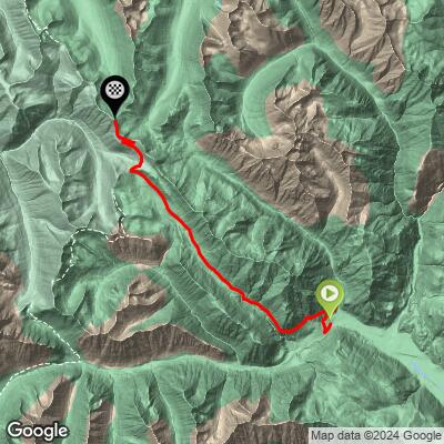
ROUTE MAP
MEMBER RATING
CURRENT WEATHER
PJAMM TRIPS ADVENTURE STARTER BUNDLES
Check out PJAMM Adventure's prepackaged (self-guided) cycling trips. They will help you plan, document and conquer your next adventure.
NEARBY CLIMBS (0) RADIAL PROXIMITY
FROM No Climbs Found
MEMBER REVIEWS & COMMENTS
Let us know what you thought of this climb. Signup for our FREE membership to write a review or post a comment.
Already have an account?
LOG IN HERE
benguernsey
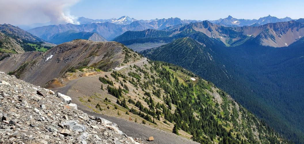
Did this climb in 2021, very long and difficult with a great pay off at the top with views of mountains upon mountains looking from the North Cascades into Canada. IMO under ranked with the surface quality and finishes steep.