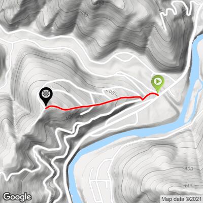
6.3
PDI
0.6 mi
DISTANCE
500 ft
GAINED
17.5 %
AVG. GRADE
FULL CLIMB STATS
INTRO
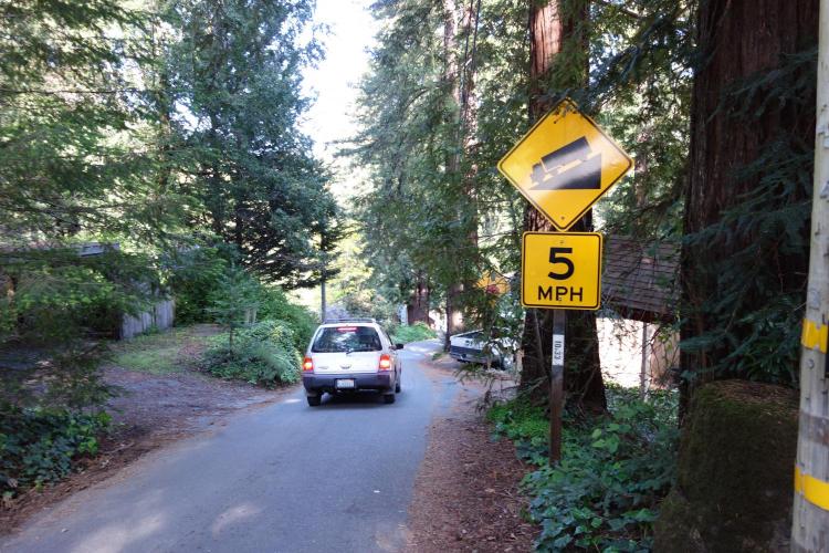
WOW – and, we don’t write that very often! This is a scorcher, no doubt about it. Short, stout, brutal, murderous!! This is (along with Cougar Lane in Santa Rosa which is a private road) the steepest paved public road in Sonoma County that we have ever encountered. Pitches hit 27% according to our Garmin and it feels that way – we had to stand and really mash the ring to get up the 1/10 mile major pitch – with a 30t, by the way! If you want to test your Super-Steep-Kick-Butt-Pitch ability, take this, because it’s The One!
PLAN YOUR ROUTE
See more details and tools regarding this climb's grade via our interactive Profile Tool.
Information Not Available
If you have any information regarding this climb, we'd like to hear from you. Click the CONTRIBUTE button to share your thoughts with us.
Information Not Available
If you have any information regarding this climb, we'd like to hear from you. Click the CONTRIBUTE button to share your thoughts with us.
Before heading out on any cycling adventure check out our Things to Bring on a Cycling Trip and use our interactive check list to ensure you don't forget anything.
Information Not Available
If you have any information regarding this climb, we'd like to hear from you. Click the CONTRIBUTE button to share your thoughts with us.
ROUTE MAP
MEMBER RATING
CURRENT WEATHER
PJAMM TRIPS ADVENTURE STARTER BUNDLES
Check out PJAMM Adventure's prepackaged (self-guided) cycling trips. They will help you plan, document and conquer your next adventure.
NEARBY CLIMBS (0) RADIAL PROXIMITY
FROM No Climbs Found
MEMBER REVIEWS & COMMENTS
Let us know what you thought of this climb. Signup for our FREE membership to write a review or post a comment.
Already have an account?
LOG IN HERE