![Sweetwater Springs Road Climbing Sweetwater Springs Road by bike - aerial drone photo of Mercury Mine and road]()
The Sweetwater West bike climb is up the lower middle, and middle left of the photo.
SWEETWATER WEST
This is a very private and stout climb (a few segments hit 16% for short distances) through a wooded and secluded portion of western Sonoma County, beginning just east of Guerneville, CA. Ride 1.4 miles east from Sweetwater’s intersection with Armstrong Woods Road where the road pitches up appreciably to begin the climb. This is a nearly private, and very challenging, albeit brief, climb in west Sonoma County. The more popular Sweetwater route begins off Westside Road near Santa Rosa, to the east, but the west side Sweetwater ascent is just as challenging, although without the classic Sonoma County vineyard scenery leading up to it.
![Sweetwater Springs Road Cycling Sweetwater Springs Road - cyclist riding past road sign at start]()
Beginning of Sweetwater West bike climb.
A very scenic loop that gives us two classic Sonoma County experiences, vineyards (of course!) and redwoods, is the 30 mile Armstrong Woods loop -- with 3,200' of climbing, and some exceptional vineyards views (note that three miles of this loop are along River Road which is busy, with fast moving vehicles, but there is a good bike lane along this stretch).
![Sweetwater Springs Road Bike climb Sweetwater Springs Road - road and cougar crossing sign]()
![Sweetwater Springs Road Climbing Sweetwater Springs Road by bike - slow and danger sign, roadway]()
Traffic/Roadway Surface: The roadway is very narrow and bumpy (no problem at all ascending, but a bit rough descending). There is next to no traffic and we rate this as a very safe road for cyclists.
![Sweetwater Springs Road Climbing by bike Sweetwater Springs Road - PJAMM Cycling John Johnson at finish with bike on road]()
Finish.
MOUNT JACKSON MINE -- SWEETWATER WEST
![Sweetwater Springs Road Cycling Sweetwater Springs Road - Mount Jackson Mine]()
Mt. Jackson Mine, Sweetwater Springs Road, Guerneville, CA.
This abandoned mine is at the beginning of the climb. The Mount Jackson Mine is the only remains that can be seen in Sonoma County today of the once vibrant mercury (quicksilver) mining in Sonoma County in the late 19th and early 20th centuries. Hundreds of mining claims were filed in the 1870’s, resulting in many mines opening in Sonoma County with “colorful names like the Rattlesnake, the Blue Jacket, the Red Cloud, the Flaming Star and Robert Louis Stevenson's hideaway, the Silverado. Miners named them for women — Edith, Emma, Georgia — and for their homes — Illinois, Missouri, Chicago” (Pressdemocrat.com).
![Sweetwater Springs Road Cycling Sweetwater Springs Road - aerial drone photo of Mount Jackson Mercury Mine]()
Mount Jackson Mercury Mine operated from 1889 until 1972.
The town of Mercury surrounding the Mount Jackson Mine consisted of a post office, church, community hall, school, and 57 company homes.
SWEETWATER EAST
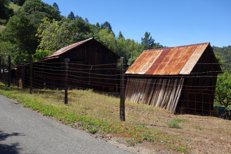
![Sweetwater Springs Road cycling Sweetwater Springs Road - barn and road]()
This western Sonoma County climb takes us through a private, wooded, and secluded area. Nearly the entire route is covered by a canopy of trees and the smell of redwood accompanies us for part of this climb. Rarely do we encounter motor vehicles on this route and, while the roadway is barely over one lane, the ride is comfortable (well, maybe not during the 16-20% sections) and safe. This has a #459 Strava Segment, meaning it was one of the first of millions created over the years.
An extremely scenic and very remote 100 mile ride with nearly 9,500' of climbing that includes two Sonoma County jewels (Sweetwater Springs Road and Kings Ridge Road) is found at the PJAMMCycling RideWithGPS Map. Note that there are provisions in Guerneville at mile 12 and Cazadero at mile 25, water at Camp Liahona Redwoods at mile 52, and Dry Creek General Store a 1/2 mile off West Dry Creek Road at mile 87, but be prepared because this is an isolated and very hot route during summertime.
Traffic/Roadway Surface: The roadway is very narrow and bumpy (no problem at all ascending, but a bit rough descending). There is next to no traffic and we rate this as a very safe road for cyclists.
![]()
That’s a wrap!

 We've partnered with Sherpa-Map.com to bring you the best route planning tool. With a PRO Membership you can use this climb as a reference when creating your route.

