10
PDI
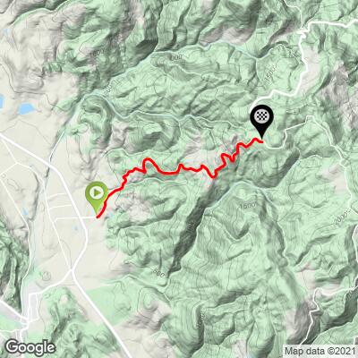
2.9 mi
DISTANCE
1,357 ft
GAINED
8.9 %
AVG. GRADE
FULL CLIMB STATS
INTRO
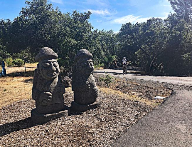
Trinity West is the #9 ranked bike climb in Sonoma County. This is a favorite climb for local cyclists and is one of the few connectors between Napa and Sonoma Counties. The views are not spectacular, but the climb is challenging and generally a steady 6-10% from start to finish. The finish of this climb is at the intersection of Cavedale and Trinity Roads at the Mayacamas Volunteer Fire Station where there is normally water and a cycling pump - it is "cyclist friendly." [Thank you MVFD!].
PLAN YOUR ROUTE
Gain 1,360' in 2.9 miles at 8.9% with 0 descent. 30% of the climb is at 10-15%, and 2% is at 15-20%. The steepest quarter-mile is 13.8%.
See more details and tools regarding this climb's grade via the “Profile Tool” button.
Roadway: Double lane rural road with a center stripe, no shoulder and rough pavement in many spots.
Traffic: Mild to moderate.
Parking: We normally park at Dunbar School across Highway 12, 1.3 miles northwest when we do climbs in this area - Map; Street View.
Provisions: Water at Mayacamas Fire Station at climb finish - Map; Street View. Or, at the wonderful Glen Ellen Village Market 1.7 miles south (Map).
Before heading out on any cycling adventure check out our Things to Bring on a Cycling Trip and use our interactive check list to ensure you don't forget anything.
If you have travelled to Sonoma County (see PJAMM's Sonoma County climb page) to cycle or have any questions concerning cycling in the North Bay, you are welcome to contact me at john@pjammcycling.com with your questions about the area. I grew up and live in Sonoma and have good knowledge of cycling in this region.
Use the “Routes in Area” button on the menu bar to see other bike climbs in this area.
ROUTE MAP
MEMBER RATING
CURRENT WEATHER
PJAMM TRIPS ADVENTURE STARTER BUNDLES
Check out PJAMM Adventure's prepackaged (self-guided) cycling trips. They will help you plan, document and conquer your next adventure.
NEARBY CLIMBS (0) RADIAL PROXIMITY
FROM No Climbs Found
MEMBER REVIEWS & COMMENTS
Let us know what you thought of this climb. Signup for our FREE membership to write a review or post a comment.
Already have an account?
LOG IN HERE