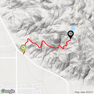
6.4
PDI
1.6 mi
DISTANCE
826 ft
GAINED
9.6 %
AVG. GRADE
FULL CLIMB STATS
INTRO
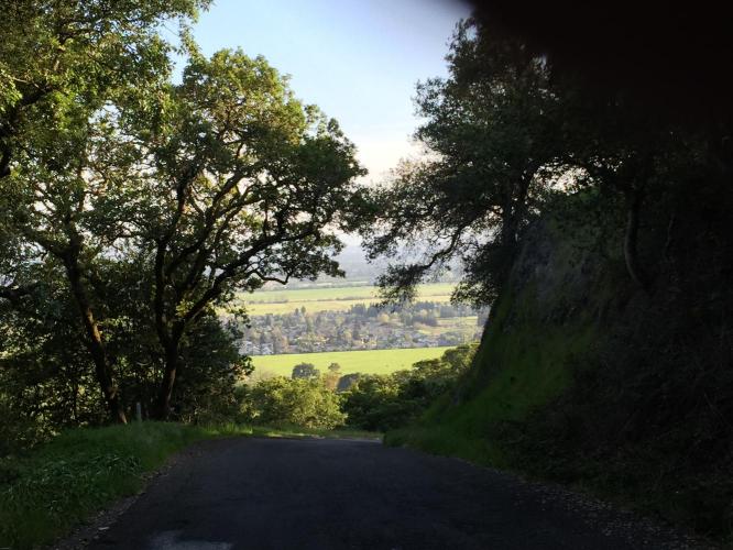
A hidden jewel of Sonoma County cycling. This one is just not on the radar of even many an experienced Sonoma County cyclist. Thanks to Tayler Hockett and Jake Baumbach for directing us to it. We recommend this climb to those who have not yet experienced it.
PLAN YOUR ROUTE
See more details and tools regarding this climb's grade via our interactive Profile Tool.
Information Not Available
If you have any information regarding this climb, we'd like to hear from you. Click the CONTRIBUTE button to share your thoughts with us.
Information Not Available
If you have any information regarding this climb, we'd like to hear from you. Click the CONTRIBUTE button to share your thoughts with us.
Before heading out on any cycling adventure check out our Things to Bring on a Cycling Trip and use our interactive check list to ensure you don't forget anything.
Information Not Available
If you have any information regarding this climb, we'd like to hear from you. Click the CONTRIBUTE button to share your thoughts with us.
ROUTE MAP
MEMBER RATING
CURRENT WEATHER
PJAMM TRIPS ADVENTURE STARTER BUNDLES
Check out PJAMM Adventure's prepackaged (self-guided) cycling trips. They will help you plan, document and conquer your next adventure.
NEARBY CLIMBS (0) RADIAL PROXIMITY
FROM No Climbs Found
MEMBER REVIEWS & COMMENTS
Let us know what you thought of this climb. Signup for our FREE membership to write a review or post a comment.
Already have an account?
LOG IN HERE
Katcanyon
This one’s tricky because the descending is a little too steep with the road getting very narrow. You’ll find yourself heavily breaking whilst trying to make sure you stay within the road. Personally, it doesn’t feel safe for me on the decent, and there’s a section where I had to get off to make sure a car was not coming around the corner, since, as you get higher, you are on higher ground (no fence below). Am I glad I did it? Yeah, it was nice practice for starters, but since it felt too narrow and steep, I wouldn't go back. Just be safe if you go. Overall, the climbs are decent, and you will get a few steep ones that will burn. The first, middle, and last climb (among them all) will be worth it. Solid 4/10 for climbing.