
15.5
PDI
3.4 mi
DISTANCE
1,814 ft
GAINED
10.3 %
AVG. GRADE
FULL CLIMB STATS
INTRO
"A concrete road, so steep - real Vuelta style," was how Primož Roglič summed it up after winning here in August 2024, and that's the whole story of this side of Pico Villuercas. The first 3 km are a single-lane track of grooved concrete between low stone parapets, and they average about 13%: kilometers of 11.3, 14.1 and 13.3%, with the steepest 100 m at 17%. In the race this was where the favorites split, in heavy heat, before Roglič outsprinted Lennert Van Eetvelt at the top and took the red jersey.
After that it's a different climb. At about km 3 the track meets the summit road from Guadalupe, the way the 2021 Vuelta came up when Romain Bardet won, and the grade drops to 5 to 7% along the top of the ridge, with the jagged quartzite crests of the Villuercas on either side. A last ramp of about 12% takes you up to the abandoned military base and heliport under the summit rocks. All told it's 5.4 km (3.4 mi) and 553 m (1814 ft) of climbing at 10.3%.
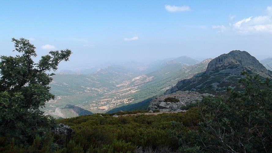
The summit, at 1601 m (5253 ft), is the highest point in Extremadura you can reach by road, and on a clear day the view goes a long way: straight down over Navezuelas, and out across the long parallel ridges and valleys that run through the geopark like folds in a blanket.
PLAN YOUR ROUTE
 We've partnered with Sherpa-Map.com to bring you the best route planning tool. With a PRO Membership you can use this climb as a reference when creating your route.
Overall: 5.4 km (3.4 mi) with 553 m (1814 ft) of climbing at a 10.3% average, from 1017 m (3336 ft) on the Navezuelas road to 1570 m (5150 ft) at the summit buildings.
Km 0-3: 11.3%, 14.1% and 13.3% - the concrete track.
Km 3-5: 5.4% and 6.7% - on the summit road shared with the Guadalupe side.
Km 5-5.4: about 12% to the finish.
Steepest sections: 100 m at 17%, 500 m at 15.6%, 1 km at 15%, 2 km at 14.9%, 5 km at 10.3%.
Roadway: The first 3 km are a narrow concrete track, grooved across for grip and lined with low stone parapets - steep enough that you'll want to stay seated on the 14% ramps when it's wet or covered in leaves, and take the descent slowly. From the junction the summit road is old, irregular asphalt, cracked and patched in places, up to the military base. Both are open to cars.
Traffic: Very light. The track sees the odd car and a few walkers; the summit road brings more visitors - hikers, geopark sightseers and stargazers after dark - but it's never busy.
Parking: There's no car park at the start, just the verge of the Navezuelas road, so it's better to park in Navezuelas, a few kilometers away, or in Cañamero, and ride to the bottom of the track.
Gear: Gear low. Three kilometers at 11 to 14% on concrete is a lot, so a compact with at least a 32 at the back is the sensible minimum, and a 34 won't feel like too much. Summers here are hot - the 2024 stage was raced in punishing heat in late August - so ride early and carry a light layer for the exposed top, which is often windier and cooler than the valley.
Provisions: Nothing on the climb and nothing at the top. Fill your bottles in Navezuelas or Cañamero before you start, and in summer carry an extra bottle on top.
Before heading out on any cycling adventure check out our Things to Bring on a Cycling Trip and use our interactive check list to ensure you don't forget anything.
Navezuelas and Cañamero are small villages with rural houses to rent, and Cañamero lends its name to one of the wine subzones of the Ribera del Guadiana. Guadalupe, on the other side of the mountain, is the bigger base, with the UNESCO-listed Real Monasterio and the Parador - our Pico Villuercas (este) page covers it.
For more riding, the east side from Guadalupe is the longer, steadier way to the same summit, so you can make a big loop of it: up one side, down the other and back around through Cañamero. Our Puerto Berzocana page climbs another of the ridges nearby. Off the bike, the hamlet of Cabañas del Castillo, under its castle crag, is close by and has one of the best views in the geopark.
ROUTE MAP

MEMBER RATING
CURRENT WEATHER
PJAMM TRIPS ADVENTURE STARTER BUNDLES
Check out PJAMM Adventure's prepackaged (self-guided) cycling trips. They will help you plan, document and conquer your next adventure.
NEARBY CLIMBS (0) RADIAL PROXIMITY
FROM No Climbs Found
MEMBER REVIEWS & COMMENTS
Let us know what you thought of this climb. Signup for our FREE membership to write a review or post a comment.
Already have an account?
LOG IN HERE
