48
PDI
11.2 mi
DISTANCE
5,819 ft
GAINED
9.8 %
AVG. GRADE
FULL CLIMB STATS
Page Contributor(s): Ard Oostra, Switzerland; Helmuth Dekkers, Netherlands
INTRO
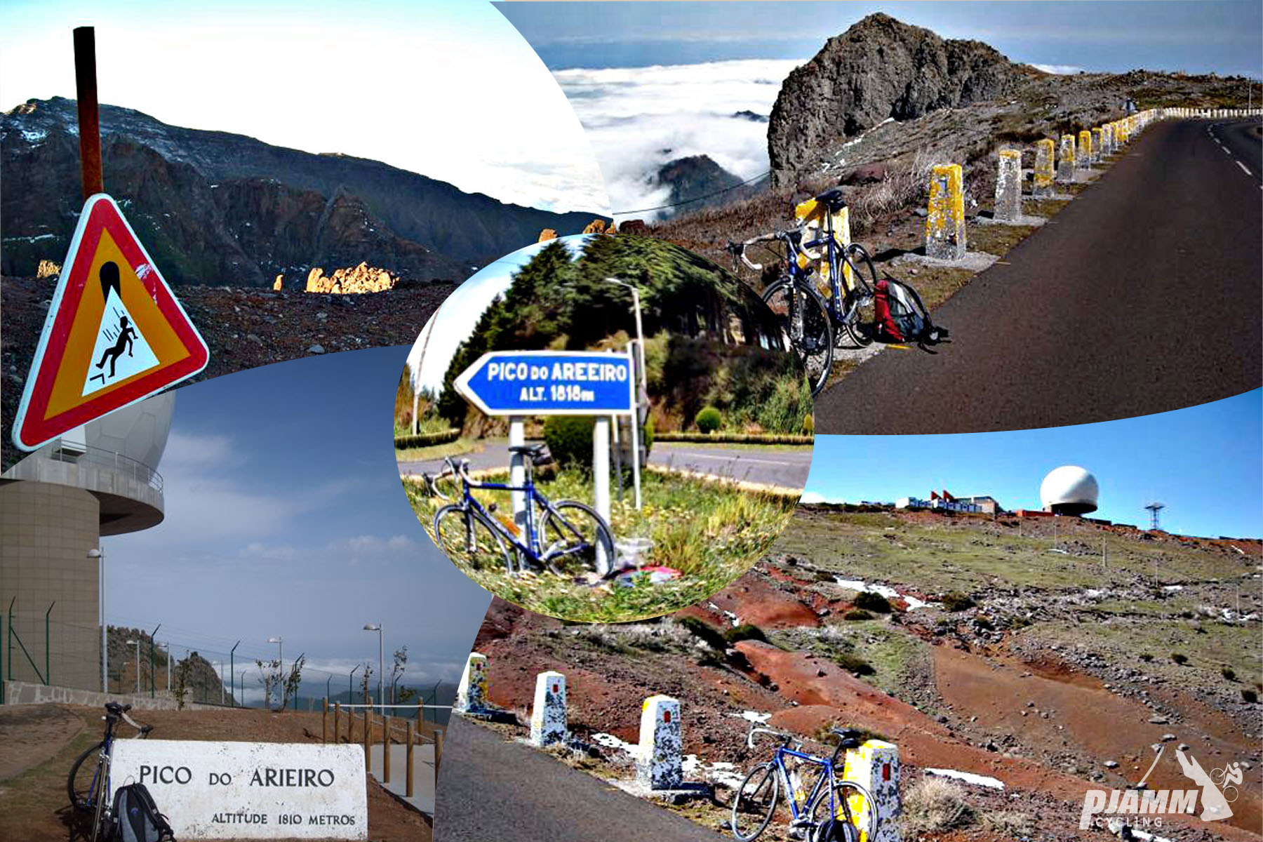
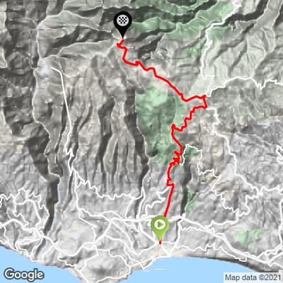
Pico Arieiro is the hardest bike climb in Portugal and one of the Top 50 hardest climbs in the world - 11.17 miles and 5,819 feet of climbing at a 9.83% average grade, starting right in downtown Funchal and finishing at 5,892 feet, just below Madeira's third-highest peak.
The crux comes immediately: the first 2.6 kilometers average roughly 20%, including a two-kilometer stretch that averages 22%, some of the hardest sustained pitches on any climb in our database. Once past the opening ramps, the road settles into a long, steady grind up through Funchal's outskirts and forested slopes toward the peak.
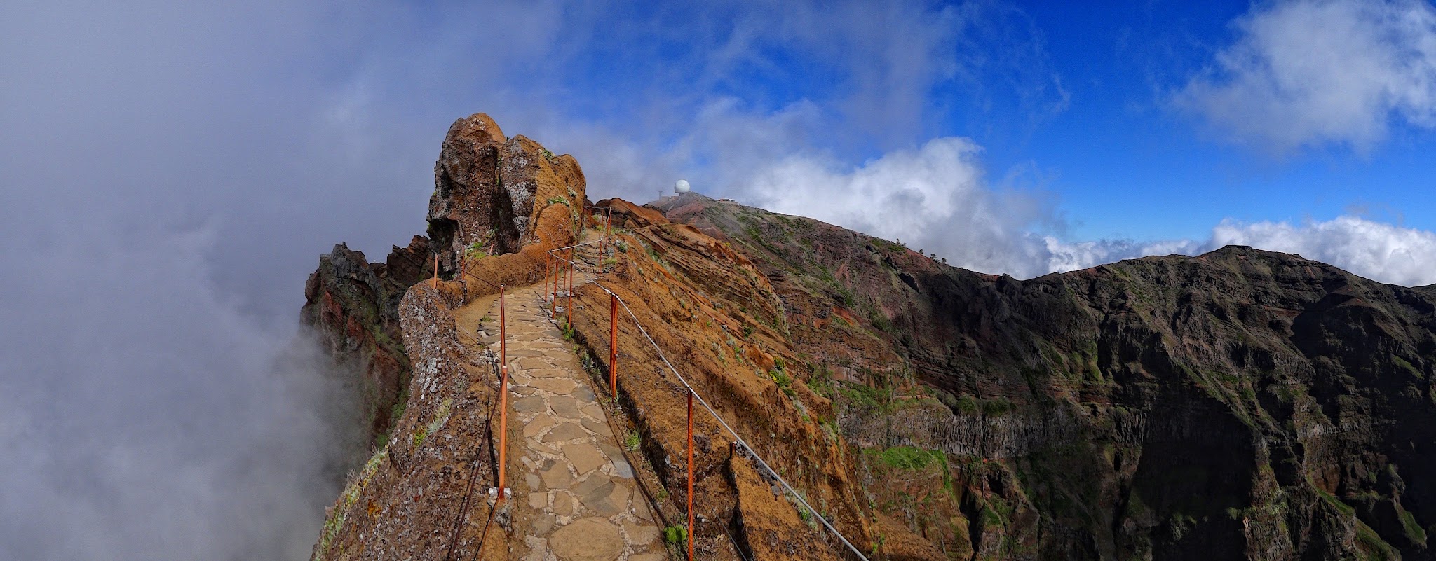
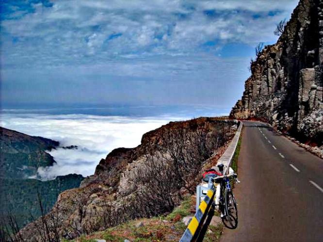
The payoff at the top is one of Madeira's best-known views - a summit plateau that regularly sits above the cloud layer, looking out over the island's volcanic ridgeline. It's a similar above-the-clouds feeling to summiting Mauna Kea, just reached here after 11 miles instead of 40.
Pico Arieiro's summit is also the trailhead for the PR1 hike to Pico Ruivo, Madeira's highest peak - the full trail reopened in April 2026 after a two-year closure, now running one-way (Arieiro to Ruivo) with mandatory advance booking, so expect other visitors and vehicle traffic at the top even midweek.
PLAN YOUR ROUTE
 We've partnered with Sherpa-Map.com to bring you the best route planning tool. With a PRO Membership you can use this climb as a reference when creating your route.
 Average grade is 9.83% (10.8% if the descent sections are excluded). About 7% of the route is downhill, but a striking 11% of the climb sits at 15-20% and another 11% at 20% or steeper. The steepest 500 meters averages 24%, and there's a full two-kilometer stretch that averages 22% - among the hardest sustained pitches of any climb in our database.
Roadway: The road is a narrow two-lane route with a center stripe for the first 3.5 kilometers through densely populated Funchal, then opens up as you climb - tropical foliage and flowers for several kilometers, a forested stretch beginning around kilometer 9.4, and unobstructed volcano and ocean views (or views above the clouds) from kilometer 12 to the top. The surface has stayed in excellent condition on our trips up this climb, and Funchal's municipal council has issued periodic traffic-conditioning notices for the Caminho do Arieiro section in 2026 for maintenance work - check current notices before you go.
Traffic: Mild to moderate for the first four kilometers through the city, then mild the rest of the way. Expect more vehicle and foot traffic right at the summit, which doubles as a viewpoint and the trailhead for the popular PR1 hike to Pico Ruivo.
Parking: There are a couple of parking garages near the climb start (Map; Street View), at 87 Rua 5 de Outubro, Funchal, Madeira - see also Google's parking map for Funchal. At the top, parking near the summit complex has periodically been restricted during 2026 maintenance work, so allow extra time to find a spot during peak midday hours.
Provisions: There are several restaurants along the lower part of the climb in Funchal, and a cafeteria at the complex at the top near the summit viewpoint - a good spot to refuel before the descent. There's little in between on the mid-mountain forested section, so carry water if you're not stopping in the city first.
Before heading out on any cycling adventure check out our Things to Bring on a Cycling Trip and use our interactive check list to ensure you don't forget anything.
The views at the top of the climb are spectacular - see Google's Viewpoint Pico do Areeiro listing and reviews. The Pico do Arieiro to Pico Ruivo hike (PR1) reopened in April 2026 after a two-year closure; it now runs one-way from Arieiro to Ruivo and requires advance booking through Madeira's SIMplifica system, so plan ahead if you want to walk it after the ride. The terrain, scenery, and colors at the top of this climb remind us a bit of Waimea Canyon on Kokee Road in Hawaii. Also worth the short walk up the steps to the Vereda do Areeiro viewpoint for magnificent views (Google Map + Reviews). Use the "Routes in Area" button on the menu bar to see other bike climbs nearby.
ROUTE MAP
MEMBER RATING
CURRENT WEATHER
PJAMM TRIPS ADVENTURE STARTER BUNDLES
Check out PJAMM Adventure's prepackaged (self-guided) cycling trips. They will help you plan, document and conquer your next adventure.
NEARBY CLIMBS (0) RADIAL PROXIMITY
FROM No Climbs Found
MEMBER REVIEWS & COMMENTS
Let us know what you thought of this climb. Signup for our FREE membership to write a review or post a comment.
Already have an account?
LOG IN HERE