
26.2
PDI
16.4 mi
DISTANCE
4,919 ft
GAINED
5.3 %
AVG. GRADE
FULL CLIMB STATS
INTRO
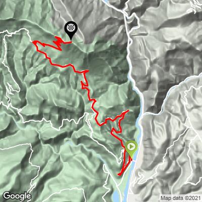
Mont Vial is a remote summit in the Alpes-Maritimes hinterland north of Nice, reached by a 26.3 km (16.4 mi) road that climbs 1,499 m (4,919 ft) from the Var River valley to a lonely, radar-topped ridge at 1,516 m (4,975 ft), averaging 5.3% along the way.
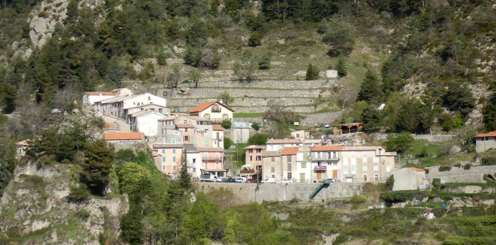
Unlike the famous cols closer to the coast, Mont Vial sees almost no cycling traffic and has no race pedigree - it's a backcountry climb that rewards riders willing to track down its unmarked turn off the valley floor. The road climbs steadily out of the Var Valley before reaching the small village of Toudon, built directly into the flank of the mountain, then continues up through pine forest to a series of switchbacks on the exposed upper slopes.
The payoff is a genuine 360-degree view from the summit - the Mediterranean to the south, the high peaks of Mercantour National Park to the north - shared only with the weather radar dome that gives the mountain its distinctive silhouette from the valley below. The final kilometers are also where the road roughens considerably, with loose gravel and potholes reported by riders in recent years, so plan for a slower, more careful finish than the stats alone suggest.
Several other climbs thread through this same stretch of the Alpes-Maritimes hinterland - see our Routes in the Area tool for what else is nearby.
PLAN YOUR ROUTE
 We've partnered with Sherpa-Map.com to bring you the best route planning tool. With a PRO Membership you can use this climb as a reference when creating your route.
 Mont Vial averages 5.3% over 26.3 km (16.4 mi), gaining 1,499 m (4,919 ft) from the Var Valley to the summit at 1,516 m (4,975 ft).
The grade is backloaded - the road eases through the lower valley approach before Toudon, then steepens through the switchbacked upper slopes. The steepest sustained kilometer averages 10.6%, and the steepest 500 meters comes in at 10.9%; independent route data has also clocked individual pitches in the 13-14% range on the final ramps below the summit.
Roadway: The road is paved the entire way, but conditions decline noticeably in the final kilometers past Toudon - recent rider reports describe loose gravel, potholes, and an irregular surface on the switchbacked approach to the summit, so plan for a cautious pace, and an even more cautious descent, once you're above the village.
Traffic: Traffic is light for essentially the entire climb and drops to almost nothing past Toudon - this is a dead-end backcountry road used mainly by the handful of residents and technicians who service the summit radar station.
Parking: There's no dedicated lot; riders typically start from a pull-off along the N202 in the Var Valley near Le Broc, or from the village center of Toudon partway up for a shorter version of the climb.
Le Broc and Saint-Martin-du-Var, in the Var Valley at the base of the climb, have the last reliable shops and cafes before the ascent - there's nothing at the summit beyond the radar installation. Toudon has a public fountain partway up, though riders have reported it isn't reliably potable, so treat it as a backup rather than your main water stop and top off before you leave the valley.
Before heading out on any cycling adventure check out our Things to Bring on a Cycling Trip and use our interactive check list to ensure you don't forget anything.
Mont Vial sits in the quiet hinterland behind Nice, far enough from the coast that it sees a fraction of the traffic of the Riviera's better-known cols - a worthwhile detour if you're based in Nice or Villefranche for a week and want a genuinely local, backcountry ride. The Var Valley villages of Le Broc and Saint-Martin-du-Var make a convenient staging point, both an easy drive or train ride from Nice itself.
Several other climbs thread through this same stretch of the Alpes-Maritimes hinterland - use our Routes in the Area tool to see what else is nearby if you want to string together a longer day.
ROUTE MAP
MEMBER RATING
CURRENT WEATHER
PJAMM TRIPS ADVENTURE STARTER BUNDLES
Check out PJAMM Adventure's prepackaged (self-guided) cycling trips. They will help you plan, document and conquer your next adventure.
NEARBY CLIMBS (0) RADIAL PROXIMITY
FROM No Climbs Found
MEMBER REVIEWS & COMMENTS
Let us know what you thought of this climb. Signup for our FREE membership to write a review or post a comment.
Already have an account?
LOG IN HERE
MethowBiker


This is a pump. The last 6.5 km average 10-13%. Zero traffic. I would have selected that option if available. There are 8 hairpins. You get a tiny break if you take them wide. Amazing views from mercantour national park to the sea.
