
28.8
PDI
3.2 mi
DISTANCE
2,501 ft
GAINED
14.9 %
AVG. GRADE
FULL CLIMB STATS
Page Contributor(s): Ard Oostra, Switzerland
INTRO
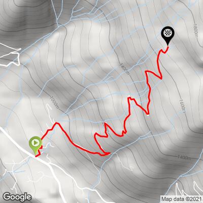
This short, punishing climb leaves the hamlet of Lammersdorf, on the high plateau above Lake Millstatt in Carinthia, and grinds up the private Lammersdorfer Almstraße to the Lammersdorfer Hütte at roughly 1,662 m - 5.2 km (3.2 mi) at an average grade of 14.7%, gaining 762 m (2,501 ft) in barely over 3 miles.
There's no easing into this one. The Almstraße is paved the entire way but pitches into the high teens almost immediately and stays there, with sections reported over 20% - genuinely one of the steepest sustained climbs in this part of Carinthia, over almost before it starts.
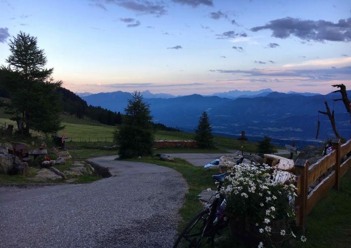
The road is a private, tolled Alm road, but cyclists ride it free - only motor vehicles pay the toll. At the top, the Lammersdorfer Hütte serves food and drink with an open view back down over Lake Millstatt and the Nockberge, and doubles as a trailhead for hikers continuing up to the Granattor, a former garnet-mining site at the high point of the Millstätter Alpe.
We currently rank this climb #379 in the world - short, but a serious test by any measure. Lammersdorf itself is a small agricultural hamlet on the Millstätter Berg plateau, part of the municipality of Millstatt am See.
PLAN YOUR ROUTE
 We've partnered with Sherpa-Map.com to bring you the best route planning tool. With a PRO Membership you can use this climb as a reference when creating your route.
 Lammersdorfer Hütte packs 762 m (2,501 ft) of gain into just 5.2 km (3.2 mi) - an average grade of 14.7%, with no flat sections to recover on. Other route trackers measuring this same road report an even steeper picture, with average grades in the mid-teens and pitches into the low 20% range on the steepest stretches. However it's measured, this is a short, sustained wall of a climb - pace conservatively from the first pedal stroke.
Roadway: The Lammersdorfer Almstraße is paved for its entire length and well maintained - it's a privately operated toll road, kept up accordingly.
Traffic: Light. This is a private road used mainly by drivers heading up to the hut and hikers continuing on toward the Granattor. Cyclists ride the toll road for free, and there's no through-traffic beyond hut visitors.
Parking: Park in Lammersdorf, near the start of the Almstraße at the edge of the hamlet.
Provisions: There's nothing on the climb itself - the Lammersdorfer Hütte at the top serves food and drink once you arrive.
Gear: With a 14.7% average and pitches reported over 20%, bring the lowest gearing you have. This is not a climb to attempt undergeared - a compact chainring and a wide-range cassette are close to mandatory.
Before heading out on any cycling adventure check out our Things to Bring on a Cycling Trip and use our interactive check list to ensure you don't forget anything.
Lammersdorf sits on the plateau of the Millstätter Berg, a quiet agricultural hamlet with sweeping views down over Lake Millstatt. From the hut at the top, hikers continue on to the Granattor, a former garnet-mining site and the high point of the Millstätter Alpe, part of a local route nicknamed the "Trail of Love." Down at the lake, the town of Millstatt am See is worth the detour - its Benedictine abbey, founded around 1080, is one of the most significant Romanesque buildings in southern Austria, with a well-known fresco of the Last Judgment in the cloister.
Given how exposed the plateau is, our Weather tool is worth checking before you go - conditions at the hut can differ noticeably from what you'll find down at lake level.
ROUTE MAP
MEMBER RATING
CURRENT WEATHER
PJAMM TRIPS ADVENTURE STARTER BUNDLES
Check out PJAMM Adventure's prepackaged (self-guided) cycling trips. They will help you plan, document and conquer your next adventure.
NEARBY CLIMBS (0) RADIAL PROXIMITY
FROM No Climbs Found
MEMBER REVIEWS & COMMENTS
Let us know what you thought of this climb. Signup for our FREE membership to write a review or post a comment.
Already have an account?
LOG IN HERE
