
18.3
PDI
4.4 mi
DISTANCE
2,252 ft
GAINED
9.8 %
AVG. GRADE
FULL CLIMB STATS
INTRO
The north side of the Col de Parquetout climbs 7.0 km (4.4 mi) from the D526 in the Valbonnais, below the Écrins, to the high point of the road at 1428 m (4685 ft), gaining 686 m (2252 ft) at a 9.8% average. The official pass sign, at 1382 m (4534 ft), comes just after a short descent on the far side.
The numbers undersell how hard it is. The first 2 km (1.2 mi) is a gentle warm-up across meadows to the hamlet of Les Angelas. After that the road heads into the forest and does not let up, averaging about 11% for the final 5 km (3.1 mi) in tight hairpins, with the gradient painted on the road as you go. One rider who climbed Alpe d'Huez straight afterward found the Huez the easier of the two, and plenty of experienced climbers have been caught out by it.
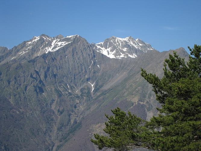
In exchange you get a narrow, almost traffic-free road, shade nearly all the way up and a real sense of being off the map. Near the top, look back over Valbonnais and Les Angelas, and if you carry on over the pass, the south side drops along an open ridge facing the Obiou toward the Lac du Sautet.
PLAN YOUR ROUTE
 We've partnered with Sherpa-Map.com to bring you the best route planning tool. With a PRO Membership you can use this climb as a reference when creating your route.
The Col de Parquetout from the Valbonnais averages 9.8% over 7.0 km (4.4 mi), gaining 686 m (2252 ft) from 742 m (2433 ft) at the D526 to 1428 m (4685 ft) at the high point of the road.
The steepest 91 m (100 yd) reaches 13.5% and the steepest 0.5 km (0.3 mi) 12.7%. The steepest kilometer (0.6 mi) averages 12.4%, the steepest 2 km (1.2 mi) 11.9% and the steepest 5 km (3.1 mi) 11.0%.
The climb is really in two parts. The first 2 km (1.2 mi) to Les Angelas gains 139 m (456 ft) at about 7%. From there to the top it gains 547 m (1795 ft) in 5 km (3.1 mi), close to 11% with no flat sections, and the hardest pitches come on the inside of the forest hairpins. Altitude markers at 1010 m, 1112 m and 1340 m help you count down.
Roadway: The D212F is a narrow, paved country road all the way over the col. It crosses the Beaumont canal at the edge of the forest, and from there it climbs in tight hairpins with the grade painted on the asphalt. The steepest ramps sit on the inside of the bends, so take the wider line where traffic allows. Above 1400 m (4593 ft) it is a small mountain road, so check conditions before an early- or late-season ride.
Traffic: Very light. This is a quiet link between the Valbonnais and the Beaumont, and riders consistently describe meeting almost no cars. The isolated, little-visited feel of the valley is a big part of the climb's charm.
Parking: There is a free car park in Valbonnais village, less than 2 km (1.2 mi) from the start along the D526, which makes a natural base. The Lac de Valbonnais also has a car park and is a good place to finish the day.
Gear: Gear low. Five kilometers at around 11% is a lot of time out of the saddle, and riders have needed gears as small as 30x25, while one found a 38x25 bottom gear simply too big. A compact crankset with a cassette of 32 teeth or larger is a sensible minimum, and the forest shade keeps it cooler than most climbs in summer.
Provisions: There are no services on the road. Fill bottles and buy food in Valbonnais or Entraigues before you start, and save something for the far side if you plan to continue over the pass toward Corps.
Before heading out on any cycling adventure check out our Things to Bring on a Cycling Trip and use our interactive check list to ensure you don't forget anything.
The Valbonnais is the quiet southwestern doorway to the Écrins National Park, and it is a good base for a few days of hard, empty roads. In Entraigues, the national park's Maison du Parc for the Valbonnais sector has free exhibitions, maps and information on the valley.
For a rest day, the Lac de Valbonnais is a calm, shallow lake that warms up nicely in summer, with lawns, a small sandy beach, a bar-restaurant, canoe and paddleboard rentals and an easy 2 km (1.2 mi) loop around the shore. Swimming is allowed but not supervised. Hikers can head up the Valjouffrey to the hamlet of Valsenestre, permanently inhabited until 1958 and set in a nature reserve.
The Parquetout combines well with the Col d'Ornon to the north, and our Col de Parquetout (Corps) page covers the gentler south side. See other climbs nearby, or build a custom route from here, with our Routes in the Area tool.
ROUTE MAP

MEMBER RATING
CURRENT WEATHER
PJAMM TRIPS ADVENTURE STARTER BUNDLES
Check out PJAMM Adventure's prepackaged (self-guided) cycling trips. They will help you plan, document and conquer your next adventure.
NEARBY CLIMBS (0) RADIAL PROXIMITY
FROM No Climbs Found
MEMBER REVIEWS & COMMENTS
Let us know what you thought of this climb. Signup for our FREE membership to write a review or post a comment.
Already have an account?
LOG IN HERE
