
15.7
PDI
6.4 mi
DISTANCE
2,401 ft
GAINED
7.2 %
AVG. GRADE
FULL CLIMB STATS
INTRO
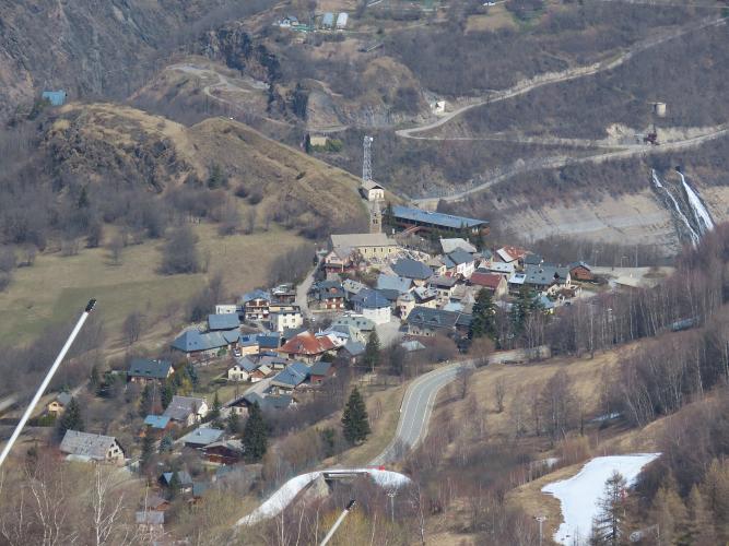
Most riders who go up to Les Deux Alpes take the D213 from the Chambon dam - wide, numbered hairpins, plenty of cars. This is the back door. It leaves the Lautaret road in the Romanche gorge and climbs a narrow lane through the woods, then runs out along a balcony through the old hamlets of Le Ponteil and Bons before joining the main road for the last few kilometers. Over 10.3 km (6.4 mi) it gains 732 m (2401 ft) at 7.2%.
All the pain comes first. The opening 2 km out of the gorge average about 10%, with no warm-up and no hairpins to break them up, so you'll be on your lowest gear within minutes of leaving the valley road. Then the road flattens to 4 or 5% along the balcony, the trees open up and you can look out across the Romanche valley while your legs come back. The D213 takes over for the finish at 7 to 9%, back among the cars and the camper vans.
Les Deux Alpes is where Marco Pantani took the yellow jersey at the 1998 Tour, after attacking Jan Ullrich on the Galibier in the rain, and there's a memorial to him in the resort. The race came up the main road that day. This side gets you to the same place with a fraction of the traffic, and it's also the way down that the Oisans tourist office suggests for its loop from Le Bourg-d'Oisans.
PLAN YOUR ROUTE
 We've partnered with Sherpa-Map.com to bring you the best route planning tool. With a PRO Membership you can use this climb as a reference when creating your route.
From 926 m (3039 ft) on the D1091 to 1658 m (5440 ft) in the resort, the climb gains 732 m (2401 ft) over 10.3 km (6.4 mi) for an average of 7.2%.
The hardest climbing is at the very start: kilometer 1 averages 10.9% and kilometer 2 9.4%, and those first 2 km together average 10.4%. Kilometer 3 eases to 7.8%, and kilometers 4 to 6, along the balcony through Le Ponteil, drop to 4 to 5.3%. The last 4 km on the D213 average 7.1 to 8.7%, with a nearly flat final stretch into the resort center.
Steepest sections: 0.5 km at 12%, 1 km at 11.2%, 2 km at 10.4%, 5 km at 7.4%.
Roadway: The Route du Ponteil is narrow, close to single-lane, with a patched surface that most riders rate OK rather than smooth - the rough bits matter more on the descent than on the way up. The last 4 km on the D213 are wide and well surfaced. Getting to the start means riding the D1091 from Le Bourg-d'Oisans, which goes through several lit tunnels, so use lights front and back.
Traffic: Light on the Route du Ponteil, which mostly serves the hamlets. The D213 is the main road into a big ski and summer resort and carries a steady stream of cars, vans and buses, busiest at weekends in July and August. The D1091 is a busy through road to the Lautaret and Briançon.
Parking: There's no real parking at the bottom, on a narrow stretch of the D1091 in the gorge, so most riders start from Le Bourg-d'Oisans and ride the valley road to the turn. Partway up, Bons has a small car park by the fire station at the entrance to the village.
Provisions: Le Ponteil and Bons are quiet residential hamlets with nothing to buy, so fill up in Le Bourg-d'Oisans. In the summer season the resort at the top has plenty of cafés, bakeries and shops; in the shoulder seasons many of them close.
Gear: The first 2 km at over 10% arrive with no warm-up, so a compact with a 30 or 32 at the back is a good idea. At 1658 m the resort is a lot cooler than the Romanche gorge, and the descent on the D213 is fast and busy, so pack a vest - and keep your lights for the tunnels on the way back to Bourg.
Before heading out on any cycling adventure check out our Things to Bring on a Cycling Trip and use our interactive check list to ensure you don't forget anything.
Le Bourg-d'Oisans is the natural base for this side, with hotels, campsites, bike shops and the foot of Alpe d'Huez. The Oisans tourist office's 42 km loop from Bourg goes up to Les Deux Alpes on the main D213 and comes back down this way through Bons and Le Ponteil, which is a good way to ride both.
Bons is worth a stop. Below the hamlet, a short, steep path signposted from the chapel (about 0.8 km round trip) leads down to the Porte Romaine, a half-arch cut through the rock for the Roman road that is thought to have crossed the Oisans. It's slippery underfoot, so it suits walking shoes better than cleats.
From the resort, the Venosc gondola drops to the Vénéon valley during the summer and winter seasons. The D213 from the Chambon dam has its own page, and our Col de Sarenne (Mizoën) page covers the quiet climb on the far side of the Lac du Chambon.
ROUTE MAP

MEMBER RATING
CURRENT WEATHER
PJAMM TRIPS ADVENTURE STARTER BUNDLES
Check out PJAMM Adventure's prepackaged (self-guided) cycling trips. They will help you plan, document and conquer your next adventure.
NEARBY CLIMBS (0) RADIAL PROXIMITY
FROM No Climbs Found
MEMBER REVIEWS & COMMENTS
Let us know what you thought of this climb. Signup for our FREE membership to write a review or post a comment.
Already have an account?
LOG IN HERE
