
28.7
PDI
11.4 mi
DISTANCE
4,366 ft
GAINED
7.3 %
AVG. GRADE
FULL CLIMB STATS
INTRO
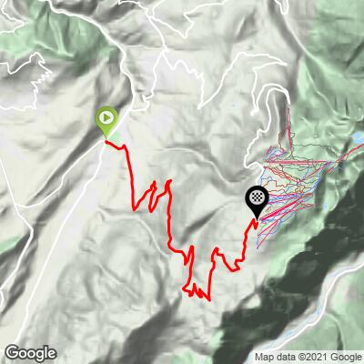
Chamrousse is an 18.4 km (11.4 mi) climb above Grenoble in the Belledonne range of the French Alps, gaining 1,331 m (4,366 ft) at an average grade of 7.3% from Uriage-les-Bains up to the Chamrousse ski resort at 1,744 m (5,721 ft).
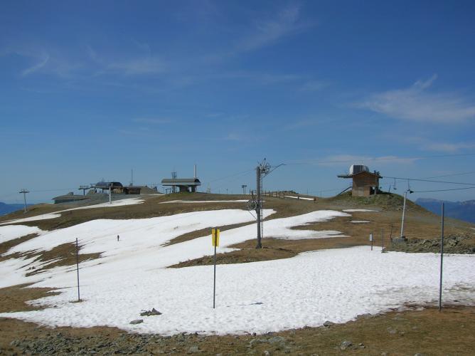
The road climbs steadily through thick pine forest on the D111, with long sweeping switchbacks and few flat sections to recover on, before opening up into the resort itself at Recoin. From the top, the Croix de Chamrousse cable car - a short walk from the finish - climbs on to a viewpoint with a 360-degree panorama over the Belledonne, Chartreuse, and Vercors ranges and, on a clear day, Mont Blanc.
Chamrousse has hosted the Tour de France twice. In 2001, Lance Armstrong won a mountain time trial from Grenoble to the summit. In 2014, Vincenzo Nibali - en route to overall victory that year - won Stage 13 here from Saint-Étienne, extending his race lead.
PLAN YOUR ROUTE
 We've partnered with Sherpa-Map.com to bring you the best route planning tool. With a PRO Membership you can use this climb as a reference when creating your route.
 This climb averages 7.3% over 18.4 km (11.4 mi), gaining 1,331 m (4,366 ft) from Uriage-les-Bains to the Chamrousse resort at 1,744 m (5,721 ft). The steepest half-kilometer averages 10.1%, and the steepest full kilometer 9.3% - there's no long sustained double-digit section, just a steady, grinding climb through the trees with occasional steeper pitches.
Roadway: The D111 is paved and well-maintained the entire way, a wide-enough two-lane road with good sightlines through the switchbacks. The tourist office's marked cycling route is officially open May through October; the road itself stays open through winter for ski-resort access, but expect snow and ice at elevation outside the summer season.
Traffic: Light to moderate. The road sees more car traffic on summer weekends and during the winter ski season, but is generally quiet on weekday mornings.
Parking: Start from Uriage-les-Bains, a small spa town with free street parking near its center - Google Parking Map. There are also several free lots at the Chamrousse resort itself (Recoin and Roche Béranger) if you'd rather start the loop from the top.
There's nothing along the lower, forested half of the climb, so fill up before leaving Uriage-les-Bains. The Chamrousse resort at the top (Recoin and Roche Béranger) has cafes, restaurants, and a supermarket to refuel at, though hours are more limited outside the winter ski season and summer hiking season.
Before heading out on any cycling adventure check out our Things to Bring on a Cycling Trip and use our interactive check list to ensure you don't forget anything.
Uriage-les-Bains, a historic thermal spa town, is a pleasant base for this climb and sits about 15 minutes from Grenoble, itself a good hub for several other Belledonne and Chartreuse climbs. At the finish, the Croix de Chamrousse cable car is worth the stop for its 360-degree panorama over the Belledonne, Chartreuse, and Vercors ranges (weather and schedule permitting); nearby Lac Achard makes a scenic side trip on foot if you have the time. See other climbs nearby, or build a custom route from here, with our Routes in the Area tool.
ROUTE MAP
MEMBER RATING
CURRENT WEATHER
PJAMM TRIPS ADVENTURE STARTER BUNDLES
Check out PJAMM Adventure's prepackaged (self-guided) cycling trips. They will help you plan, document and conquer your next adventure.
NEARBY CLIMBS (0) RADIAL PROXIMITY
FROM No Climbs Found
MEMBER REVIEWS & COMMENTS
Let us know what you thought of this climb. Signup for our FREE membership to write a review or post a comment.
Already have an account?
LOG IN HERE
