Mont du Chat - Le Bourget-du-Lac  Bike Climb - PJAMM Cycling

30.3
PDI
8.3 mi
DISTANCE
3,964 ft
GAINED
9.1 %
AVG. GRADE

FULL CLIMB STATS

INTRO

This 8.3 mile bike climb is located in Auvergne-Rhône-Alpes, France. The average gradient is 9.1% and there is a total elevation gain of 3,964 ft, finishing at 4,753 ft.

Use the profile tool, route map, and weather forecast to conquer this cycling climb.

PLAN YOUR ROUTE

We've partnered with Sherpa-Map.com to bring you the best route planning tool. With a PRO Membership you can use this climb as a reference when creating your route.

See more details and tools regarding this climb's grade via our interactive Profile Tool.
Information Not Available

If you have any information regarding this climb, we'd like to hear from you. Click the CONTRIBUTE button to share your thoughts with us.

Information Not Available

If you have any information regarding this climb, we'd like to hear from you. Click the CONTRIBUTE button to share your thoughts with us.

Before heading out on any cycling adventure check out our Things to Bring on a Cycling Trip and use our interactive check list to ensure you don't forget anything.
Information Not Available

If you have any information regarding this climb, we'd like to hear from you. Click the CONTRIBUTE button to share your thoughts with us.

ROUTE MAP

MEMBER RATING

Not Yet Rated
-
Road
-
Traffic
-
Scenery

CURRENT WEATHER

PJAMM TRIPS ADVENTURE STARTER BUNDLES

Check out PJAMM Adventure's prepackaged (self-guided) cycling trips. They will help you plan, document and conquer your next adventure.
ALL TRIPS
Browse all of our prepackaged trips and find your next adventure!

NEARBY CLIMBS (0) RADIAL PROXIMITY

FROM
No Climbs Found

MEMBER REVIEWS & COMMENTS

Let us know what you thought of this climb. Signup for our FREE membership to write a review or post a comment.
Already have an account?
ROUTE MAP
PROFILE TOOL
Route Data
S.G. (%)
hide
Segment Data
hide
CLIMB SUMMARY

Climb Summary


The Col - May 28, 2018

The primary approaches to Col du Chat are from Meyrieux-Trouet from the west and Le Bourget-du-Lac from the east.  The col has been included only twice in the Tour de France as of 2017, once in 1974 and again in 2017.


We rode this climb in May, 2018 and were very impressed with it.  The roadway on both sides of the col is in excellent condition and there is very little traffic on either side (we encountered only a handful of autos on our ride up from Meyrieux in on a Monday morning and only 1 and 2 cyclists on the ride up from Bourget).  

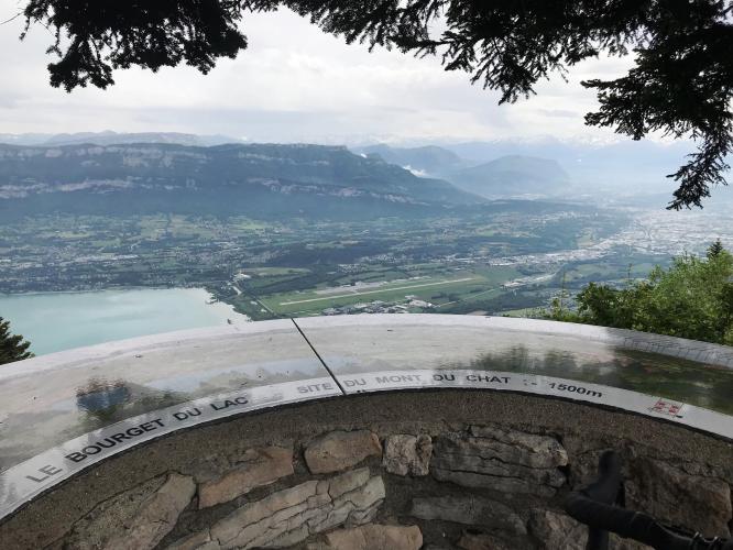
We are surrounded by trees most of the climb on both sides, with the views along the narrow roadway opening in just the last kilometer which permits nice views of the lake below.


There are road markers along the route

Beware - no provisions on this climb.  There is a restaurant at the top which was shuttered 28 May 2018 when we arrived the first time around 1 p.m. and again around 4 p.m. on our return from Bourget.  However, our research indicates that Restaurant des Aigles,  address Relais du Chat, 73170 Saint-Paul, France, tel. #  +33 4 79 85 54 66 has a 4.5 rating on Trip Advisor, Facebook address - https://www.facebook.com/Restaurant.lesaigles.73170/ ) is generally open and highly regarded.


From Meyrieux-Trouet (pop. 306, 2014)


Steepest kilometer begins at km 6.2 (12.2%)

From Le Bourget-du-Lac  (pop. 4,486, 2014)

Steepest kilometer begins at km 3.4 (11.1%)