
26.1
PDI
7.9 mi
DISTANCE
3,573 ft
GAINED
8.6 %
AVG. GRADE
FULL CLIMB STATS
INTRO
Col du Coq Sud climbs 12.7 km (7.9 mi) from the Grésivaudan valley town of Saint-Nazaire-les-Eymes to Col du Coq at 1,433 m (4,700 ft), gaining 1,089 m (3,573 ft) at an average grade of 8.6%. At 1,434 m, Col du Coq is the highest paved pass in the Chartreuse massif, and this south side is generally considered the tougher of its two approaches.
The climb opens hard - the first kilometer out of town runs dead straight at 10-12% with almost no shade - then settles into a long, fairly regular grind through two lit tunnels before splitting onto the narrower D30E. The final two to three kilometers ramp back up into the 9% range just as legs are tiring, a finish many regular riders of the climb rate as tougher, kilometer for kilometer, than the far more famous Alpe d'Huez.
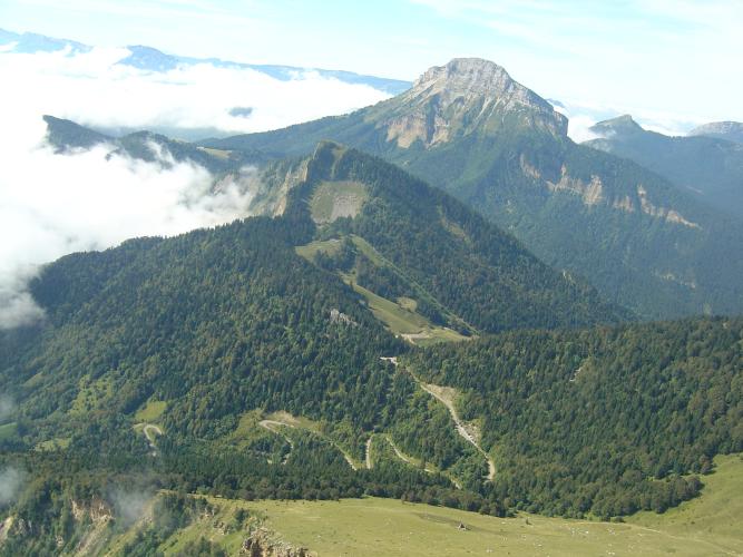
The payoff is the view: Col du Coq sits directly beneath the Dent de Crolles, a dramatic limestone ridge that dominates the skyline for most of the ascent, with the Belledonne range rising across the valley behind you. This side has never been used by the Tour de France, so it remains a proper local secret - a serious mountain pass a short drive from Grenoble that sees far less traffic than its profile would suggest.
Col du Coq closes with the first heavy snow most winters and reopens in spring; plan on a roughly May-through-October window and check current conditions before a late-season trip.
PLAN YOUR ROUTE
 We've partnered with Sherpa-Map.com to bring you the best route planning tool. With a PRO Membership you can use this climb as a reference when creating your route.
 Col du Coq Sud gains 1,089 m (3,573 ft) over 12.7 km (7.9 mi) at an average grade of 8.6%, starting at 349 m (1,144 ft) in Saint-Nazaire-les-Eymes and topping out at 1,433 m (4,700 ft).
The climb is front- and back-loaded. The opening kilometer is the steepest sustained section, averaging in the 11-12% range, and the steepest 100 meters on the whole route touches 12.8%. The middle third, through the two tunnels and out onto the D30E, eases into a more even rhythm around 8-9%. The steepest full kilometer on the climb averages 10.1%, and it arrives late - in the closing two to three kilometers, right where fatigue is highest.
There's little flat ground anywhere on the route to recover; riders who pace the first kilometer too hard tend to pay for it in the final push to the col.
Roadway: The D30/D30E is paved the entire way. The lower section on the main D30 is in good condition; several recent rider reports describe rougher, patchier chip-seal on the narrower D30E in the final kilometers after the tunnels. The two tunnels near km 6 were rebuilt and relit in 2017 and are well-lit and safe, though a rear light is still a good idea given the noise and occasional car traffic inside. Col du Coq closes with the season's first significant snowfall and typically doesn't reopen until spring - check Isère's road status pages before a late-autumn or early-spring attempt.
Traffic: Moderate on the lower D30, which carries local commuter traffic between the Grésivaudan valley and the Chartreuse plateau, heaviest on weekday evenings. Traffic thins noticeably once the route turns onto the D30E past the tunnels, which serves only a handful of hamlets and the pass itself. Weekends can bring extra cars and paragliders headed for the Saint-Hilaire launch site nearby.
Parking: Most riders start from Saint-Nazaire-les-Eymes itself, parking for free on residential streets near the D30/D1090 junction where the climb begins. There is no dedicated cyclist parking area at the base.
There are no services once you leave Saint-Nazaire-les-Eymes - the D30E beyond the tunnels serves only a few small hamlets and the pass itself, with no shops, cafes, or water sources along the way. Stock up in town before starting; Saint-Nazaire-les-Eymes and the neighboring Grésivaudan valley towns have grocery stores and bakeries. The lower kilometer is fully exposed to the sun, so carry more water than you think you'll need on a warm day, even though the climb is relatively short.
Before heading out on any cycling adventure check out our Things to Bring on a Cycling Trip and use our interactive check list to ensure you don't forget anything.
Saint-Nazaire-les-Eymes sits in the Grésivaudan valley just northeast of Grenoble, making Col du Coq an easy half-day objective for anyone based in the city. The Chartreuse massif above the pass is riddled with other cols and quiet plateau roads worth exploring if you have more than one day - our Routes in the Area tool is a good way to see what else nearby is worth combining with this climb.
Grenoble itself offers the full range of hotels and restaurants for anyone building a longer cycling trip around the Chartreuse and Belledonne ranges, and it's a short drive or train ride from the base of the climb.
ROUTE MAP

MEMBER RATING
CURRENT WEATHER
PJAMM TRIPS ADVENTURE STARTER BUNDLES
Check out PJAMM Adventure's prepackaged (self-guided) cycling trips. They will help you plan, document and conquer your next adventure.
NEARBY CLIMBS (0) RADIAL PROXIMITY
FROM No Climbs Found
MEMBER REVIEWS & COMMENTS
Let us know what you thought of this climb. Signup for our FREE membership to write a review or post a comment.
Already have an account?
LOG IN HERE
