
30
PDI
13.1 mi
DISTANCE
4,777 ft
GAINED
6.9 %
AVG. GRADE
FULL CLIMB STATS
INTRO
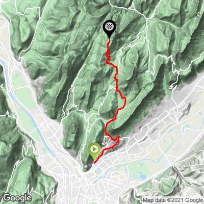
Charmant Som climbs 13.1 miles and 4,777 feet from La Tronche, on the edge of Grenoble, to the Charmant Som chalets at 5,472 feet (1,668 m) - the highest point any paved road reaches in the entire Chartreuse massif. The average grade is 6.9%, but that number hides a climb of two very different halves: a long, steady grind up to Col de Porte, followed by a final stretch that averages well over 8%, with the last kilometer regularly cited as one of the hardest in the range.
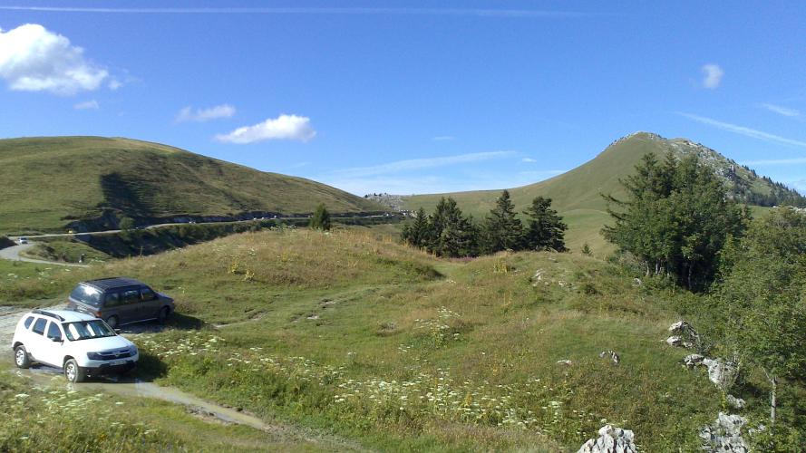
Most of the climbing happens on the way to Col de Porte (1,326 m), a broad, forested approach with a few short, steep pitches of its own. The real difficulty starts on the far side of the col, on the D57E - a narrow road built in 1936, with a series of interpretive photo panels along the way documenting its construction. The final kilometer, switchbacking up along an exposed ridge to the alpine pasture at the top, is where riders consistently report the steepest, hardest riding of the day.
At the road's end, the Auberge du Charmant Som serves food and cheese made from its own herd of alpine cattle - a popular stop, though it closes for winter. The true summit, marked by a cross at 1,867 m, sits another 20-45 minutes up a hiking trail beyond where the pavement stops; from up there, or even from the chalets, the views take in the Grand Som, Chamechaude, the Grande Chartreuse monastery below, and Mont Blanc on a clear day.
PLAN YOUR ROUTE
 We've partnered with Sherpa-Map.com to bring you the best route planning tool. With a PRO Membership you can use this climb as a reference when creating your route.
 Charmant Som averages 6.9% over 13.1 miles, gaining 4,777 feet from La Tronche (739 ft) to the road's end at the chalets (5,472 ft). The steepest mile averages 10.1%, the steepest 2.5 miles hold 8.8%, and the steepest kilometer touches 10.8% - nearly all of it concentrated in the final push past Col de Porte, where the road tilts up hard for the last several kilometers after a much gentler run to the col itself.
Roadway: The road is paved the entire way, including the final stretch on the D57E above Col de Porte, though multiple recent rider reports describe the pavement on that upper section as rough and patched in places - budget for a bumpier ride than the smooth valley roads below. The route is narrow throughout the final climb, with limited passing room on the switchbacks.
Traffic: Traffic is light on the lower approach through the Chartreuse foothills but picks up noticeably on weekend afternoons near the top, where day-trippers drive up for the Auberge du Charmant Som's food and views - expect cars and the occasional tour bus sharing the final narrow kilometers.
Parking: There's no dedicated cycling lot at the base in La Tronche - riders typically start from wherever they're staying in the Grenoble area. At the top, informal parking is available near the Auberge du Charmant Som for those doing just the upper section from Col de Porte.
Save something for the final kilometers past Col de Porte, where sustained double-digit pitches on rough pavement make a compact or wide-range cassette worth having. The Auberge du Charmant Som sells food and its own cheese at the top when it's open (closed in winter), but there's little else in the way of services on the climb itself, so carry what you need for the full 13.1 miles.
Before heading out on any cycling adventure check out our Things to Bring on a Cycling Trip and use our interactive check list to ensure you don't forget anything.
La Tronche and nearby Grenoble have every kind of restaurant and shop for a pre- or post-ride stop. At the top, the Auberge du Charmant Som is a genuine destination in its own right - known for cheese made on site from its own alpine herd and a blueberry tart regularly singled out by riders who make the climb.
It's open seasonally and closed through the winter, so check ahead if the stop is part of the plan. The climb is best ridden between late spring and early autumn; snow can linger into May on the exposed final kilometers. With the Col de Porte approaches and the rest of the Chartreuse's climbs close by, our Routes in the Area tool is worth checking to plan out more of the massif.
ROUTE MAP
MEMBER RATING
CURRENT WEATHER
PJAMM TRIPS ADVENTURE STARTER BUNDLES
Check out PJAMM Adventure's prepackaged (self-guided) cycling trips. They will help you plan, document and conquer your next adventure.
NEARBY CLIMBS (0) RADIAL PROXIMITY
FROM No Climbs Found
MEMBER REVIEWS & COMMENTS
Let us know what you thought of this climb. Signup for our FREE membership to write a review or post a comment.
Already have an account?
LOG IN HERE
