
22.7
PDI
13.2 mi
DISTANCE
4,118 ft
GAINED
5.7 %
AVG. GRADE
FULL CLIMB STATS
INTRO
Station du Barioz climbs 21.2 km (13.2 mi) from Le Cheylas in the Grésivaudan valley, gaining 1255 m (4,118 ft) at an average grade of 5.7% to the Barioz Nordic ski area high in the Belledonne massif. It's the longest of our three routes to this summit, and the one that takes in the most of the Pays d'Allevard along the way.
The climb comes in two distinct halves. The first 8 km (5 mi) are an easy, rolling warm-up on back roads through the hamlets of Le Cheylas, past Morêtel-de-Mailles and the Sailles marshes into Saint-Pierre-d'Allevard, whose 11th-century Romanesque bell tower is a listed historic monument. Once the road turns uphill on Route du Col du Barioz, the character changes completely - the remaining 13 km (8.1 mi) climb at close to 7% through forest and hillside pasture, with the steepest kilometer averaging 9.3%.
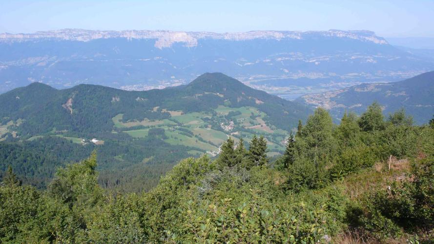
About 15.5 km (9.6 mi) in, you cross the Col du Barioz itself at 1042 m (3,419 ft), where the Route des Balcons de Belledonne links the Allevard side with Theys. Most riders would stop there - this route keeps going, turning onto Route des Alpages for another 5.5 km (3.4 mi) of steady climbing to the Nordic area, with views opening back over the Allevard basin toward the Bauges and Chartreuse.
PLAN YOUR ROUTE
 We've partnered with Sherpa-Map.com to bring you the best route planning tool. With a PRO Membership you can use this climb as a reference when creating your route.
 From Le Cheylas, Station du Barioz climbs 21.2 km (13.2 mi) at a 5.7% average grade, gaining 1255 m (4,118 ft) from a start at 245 m (804 ft). That average is pulled down by a gentle opening: the first 8 km (5 mi) to Saint-Pierre-d'Allevard gain less than 300 m (984 ft), with one short ramp around km 3 before the road flattens out again through Morêtel-de-Mailles and Sailles.
The real climb starts once you leave Saint-Pierre-d'Allevard. From there to the finish, the road gains roughly 900 m (2,953 ft) in about 13 km (8.1 mi), close to 7% on average, with the steepest kilometer at 9.3% and the steepest half-kilometer at 12.0%. The steepest mile averages 9.1% and the steepest 5 km (3.1 mi) average 7.5%.
There's no real letup after the Col du Barioz, around 15.5 km (9.6 mi) in - the final 5.5 km (3.4 mi) on Route des Alpages hold between 6% and 8.5% most of the way, so save something for the finish.
Roadway: Paved the entire way. The lower section uses small local roads through the hamlets of Le Cheylas and Morêtel-de-Mailles rather than the busier valley road, then joins Route du Col du Barioz through Saint-Pierre-d'Allevard. Above the col, Route des Alpages is a mountain access road that ends at the Nordic area, so expect a narrower surface with the patching and debris typical of a forested Belledonne road, especially after storms.
Traffic: Light for most of the climb. Expect some local traffic around Saint-Pierre-d'Allevard and on the approach to the col, which is a through-route over to Theys. Beyond the col, the road serves little more than the Nordic area, a few alpine farms and walkers heading for the Crêt du Poulet, so it's very quiet outside of winter.
Parking: The start in Le Cheylas is a residential area, so roadside parking there is limited - Saint-Pierre-d'Allevard, about 8 km (5 mi) in, is a more practical place to leave a car if you want to skip the flat opening section and ride just the climbing half.
The flat first third makes this climb feel easier than it is on paper - most of the work is packed into the final 13 km (8.1 mi), with pitches over 9%, so a compact crankset and a 30-32t low gear are worth having over a standard double.
Saint-Pierre-d'Allevard is the last real village on the route, so top up bottles and grab food there before the climbing starts in earnest. At the top, the Nordic area's foyer offers food and drink during the ski season only. In summer, the Refuge du Crêt du Poulet, a 2.5-hour round-trip walk from the Nordic area on alpine tracks, serves drinks and homemade tarts on its terrace - bring shoes you can walk in if you want to make the detour.
Before heading out on any cycling adventure check out our Things to Bring on a Cycling Trip and use our interactive check list to ensure you don't forget anything.
This is the Pays d'Allevard side of the Barioz, and it's worth treating as more than just a start line. Saint-Pierre-d'Allevard's listed 11th-century bell tower and the medieval Tour d'Aquin fortified house are both in the commune, and the whole hillside carries traces of the iron mining that shaped this area for centuries. Just up the valley, the spa town of Allevard-les-Bains makes a comfortable base with more lodging and restaurant options than the smaller villages.
If you have legs left at the top, the Refuge du Crêt du Poulet at 1700 m (5,577 ft) sits a short hike above the Nordic area and looks straight across at the Belledonne peaks and down the Haut-Bréda valley - one of the best viewpoints in this corner of the range. Le Collet d'Allevard, a steeper climb from the same valley, is the natural next ride; our Routes in the Area tool shows what else is within reach from Allevard.
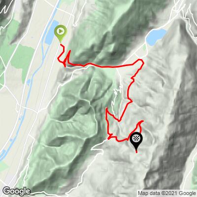
ROUTE MAP
MEMBER RATING
CURRENT WEATHER
PJAMM TRIPS ADVENTURE STARTER BUNDLES
Check out PJAMM Adventure's prepackaged (self-guided) cycling trips. They will help you plan, document and conquer your next adventure.
NEARBY CLIMBS (0) RADIAL PROXIMITY
FROM No Climbs Found
MEMBER REVIEWS & COMMENTS
Let us know what you thought of this climb. Signup for our FREE membership to write a review or post a comment.
Already have an account?
LOG IN HERE
