
20
PDI
8.4 mi
DISTANCE
3,111 ft
GAINED
7 %
AVG. GRADE
FULL CLIMB STATS
INTRO
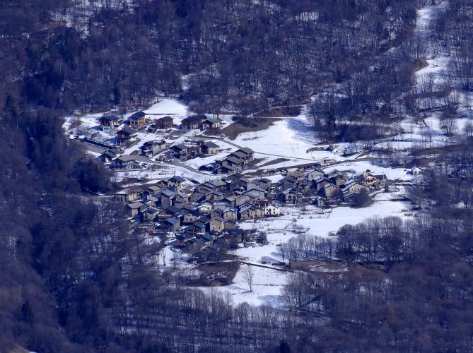
St. Michael - Beaune climbs from Saint-Michel-de-Maurienne, on the valley floor at about 720 m (2,361 ft), up the mountainside to the hamlets of Beaune, finishing at about 1,668 m (5,472 ft). It covers 13.6 km (8.4 mi) and gains 948 m (3,111 ft) at a 7.0% average.
This is the quiet side of the valley, opposite the Télégraphe road. Maurienne Tourisme describes the signed Beau Plan loop that shares these roads as in good condition and lightly used - much quieter than the Télégraphe, though just as steep. The route climbs through La Traversaz and Le Thyl on small roads, with steady grades rather than sharp ramps: the steepest kilometer averages 9.4% and the steepest 500 m (0.3 mi) averages 11.5%. The views on this side of the mountain take in the Aiguilles d'Arves, the Croix des Têtes and the Karellis and Valmeinier ski areas.
The loop is signed as black (very hard) and is generally open from mid-March to mid-November, depending on snow.
PLAN YOUR ROUTE
 We've partnered with Sherpa-Map.com to bring you the best route planning tool. With a PRO Membership you can use this climb as a reference when creating your route.
St. Michael - Beaune averages 7.0% over 13.6 km (8.4 mi), gaining 948 m (3,111 ft) from about 720 m (2,361 ft) to 1,668 m (5,472 ft). The steepest 100 m (110 yd) reaches 12.8%, the steepest 0.4 km (0.25 mi) averages 11.7%, and the steepest 500 m (0.3 mi) averages 11.5%.
Beyond those ramps, the grade is remarkably even. The steepest kilometer averages 9.4%, the steepest 2 km (1.2 mi) averages 8.3%, and both the steepest 5 km (3.1 mi) and the steepest 10 km (6.2 mi) average 7.3%, only slightly above the overall 7.0%. That means there are hard pitches but no long flat sections or easy stretches to recover on, so pace it as a steady 7% climb and keep something in reserve for the upper hamlets.
Roadway: Paved, on small mountain roads - the D 82a runs through La Traversaz, and the hamlet roads above are minor. Maurienne Tourisme describes the roads of its Beau Plan loop, which shares this side of the mountain, as in good condition, and the loop is generally open from 15 March to 15 November, subject to snow and weather. Expect narrower lanes than on the Télégraphe, and take care on the way down.
Traffic: Light. This is local traffic for the villages and hamlets, far less than on the Télégraphe road across the valley.
Parking: Our Cols du Télégraphe & Galibier and Valmeinier pages cover street parking at the shared start in Saint-Michel-de-Maurienne. Two extra options: Espace Alu, the aluminium museum on Place de l'Église, is a Qualité Cyclo Maurienne site with secure bike parking, and there is a public car park at the entrance to the Beaune hamlet if you would rather start higher up and ride only the upper part of the climb.
Provisions: Water and food are available in Saint-Michel-de-Maurienne before the climb, and refreshments are listed in Le Thyl and Saint-Martin-de-la-Porte, so top up your bottles in town and carry what you need for the upper hamlets. The nearest bike repair shop is in Saint-Jean-de-Maurienne, so bring a spare tube and tools.
Gear: Compact gearing (a 34-tooth chainring with a 30- to 34-tooth rear cog) makes the sustained 7-9% grades comfortable. You finish about 948 m (3,111 ft) above the start, in noticeably cooler air, so pack a layer for the descent.
Before heading out on any cycling adventure check out our Things to Bring on a Cycling Trip and use our interactive check list to ensure you don't forget anything.
Saint-Michel-de-Maurienne rewards a stop before or after the ride. Espace Alu, on Place de l'Église, is a museum devoted to aluminium, the industry that earned the Maurienne the nickname "valley of aluminium" after six hydroelectric-powered plants opened here between 1892 and 1907. Its 1950s production tapestry was classified as a historic monument in 2017, and guides are available in English. Check opening days before you plan around it.
Higher up, the route passes La Traversaz, a hamlet with a chapel, a mill and a wash-house, and Le Thyl, whose cobbled lanes are worth a walk, before reaching the Beaune hamlets, which have gîte accommodation in a quiet mountain setting. To go over the Télégraphe to Valloire instead, see our Cols du Télégraphe & Galibier page, and for the other road up to Beaune see our St. Michael - La Villette - Beaune climb. Saint-Michel-Valloire station on the Maurienne rail line makes this an easy car-free day.
ROUTE MAP

MEMBER RATING
CURRENT WEATHER
PJAMM TRIPS ADVENTURE STARTER BUNDLES
Check out PJAMM Adventure's prepackaged (self-guided) cycling trips. They will help you plan, document and conquer your next adventure.
NEARBY CLIMBS (0) RADIAL PROXIMITY
FROM No Climbs Found
MEMBER REVIEWS & COMMENTS
Let us know what you thought of this climb. Signup for our FREE membership to write a review or post a comment.
Already have an account?
LOG IN HERE
