
18
PDI
5.8 mi
DISTANCE
2,551 ft
GAINED
8.2 %
AVG. GRADE
FULL CLIMB STATS
INTRO
Col de la Forclaz South climbs 9.4 km (5.8 mi) from the valley between Doussard and Faverges, at the southern end of Lake Annecy, gaining 778 m (2,551 ft) at an 8.2% average. This is the steep side of the Forclaz de Montmin: it climbs through the mountain village of Montmin to the col at about 1150 m (3,773 ft), and our route carries on past the col for the final stretch up toward the paragliding launch, finishing at 1268 m (4,160 ft). It ranks #1219 on our list of the world's hardest climbs.
The numbers don't flatter it. The steepest kilometer averages 12.3%, the steepest 2 km (1.2 mi) 11.5%, and the road is narrow and partly single-lane, fully exposed to the sun on the lower slopes. The one real break is the flat run through Montmin around km 6-7, a quiet valley of seven farming hamlets below the Tournette, before the road kicks up again to the col.
From the south you climb with the Aravis and Tournette in view rather than the lake, so the payoff comes at the top: the Col de la Forclaz is one of Europe's busiest paragliding launches, and the view drops straight down to the turquoise water of Lake Annecy and across to the Bauges. The Tour de France climbed the Forclaz de Montmin as a first-category climb on the 2016 stage from Albertville to Saint-Gervais, when Thomas De Gendt led over the top.
PLAN YOUR ROUTE
 We've partnered with Sherpa-Map.com to bring you the best route planning tool. With a PRO Membership you can use this climb as a reference when creating your route.
Col de la Forclaz South averages 8.2% over 9.4 km (5.8 mi), and it is hard from the first pedal stroke - several kilometers run at 9-11%, with only one genuine break.
The first kilometer climbs at about 8.5%, and the second at close to 10.6%. The grade settles to 9% and then nearly 7% through km 3 and 4, before another 10.6% kilometer leads up toward Montmin. The steepest kilometer on the climb averages 12.3% and the steepest 5 km (3.1 mi) 9.3%.
Around km 6-7 the road levels out completely as it crosses the Montmin valley at about 1020 m (3,346 ft) - use it, because the climbing that follows is steep again. The last 2.5 km (1.6 mi) average roughly 9-10% to the col at about 1150 m (3,773 ft), and the final few hundred meters beyond it, up toward the paragliding launch, are the steepest of all: the steepest 500 m on the route averages 16.2%.
Roadway: Paved the entire way. The road up through Montmin is narrow and partly single-lane, with little shade on the lower slopes, and the final stretch above the col is narrower and steeper still. The Haute-Savoie tourist board lists the route as a cycling season road from 1 April to 31 October, and the col road can be closed after heavy snow in winter, so check conditions if you're riding early or late in the year.
Traffic: Light on the lower slopes, mostly Montmin residents and farm traffic. The exception is the paragliding shuttles: minibuses run paragliders up to the launch at the col through the flying season and have been reported driving fast on the narrow road, so hold your line on blind bends. On summer weekends the col itself is busy with visitors, paragliders and hikers.
Parking: The start is on the Lake Annecy cycle path between Doussard and Faverges, so the simplest approach is to park in either town and ride the path to the base. Montmin has a car park used by hikers heading for the Tournette, handy if you want to split the climb. The free car park at the col has around 50 spaces and is often full from 9 AM on July and August weekends, so don't count on driving up late.
Gear: Bring your lowest gears. With kilometers at 10-12% and a short ramp near 16% above the col, a compact crankset with a 32-34 tooth cog is a sensible choice for most riders. The lower slopes are exposed to the sun, so on a summer day start early and carry plenty of water. Check your brakes before descending - the road is narrow and steep, and you may meet a shuttle bus coming up.
Provisions: Faverges and Doussard have shops and cafes before you start. Montmin, about two-thirds of the way up, is a small farming village, and the col has several restaurants and mountain chalets, some open year-round - a good place for a drink while you watch the paragliders take off.
Before heading out on any cycling adventure check out our Things to Bring on a Cycling Trip and use our interactive check list to ensure you don't forget anything.
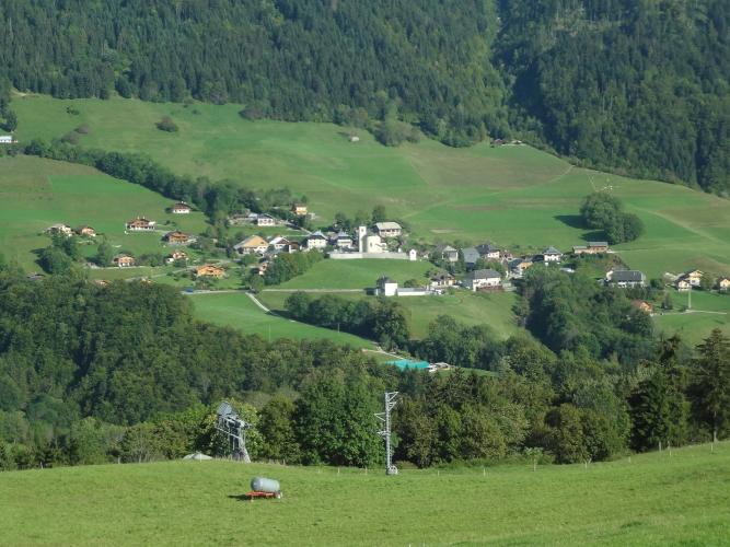
The south side is the one that takes you through Montmin, a valley of seven hamlets below the Tournette that was first settled shortly after the year 1000 and became part of the commune of Talloires-Montmin in 2016. Each hamlet still has its own communal bread oven, fountain and chapel or oratory. The 7.3 km (4.5 mi) Notre-Dame des Sept Fontaines walk loops through them if you want to see the village on foot after your ride, and the local dairy farms produce Reblochon and Tomme.
At the top, the Col de la Forclaz is one of the best-known free-flight sites in Europe - it hosted the French hang gliding championships in 1995 - and on a good day the sky above the lake fills with paragliders. Hikers use the col as a base for the Tournette (2351 m / 7,713 ft), the highest summit around the lake, and for the Chalet de l'Aulp, which serves food in summer.
The paragliders' landing field at Doussard and the lakeside cycle path are covered on our Combe d'Ire page. Our Routes in the Area tool shows the other climbs around the southern end of the lake, including the Semnoz and the Col de l'Arpettaz.
ROUTE MAP

MEMBER RATING
CURRENT WEATHER
PJAMM TRIPS ADVENTURE STARTER BUNDLES
Check out PJAMM Adventure's prepackaged (self-guided) cycling trips. They will help you plan, document and conquer your next adventure.
NEARBY CLIMBS (0) RADIAL PROXIMITY
FROM No Climbs Found
MEMBER REVIEWS & COMMENTS
Let us know what you thought of this climb. Signup for our FREE membership to write a review or post a comment.
Already have an account?
LOG IN HERE
