
16.7
PDI
7.7 mi
DISTANCE
2,685 ft
GAINED
6.4 %
AVG. GRADE
FULL CLIMB STATS
INTRO
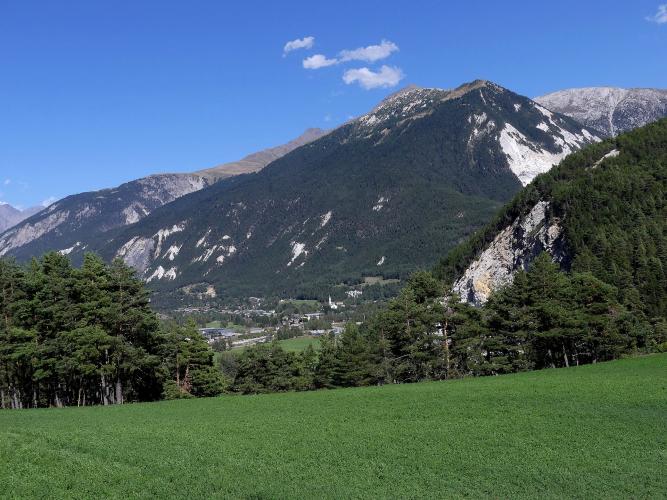
This climb takes you into a side valley that most people driving up the Haute-Maurienne never see. From Bramans the road heads straight up the hillside, swings into the wide valley that leads to Le Planay, then turns south into the Vallon d'Étache and climbs to a small chapel and a summer farm at 2017 m (6,619 ft), where the tarmac has already run out.
It's 12.5 km (7.7 mi) with 818 m (2,685 ft) of climbing at 6.4%. The first 3 km out of Bramans average close to 9%, with a pitch of nearly 16% in the second kilometer. Then the road gives you 5 km of near-rest - false flats, a couple of short dips, barely 2% in places - up the valley past the turn for Saint-Pierre d'Extravache to Le Planay. Turn into the Vallon d'Étache and it kicks straight back up to 9% for three kilometers before easing over the last stretch to the farm.
The road up the Vallon d'Étache is rough, with drainage channels cut across it that you want to see coming on the way down, and the last kilometer or so is unpaved. In exchange you get a high, quiet valley almost to yourself: a few vehicles an hour and, most days, hardly another rider.
PLAN YOUR ROUTE
 We've partnered with Sherpa-Map.com to bring you the best route planning tool. With a PRO Membership you can use this climb as a reference when creating your route.
The climb averages 6.4% over 12.5 km (7.7 mi), from 1228 m (4,030 ft) in Bramans to 2017 m (6,619 ft) at the Ferme d'Étache, with 29 m (96 ft) of descent along the way.
The opening 3 km are steep - 8.4%, 9.0% and 10.2% by the kilometer - and both the steepest kilometer (12.8%) and the steepest 500 m (15.8%) sit inside the first 2 km out of the village.
Kilometers 4 to 8 are the recovery: 5.4%, 2.2%, 2.2%, 4.1% and 5.1% as the road runs up the valley to Le Planay. Into the Vallon d'Étache, kilometers 9 to 11 climb at 9.2%, 9.1% and 8.0%, and the steepest 2 km of the climb (9.8%) are here. The last 1.4 km (0.9 mi) ease to 4-5% on the rough, partly unpaved approach to the farm. The steepest 5 km average 7.3% and the steepest 10 km 6.5%.
Roadway: Paved from Bramans up the valley and most of the way up the Vallon d'Étache, but the surface is poor in places, and above Le Planay the road is crossed by drainage channels that are easy to hit fast on the descent. The asphalt gives out in the last kilometer or so before the Ferme d'Étache, so you finish on rough track - fine on a road bike at a careful pace, easier on wider tyres. Val-Cenis lists the climb as rideable from May to October, snow permitting.
Traffic: Light - a few vehicles an hour heading for the hamlets, farms and trailheads up the valley, and very few other cyclists.
Parking: Start from Bramans and park in the village, keeping clear of the narrow lanes where the climb begins. There's also a parking area at Étache near the top if a support car is meeting you.
Provisions: Bramans has water and food; there's nothing to buy above the village and no café at the top, so leave with both bottles full. The nearest bike shop is in Termignon, so carry a spare tube and a pump.
Gear: A compact with a 32-tooth cog is not overkill - the ramps out of Bramans reach the mid-teens. Tyres of 28 mm or more make the rough upper road and the unpaved finish far less nervy, and at 2017 m a jacket for the descent is worth carrying even in summer.
Before heading out on any cycling adventure check out our Things to Bring on a Cycling Trip and use our interactive check list to ensure you don't forget anything.
Stop at Saint-Pierre d'Extravache, a few hundred meters off the route around km 4. Its 11th-century apse is one of the few Romanesque buildings left in Savoie, and the church only survives because a British doctor, Marc de Lavis-Trafford, paid for its restoration - Bramans made him an honorary citizen in 1937. It faces the Dent Parrachée, it's open every day, and it costs nothing to look around.
Bramans is also the French end of the old mule path over the Col du Clapier to Susa, one of the passes long put forward as Hannibal's route into Italy - something to keep in mind if you're in the valley with hiking boots. For more riding in the Haute-Maurienne, the Montée du Barrage climbs to the Aussois dams from Avrieux just down the valley, and the Col du Mont-Cenis road leaves from Lanslebourg.
ROUTE MAP

MEMBER RATING
CURRENT WEATHER
PJAMM TRIPS ADVENTURE STARTER BUNDLES
Check out PJAMM Adventure's prepackaged (self-guided) cycling trips. They will help you plan, document and conquer your next adventure.
NEARBY CLIMBS (0) RADIAL PROXIMITY
FROM No Climbs Found
MEMBER REVIEWS & COMMENTS
Let us know what you thought of this climb. Signup for our FREE membership to write a review or post a comment.
Already have an account?
LOG IN HERE
