
21
PDI
7.6 mi
DISTANCE
3,040 ft
GAINED
7.6 %
AVG. GRADE
FULL CLIMB STATS
INTRO
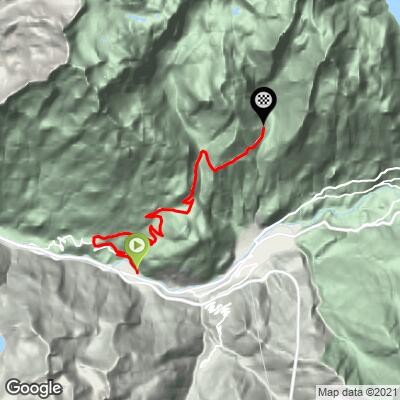
Saint-André - l'Orgère climbs 12.2 km (7.6 mi) and 927 m (3,040 ft) at an average grade of 7.6%, from the Arc river valley at Freney, 1,035 m (3,397 ft), up to the Vallon de l'Orgère at 1,953 m (6,408 ft), on the edge of Vanoise National Park. It ranks #887 on our list of the world's hardest climbs.
The climb is relentless rather than flashy. It leaves the valley through hamlets and deciduous woods, then holds 8-10% for much of the way with few switchbacks to break it up, and the steepest kilometer reaches 11.0%. About two-thirds of the way up the road narrows and runs through fir forest, and the grade finally relents to roughly 2% in the last kilometer as the valley opens out.
The reward is the Orgère itself: a high alpine valley with a refuge that serves meals, marmots whistling from the slopes and, with luck, ibex. Traffic is light, which makes this a good quiet alternative to the Maurienne's headline cols. Bring your low gears.
PLAN YOUR ROUTE
 We've partnered with Sherpa-Map.com to bring you the best route planning tool. With a PRO Membership you can use this climb as a reference when creating your route.
 Saint-André - l'Orgère averages 7.6% over 12.2 km (7.6 mi), and it rarely lets up. The steepest 0.5 km (0.3 mi) averages 11.4%, the steepest 1 km (0.6 mi) 11.0%, the steepest 2 km (1.2 mi) 10.0%, the steepest 5 km (3.1 mi) 9.0% and the steepest 10 km (6.2 mi) 8.2%.
After a gentler first kilometer at about 6%, the road runs at 8-10% through the stretch from roughly 2 to 7 km (1.2 to 4.3 mi), with the hardest sustained effort around 2 to 4 km (1.2 to 2.5 mi) in. A brief easing near 7 km (4.3 mi) gives way to another run near 9% before the grade flattens to a gentle finish in the last kilometer. There are few hairpins, so there is little chance to change rhythm: a low gear and steady pacing are the key.
Roadway: The road is paved to the Orgère and is narrow in its upper half, where it runs through fir forest. Riders describe it as mostly well surfaced and suitable for road bikes. The valley is snowbound in winter; access typically opens around mid-May and runs to early November, depending on when the road is cleared.
Traffic: Light. The road mainly serves walkers and visitors heading to the Vallon de l'Orgère and the refuge, and riders report few vehicles.
Parking: The start is at the bridge over the Arc in Freney, a small village in the Maurienne valley, so park courteously nearby without blocking farm or residential access. Modane, a few kilometers east, has the area's mainline railway station and shops if you are arriving by train. At the top there is public parking near the refuge, useful if you would rather drive up and explore the valley on foot.
Provisions: Fill up in the valley before you start, since the climb passes no shops. The refuge at the top serves meals and drinks in the summer season and can prepare picnic lunches on request.
Gear: Choose low gears: the road holds 8-10% for long stretches with few hairpins. The lower slopes can be sun-exposed and hot, while the top sits at 1,953 m (6,408 ft) in a high mountain valley, so bring a light jacket for the descent.
Before heading out on any cycling adventure check out our Things to Bring on a Cycling Trip and use our interactive check list to ensure you don't forget anything.
The climb rises from the Maurienne valley near Saint-André, a village of about 450 residents spread over 15 hamlets on the right bank of the Arc, 5 km (3.1 mi) west of Modane. Saint-André once housed an aluminum works (1893 to 1983), and its slopes hold the alpine Fort du Sapey at 1,740 m (5,709 ft). Modane is the practical base for lodging, food and the railway.
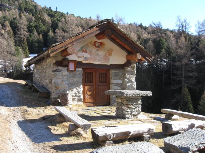
At the top, the Refuge de l'Orgère (1,935 m / 6,348 ft) sleeps up to 70 in summer and 14 on a self-catering basis in winter, with a restaurant and garden. From there a 12.6 km (7.8 mi) hiking loop circles the Vallon de l'Orgère, open from mid-June to mid-October, passing the former Aiguille Doran refuge; dogs are not allowed in the national park.
Our Montée de Valfréjus and Montée d'Aussois (Modane) pages cover the neighboring climbs above Modane, and you can see other climbs nearby, or build a custom route from here, with our Routes in the Area tool.
ROUTE MAP
MEMBER RATING
CURRENT WEATHER
PJAMM TRIPS ADVENTURE STARTER BUNDLES
Check out PJAMM Adventure's prepackaged (self-guided) cycling trips. They will help you plan, document and conquer your next adventure.
NEARBY CLIMBS (0) RADIAL PROXIMITY
FROM No Climbs Found
MEMBER REVIEWS & COMMENTS
Let us know what you thought of this climb. Signup for our FREE membership to write a review or post a comment.
Already have an account?
LOG IN HERE
