
19.1
PDI
7.3 mi
DISTANCE
2,849 ft
GAINED
7.5 %
AVG. GRADE
FULL CLIMB STATS
INTRO
Col du Mollard West climbs 11.7 km (7.3 mi) from the hamlet of Gevoudaz, in the Arvan valley above Saint-Jean-de-Maurienne, gaining 868 m (2,849 ft) at a 7.5% average from 763 m (2,502 ft) to the col at 1631 m (5,351 ft). Of the Mollard's main approaches it's the steepest on average and the most consistent: there isn't a single meter of descent, and the grade sits between about 6.5% and 9% almost the whole way.
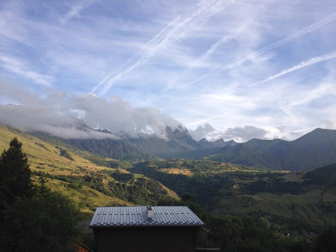
Our route starts where the climbing gets serious. The road up from the Opinel roundabout in Saint-Jean-de-Maurienne is a near-flat run of roughly 5-6 km (3.1-3.7 mi) through a shaded valley; at Gevoudaz the D110 turns uphill into tight forest switchbacks with views across to the Aiguilles d'Arves. It climbs past the hamlets of Le Collet and La Cochette, breaks out of the trees onto the open plateau of Albiez-le-Vieux, and finishes through the chalets of Le Mollard at the col.
Gevoudaz is where the Opinel knife was born - Joseph Opinel made the first one here in 1890 - and the road you climb is part of the Opinel Road heritage trail. The Tour de France has crossed the Mollard too, though on Stage 19 in 2015, when Vincenzo Nibali won at La Toussuire, it came over via the short Belleville side straight off the Croix de Fer; this western road stays quiet, with very little traffic.
PLAN YOUR ROUTE
 We've partnered with Sherpa-Map.com to bring you the best route planning tool. With a PRO Membership you can use this climb as a reference when creating your route.
Col du Mollard West averages 7.5% over 11.7 km (7.3 mi) and never once goes downhill. The hardest stretch comes early: km 2 to km 4 run at about 8-9% through the forest switchbacks above Gevoudaz, and that's where you'll find the steepest kilometer (9.1%), the steepest 2 km (8.8%) and the steepest 5 km (8.3%) of the climb. The steepest 500 m reach 9.4%.
The middle kilometers past Le Collet and La Cochette settle into a rhythm of about 7-8%. Km 10, onto the plateau toward Albiez-le-Vieux, is the only real breather at about 5.5%, before the last 2 km (1.2 mi) to the col climb back to 6.5-8%. The steepest 10 km average 7.6%, almost exactly the overall average - a good sign of how even this climb is.
Roadway: Paved all the way. The D110 is a narrow mountain road, partly sunk into the forest, with plenty of hairpins on the lower half; riders described the surface as near-perfect in 2023, though older reports mention patchy sections. The yellow cycling markers along the way give the distance and grade to the col. The Albiez villages are a small ski area, so check Savoie's road information before an early- or late-season ride.
Traffic: Very light. Below Albiez-le-Vieux the road serves only a handful of hamlets, so you'll mostly share it with other cyclists - a far quieter way into the Arvan valley's high villages than the D926 Croix de Fer road.
Parking: Gevoudaz is a tiny hamlet, so most riders start in Saint-Jean-de-Maurienne and ride the 5-6 km (3.1-3.7 mi) of gentle valley road to the base; town-center parking is covered on our Col de la Croix de Fer (Saint-Jean-de-Maurienne) page. The Opinel Museum, where the Opinel Road begins, makes an easy landmark to set off from.
Provisions: Fill your bottles in Saint-Jean-de-Maurienne. There's nowhere to stop on the forest section; Albiez-le-Vieux, about 1.5 km (0.9 mi) from the top, is the first village, and the col has a water point - riders in 2026 reported a pump for filling bottles.
Gear: A compact crankset with a 28-30 tooth low cog suits the long 8-9% early section. The forest gives good shade on the lower half, but the top is open and 868 m (2,849 ft) above the start, so carry a layer for the descent.
Before heading out on any cycling adventure check out our Things to Bring on a Cycling Trip and use our interactive check list to ensure you don't forget anything.
This is the Opinel climb. Gevoudaz, at the base, is the hamlet where Joseph Opinel made his first knife in 1890 in a corner of his father's tool workshop, and a 1.5 km (0.9 mi) walking path laid out in 2021 passes the old Opinel workshops, Joseph Opinel's former house and the small Saint-Grat chapel. Near the top, the Opinel Square in Albiez-le-Vieux has a sculpture by Jean-Claude Opinel, installed in 2011 a few hundred meters from the cemetery where the first Opinel blacksmiths are buried, and lit blue at night. They're the last two stops on the free Opinel Road heritage trail, which starts at the Opinel Museum in Saint-Jean-de-Maurienne - see our Col de la Croix de Fer (Saint-Jean-de-Maurienne) page for the museum and the town's giant knife.
Albiez-le-Jeune and Albiez-Montrond are covered on our Col du Mollard North page. From the col you can drop down the short Belleville side to the D926 and carry on up the Croix de Fer, or head back to Saint-Jean and add La Toussuire - see other climbs nearby, or build a custom route from here, with our Routes in the Area tool.
ROUTE MAP

MEMBER RATING
CURRENT WEATHER
PJAMM TRIPS ADVENTURE STARTER BUNDLES
Check out PJAMM Adventure's prepackaged (self-guided) cycling trips. They will help you plan, document and conquer your next adventure.
NEARBY CLIMBS (0) RADIAL PROXIMITY
FROM No Climbs Found
MEMBER REVIEWS & COMMENTS
Let us know what you thought of this climb. Signup for our FREE membership to write a review or post a comment.
Already have an account?
LOG IN HERE
