
16
PDI
4.7 mi
DISTANCE
2,184 ft
GAINED
8.7 %
AVG. GRADE
FULL CLIMB STATS
INTRO
This is one for riders who like their roads small. From Saint-Rémy-de-Maurienne it leaves the valley floor straight up a single-lane forest road and holds 9-10% for more than 5 km, in the trees nearly the whole way, without a village or a cafe to break it up. Then the tarmac runs out and the last stretch to the hamlet of Servion is gravel.
It's 7.6 km (4.7 mi) with 666 m (2184 ft) of climbing at 8.7%. The first 5.3 km are the hard part, averaging 9.5%, with the steepest kilometer at 11.5% and half a kilometer at 12.1%. Around km 5.4 the paved Replat road hands over to the Route de Servion, a compacted gravel forest track that climbs more gently, at about 7%, for roughly 2 km into Servion.
Servion sits on the slopes above Saint-Étienne-de-Cuines, and a paved road runs down from it to the valley, so you don't have to ride the gravel back down. A gravel bike is the comfortable choice; on a road bike with wide tires it's doable, but expect to pick your line on the track.
PLAN YOUR ROUTE
 We've partnered with Sherpa-Map.com to bring you the best route planning tool. With a PRO Membership you can use this climb as a reference when creating your route.
Overall: 7.6 km (4.7 mi) from 483 m (1585 ft) to 1139 m (3738 ft), gaining 666 m (2184 ft) at an average of 8.7%.
The shape: 5.3 km (3.3 mi) at 9.5% on the paved forest roads, then about 2 km at 7.3% on the gravel Route de Servion, and a last 0.3 km at 3.5% into the hamlet.
Kilometer by kilometer: 9%, 9.7%, 10.7%, 8.5%, 9.4%, 8.7%, 6.6%, and 5.2% for the final 0.6 km.
Steepest sections: 0.5 km at 12.1%, 1 km at 11.5%, 2 km at 10.8%, 5 km at 9.7%.
Roadway: Paved to about km 5.4, then roughly 2 km of unpaved forest track into Servion. The paved section is a single-lane forest road with patches, potholes and fallen leaves in autumn, and riders who've climbed the Replat road describe potholes and loose gravel to weave around and an unpleasant descent. The Route de Servion is compacted gravel, firm in dry weather but rougher and muddier after rain. Go down the paved road from Servion to Saint-Étienne-de-Cuines rather than back the way you came. Expect snow up here in winter.
Traffic: Very light - these are forest roads serving a few chalets and trailheads. You may meet a forestry vehicle or a local car on the paved section, and there's little room to pass.
Parking: Park in Saint-Rémy-de-Maurienne near the village center and ride the short way to the start. There's nowhere worth driving to at the top.
Gear: Tires matter more than anything here: 35 mm or wider for the gravel, tubeless if you have it, and a spare tube either way. Pair them with low gearing - a 34x32 or a gravel 1x setup - for more than 5 km at 9-10% on the paved part.
Provisions: There's nothing on the climb or in Servion. Fill bottles and eat in Saint-Rémy-de-Maurienne before you start.
Before heading out on any cycling adventure check out our Things to Bring on a Cycling Trip and use our interactive check list to ensure you don't forget anything.
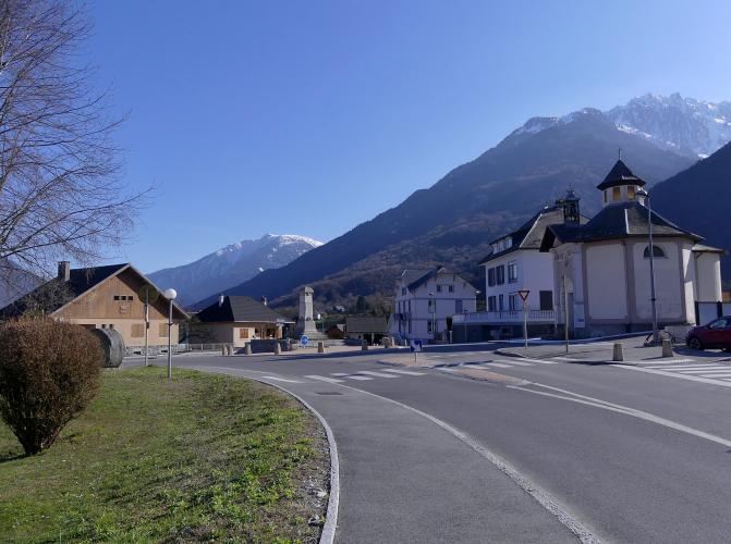
Saint-Rémy-de-Maurienne, in the lower Maurienne, is the start of two of our forest climbs - this one and the Route de la Fresche, which covers the village and a classic Belledonne hike from the top of the road. From Servion the paved road drops to Saint-Étienne-de-Cuines, about 6 km up the valley from Saint-Rémy, and our Route de Servion (Saint-Étienne-de-Cuines) page climbs that side.
The big Maurienne climbs are close by. La Chambre, just up the valley, is the start of the Col de la Madeleine and the Col du Chaussy - see our Col de la Madeleine (La Chambre) and Col du Chaussy (La Chambre) pages - and the Lacets de Montvernier are a little further on. The nearest station is Saint-Avre - La Chambre, on the Maurienne line.
ROUTE MAP

MEMBER RATING
CURRENT WEATHER
PJAMM TRIPS ADVENTURE STARTER BUNDLES
Check out PJAMM Adventure's prepackaged (self-guided) cycling trips. They will help you plan, document and conquer your next adventure.
NEARBY CLIMBS (0) RADIAL PROXIMITY
FROM No Climbs Found
MEMBER REVIEWS & COMMENTS
Let us know what you thought of this climb. Signup for our FREE membership to write a review or post a comment.
Already have an account?
LOG IN HERE
