
19.9
PDI
5.2 mi
DISTANCE
2,606 ft
GAINED
8.9 %
AVG. GRADE
FULL CLIMB STATS
INTRO
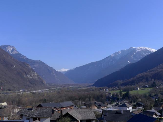
The Route de la Fresche (La Frèche on local maps) climbs 8.4 km (5.2 mi) from Saint-Rémy-de-Maurienne, gaining 794 m (2,606 ft) at an 8.9% average grade. It runs from 439 m (1,439 ft) in the Maurienne valley to 1,185 m (3,887 ft), where the pavement ends and a gravel path continues into the forest.
This is a short, hard climb with very little in the way of rest. The road is steady at 9-10% for long stretches, with about 16 hairpins, and it climbs the whole way through forest, so there is shade but few big views. The steepest 0.5 km (0.3 mi) averages 13.5%, and one short pitch reaches well over 20%. The surface is rough in places, so it suits a bike with low gears and a little patience.
It is a quiet, wild-feeling road on the slopes of the Belledonne massif, and the reward is solitude rather than a panorama. Roe deer are sometimes seen in the forest, and from the end of the pavement a trail continues up to the Frèche plateau and lake.
PLAN YOUR ROUTE
 We've partnered with Sherpa-Map.com to bring you the best route planning tool. With a PRO Membership you can use this climb as a reference when creating your route.
The climb averages 8.9% over 8.4 km (5.2 mi), and it hardly lets up. The steepest 91 m (100 yd) reaches 26.4%, the steepest 0.5 km (0.3 mi) averages 13.5%, and the steepest 1 km (0.6 mi) averages 11.9%. Over the hardest 2 km (1.2 mi) the grade is 10.2%, and over the hardest 5 km (3.1 mi) it is 8.9%.
Because there are no flat sections to recover on, pacing matters more than on a longer climb with the same total gain. Start in your easiest gear, and keep something in reserve for the final kilometers.
Roadway: The route follows the paved forest road from Saint-Rémy-de-Maurienne toward the electricity plant and the Varrat car park, which sits at the end of the pavement. The surface is bad in places, with gravel, holes and bumps, but the climb can be ridden on a road bike. At the top, the pavement gives way to a gravel path that continues into the forest. The rough surface makes the descent unpleasant, so take it slowly. At roughly 1,200 m (3,937 ft) in the Belledonne, expect snow on the upper road in winter and early spring.
Traffic: Light. This is a forest road serving trailheads and local installations, not a through route, so you will meet few vehicles, mostly walkers driving up to the Varrat car park.
Parking: Saint-Rémy-de-Maurienne is a village of around 1,300 residents, so park courteously near the center and ride out to the start by the roundabout at La Poste. There are only a few spaces at the Varrat car park at the top, which is used by hikers, so do not plan on driving up unless you are heading for the trails.
Provisions: There are no services on the climb, so fill your bottles in Saint-Rémy-de-Maurienne before you start and carry enough for a steep ride of well over an hour.
Gear: Take your lowest gears: a compact crankset with a 32 to 34 tooth cassette is the right setup for a road that stays at 9-10%. Wider tires help on the broken asphalt and on the descent, and a light layer is worth carrying for the cooler air higher in the forest.
Before heading out on any cycling adventure check out our Things to Bring on a Cycling Trip and use our interactive check list to ensure you don't forget anything.
The end of the pavement is the trailhead for a classic Belledonne hike, which makes a good post-ride walk if you have time. From the Varrat car park (about 1,190 m / 3,904 ft), a 6.8 km (4.2 mi) loop climbs through forest to the ruins of La Frèche at 1,795 m (5,889 ft) and on to the Frèche plateau at 1,965 m (6,447 ft), where the lake sits just above. It takes around four hours, and the lake can dry out late in summer, so do not count on it, and poles help on the steep sections. An unguarded shelter, the Abri de la Frêche, stands at 1,750 m (5,741 ft) nearby.
Saint-Rémy-de-Maurienne sits at the entrance to the Maurienne valley, with commune land rising from 394 m (1,293 ft) to nearly 2,760 m (9,055 ft). For bigger Maurienne days from here, see our Col de la Madeleine (La Chambre) page. See other climbs nearby, or build a custom route from here, with our Routes in the Area tool.
ROUTE MAP

MEMBER RATING
CURRENT WEATHER
PJAMM TRIPS ADVENTURE STARTER BUNDLES
Check out PJAMM Adventure's prepackaged (self-guided) cycling trips. They will help you plan, document and conquer your next adventure.
NEARBY CLIMBS (0) RADIAL PROXIMITY
FROM No Climbs Found
MEMBER REVIEWS & COMMENTS
Let us know what you thought of this climb. Signup for our FREE membership to write a review or post a comment.
Already have an account?
LOG IN HERE
