
29.1
PDI
11 mi
DISTANCE
4,268 ft
GAINED
7.4 %
AVG. GRADE
FULL CLIMB STATS
INTRO
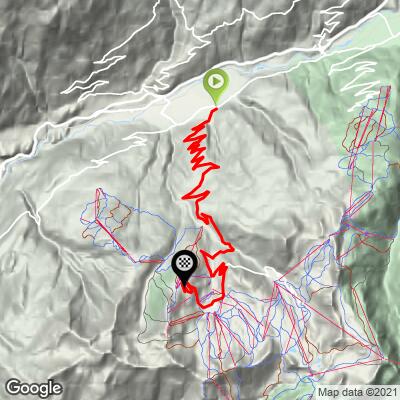
This is the classic Tour de France approach to La Plagne, starting in Mâcot-la-Plagne in the Tarentaise valley and finishing at Aime 2000, the highest of La Plagne's eleven villages at 2,100 m. It climbs 17.6 km (11.0 mi), gaining 1,301 m (4,268 ft) at a 7.4% average grade to a summit of 2,091 m (6,860 ft).
La Plagne has hosted five Tour de France stage finishes, most recently in 2025, when Thymen Arensman soloed to victory on the final HC climb of that year's race, holding off Jonas Vingegaard and Tadej Pogačar by two seconds on the line - Stage 19, Albertville to La Plagne. Its most famous appearance came in 1987, when Stephen Roche's legendary chase of Pedro Delgado over the closing kilometers - Roche collapsed across the line and needed oxygen - effectively won him that year's Tour, decided by just 40 seconds overall. The climb also hosted the 2002 Tour and has been a regular fixture of L'Étape du Tour, drawing thousands of amateur riders up the same road each summer.
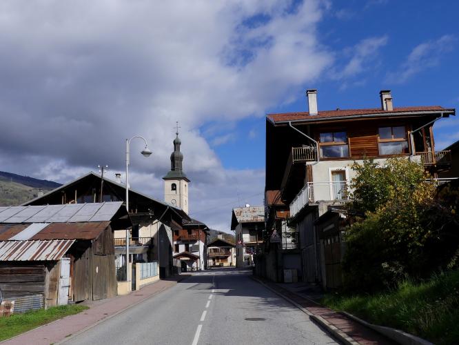
Outside ski season the road is quiet, tarmacked, and in good condition the entire way, with numbered switchbacks and dedicated pull-off parking areas along the upper half. It closes seasonally in winter for the ski resort and reopens once the snow clears in spring.
PLAN YOUR ROUTE
 We've partnered with Sherpa-Map.com to bring you the best route planning tool. With a PRO Membership you can use this climb as a reference when creating your route.
 The 7.4% average grade over 17.6 km (11.0 mi) climbs steadily rather than in isolated brutal pitches - there's no single defining wall, which is part of why it suits a long, sustained race-winning effort like Roche's in 1987. The steepest 100 yards reaches 12.5%, and the steepest half mile 9.8% (steepest kilometer, 9.4%). The grade eases slightly in the middle of the climb before firming back up over the final kilometers into Aime 2000 - steepest 2 km, 8.2%; steepest 5 km, 8.0%; steepest 10 km, 8.0% - a remarkably consistent grind all the way to the finish.
Roadway: Paved and in good condition for the entire climb. Numbered hairpins mark the upper switchbacks, and dedicated pull-off parking areas exist at several of them (bends 5, 7, 9, 10, 11, and 12) as well as at Provagnes, between Mâcot and Aime. Like the rest of the Tarentaise's high-altitude roads, it's a ski-resort access road at the top, so it's plowed and open through winter for resort traffic but can see snow and ice in the shoulder seasons - check Savoie's road status pages if you're riding outside summer.
Traffic: Light outside ski season - this is a popular road climb but not a through-route, so summer traffic is mostly other cyclists, resort staff, and vacationers. Expect it to be considerably busier in winter with ski traffic, and briefly very busy on race weekends when L'Étape du Tour or a Tour de France stage uses this climb.
Parking: Most riders start from Mâcot-la-Plagne itself, where there's ordinary village street parking. The dedicated pull-off areas at the numbered upper bends and at Provagnes (between Mâcot and Aime) are also usable if you'd rather start partway up.
A standard road bike and gearing handle this climb well - the grade is sustained but rarely severe, without the double-digit ramps of some Alpine finishes. The road is paved the entire way. There's little in the way of services directly on the climb itself, so fill bottles in Mâcot-la-Plagne before you start; Aime 2000 and the other villages near the finish have shops and cafes if you need to restock before heading back down.
Before heading out on any cycling adventure check out our Things to Bring on a Cycling Trip and use our interactive check list to ensure you don't forget anything.
La Plagne is part of the Paradiski ski area, one of the largest in France, and Aime 2000 - this climb's finish - is its highest village at 2,100 m, known for its distinctive 1960s "paquebot des neiges" (snow liner) apartment blocks. Outside winter, most of the resort's lifts and shops run on a reduced schedule, so don't expect a bustling town at the top - it's a quiet, purpose-built ski village most of the year.
If you're chasing Tour de France history, this road has carried the race five times, most recently in 2025 - our Routes in the Area tool is worth checking for other Tarentaise valley climbs to combine with this one on a multi-day trip.
ROUTE MAP
MEMBER RATING
CURRENT WEATHER
PJAMM TRIPS ADVENTURE STARTER BUNDLES
Check out PJAMM Adventure's prepackaged (self-guided) cycling trips. They will help you plan, document and conquer your next adventure.
NEARBY CLIMBS (0) RADIAL PROXIMITY
FROM No Climbs Found
MEMBER REVIEWS & COMMENTS
Let us know what you thought of this climb. Signup for our FREE membership to write a review or post a comment.
Already have an account?
LOG IN HERE
