
22.4
PDI
6.6 mi
DISTANCE
2,990 ft
GAINED
8.7 %
AVG. GRADE
FULL CLIMB STATS
INTRO
PLAN YOUR ROUTE
 We've partnered with Sherpa-Map.com to bring you the best route planning tool. With a PRO Membership you can use this climb as a reference when creating your route.
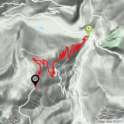
 Plan Villard gains 911 m (2,990 ft) over 10.6 km (6.6 mi) at an 8.7% average grade. The steepest 100 meters reaches 15.3%, easing to 11.4% over the steepest quarter mile and 9.8% for the steepest full kilometer - the hardest pitches come in short, punchy sections rather than one sustained wall. Even the steepest 5 km block still averages 9.1%, so there's little true recovery anywhere on the climb, especially once the road narrows above Arêches.
Roadway: Paved the entire way, in good condition through Arêches and the hamlets above it. The final kilometers narrow to a single-lane mountain road as the route climbs into the high pasture at Plan Villard.
Traffic: Light. This is a dead-end road serving Arêches and the alpine pasture above it rather than a through-route, so traffic thins out quickly past the village.
Parking: There's parking in Beaufort near the village center, or - to shorten the climb - in Arêches itself, which has its own parking areas near the ski lifts and tourist office.
Provisions: Beaufort is a real working village with a bakery, a few restaurants, and a well-stocked grocery store, plus the Beaufort AOP cheese cooperative if you want to bring some home. Arêches, partway up, has a smaller seasonal selection of cafes and shops. Above Arêches there's nothing, so top off water before continuing to Plan Villard.
Gear: The short, steep pitches above Arêches favor a compact crankset and an easy low gear - there's no long, steady grade here to settle into a rhythm on.
Before heading out on any cycling adventure check out our Things to Bring on a Cycling Trip and use our interactive check list to ensure you don't forget anything.
Plan Villard is a popular trailhead in its own right - hiking routes continue from the pasture up to Roche Plane (2,166 m) and Mont Mirantin (2,460 m), and the road also serves as a waypoint on Arêches-Beaufort's marked cross-country mountain bike network, so expect to share it with hikers and mountain bikers in season.
For lodging, Beaufort and Arêches both have hotels and gîtes; Arêches is the smaller, quieter of the two. If you're building a longer trip in the Beaufortain, several other serious climbs - Col du Pré, Cormet de Roselend, and Cormet d'Arêches among them - start from these same two villages; see our Routes in the Area tool for what else is within reach.
ROUTE MAP
MEMBER RATING
CURRENT WEATHER
PJAMM TRIPS ADVENTURE STARTER BUNDLES
Check out PJAMM Adventure's prepackaged (self-guided) cycling trips. They will help you plan, document and conquer your next adventure.
NEARBY CLIMBS (0) RADIAL PROXIMITY
FROM No Climbs Found
MEMBER REVIEWS & COMMENTS
Let us know what you thought of this climb. Signup for our FREE membership to write a review or post a comment.
Already have an account?
LOG IN HERE
